Having seen the old church at Fleet before, I decided we'd 'save the best till last' and go inland first, retracing my steps of a previous walk in April. We headed north-east from the church at Fleet and crossed the B3157. We then headed north towards Higher Barn where we sat with our lunch on upturned buckets, sheltering from the rain. All day we donned light rain jackets, only to take them off minutes later because the rain had stopped and we were too hot. I much prefer a heavy, know-where-you-stand downpour where you can wear your waterproofs all the time and have the satisfaction of taking them off and getting muddy fingers at the end. OK, so maybe I don't 'much' prefer it, but there is a certain certainty about that situation. Showers lend themselves well to photography, on the other hand, or can do if the scenery and cloud landscape permits.
We assumed the footpath had been diverted just after Tatton Coppice because the signs ran out and we ended up taking a longer route. Looking at the newer map when we got back, we realised the path hadn't been diverted; there just weren't the right signs in the right place - grrrhhh! We managed to get out onto the road at Langton Cross, but it involved doubling back on ourselves for a tiny bit - another reason the walk was longer than my predicted 6.5 miles!
Somehow we managed to miss the Mediaeval Cross at Langton Cross, but we did spot a Butterfly Orchid which someone had fenced round.
 |
| Greater Butterfly Orchid at Langton Cross |
We passed a circular building in a field which I later found out used to be a lime kiln; there are, or were, a few in this area.
 |
| Lime kiln near Langton Herring - SY6282 |
 |
| Bus stop at Langton Herring - SY6182 |
It has also got a very nice pub, The Elm Tree, where we sat in the garden with a drink to gather strength for the next part of the walk.
At the church we learnt a sad story. In 1830 four young boys, aged between 6 and 8 were playing at the village lime kiln when they were overcome by fumes from the kiln and were killed. They are all buried in the church graveyard.
 |
| Grave to four boys at Langton Herring churchyard - SY6182 |
We were now walking south towards the coast and I was suddenly glad we'd saved this bit till last. I think it's a good policy to employ; just when your energy is waning and you need something to keep you distracted, there is the Fleet lagoon.
 |
| The Fleet from near Langton Herring - SY6181 |
I was very pleased to hear and see the Corn Bunting, a bird we had seen and heard on South Uist, but one I've only seen once before in Dorset. Its call is quite distinctive, a bit like rattling keys, and it alerted me to its presence. This photo is from our holiday in South Uist, so I'm cheating a bit.
 |
| Corn Bunting |
We joined the South-west coast path and continued to Gore Cove, right at the edge of the Fleet.
We passed the curious Moonfleet Manor Hotel, named no doubt after J Meade Falkner's children's novel set in this area. It seems to be a mish-mash of architectural design, with some strange castellations, but the eastern most part of the building looked quite attractive.
We passed briefly through SY6280 and I photographed what used to be a pit for extracting minerals, but is now barely discernible as such.
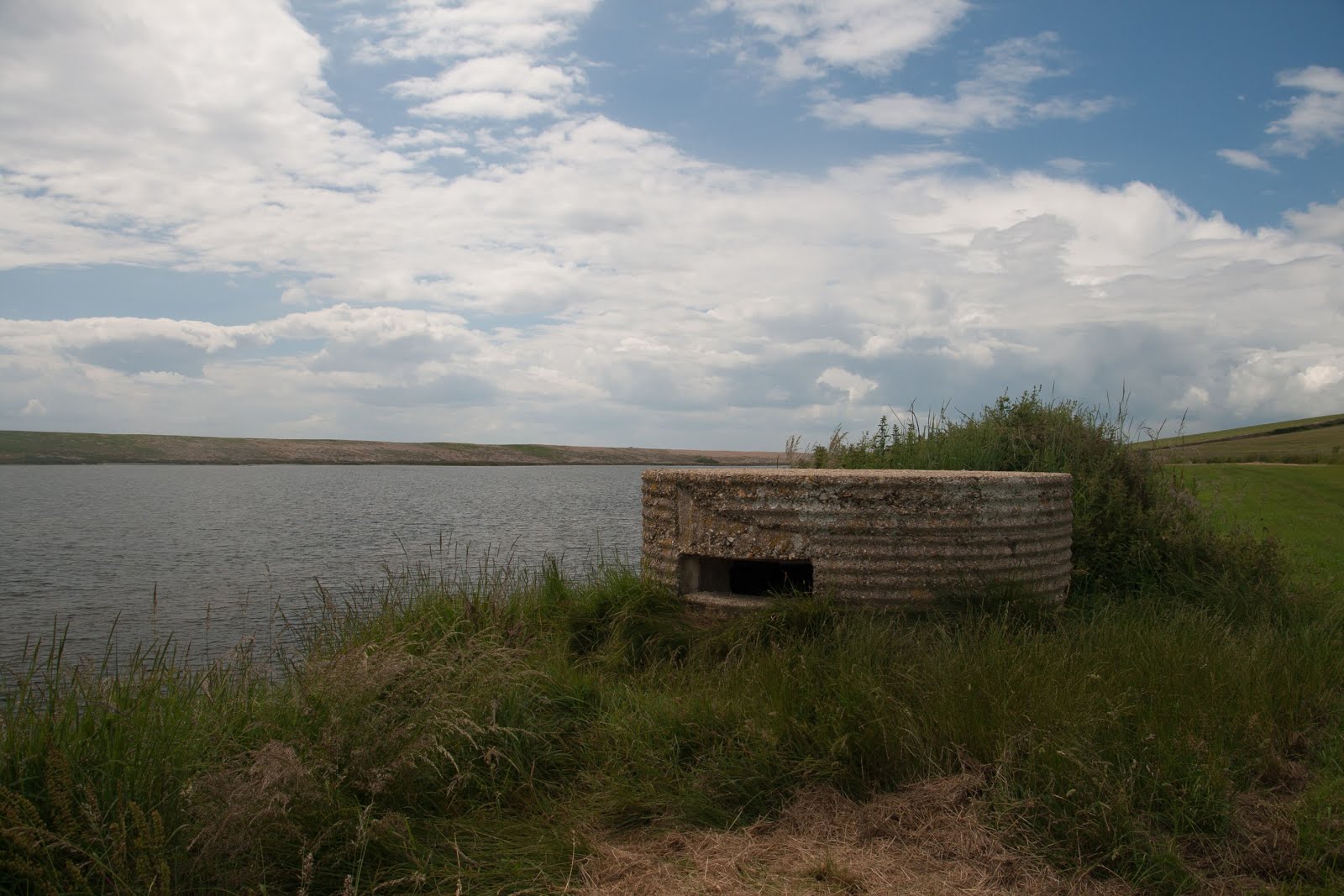
There were two pill boxes in the next gridsquare, both different types - one circular and one octagonal. It is still possible to enter the rectangular one, and probably the circular one too, but we didn't attempt that (not with Paul's back!)
 |
| Gore Cove and the south-west coast path - SY6180 |
We passed the curious Moonfleet Manor Hotel, named no doubt after J Meade Falkner's children's novel set in this area. It seems to be a mish-mash of architectural design, with some strange castellations, but the eastern most part of the building looked quite attractive.
We passed briefly through SY6280 and I photographed what used to be a pit for extracting minerals, but is now barely discernible as such.
 |
| SY6280 - pit for extracting minerals |
There were two pill boxes in the next gridsquare, both different types - one circular and one octagonal. It is still possible to enter the rectangular one, and probably the circular one too, but we didn't attempt that (not with Paul's back!)
 |
| Type 22 Second World War pill box on The Fleet - SY6279 |
 |
| Type 25 Second World War pill box on The Fleet - SY6279 |
The Fleet is a nature reserve, but other than the Corn Bunting, Mute Swan and Cormorant, we didn't see many birds. We did see seven species of butterflies, however - Painted Lady, Small Tortoiseshell, Meadow Brown, Large White, Red Admiral. Large Skipper and Speckled Wood.
There was just one more gridsquare to photograph before we reached East Fleet and there was no question of the subect for my photograph. Who can resist photographing a bay with the name of Butterstreet Cove? Butter Street is the name of what appears to be the only street in East Fleet. Most of the village was washed away in the great storm of November 1824, as was the church. All that is left standing now is the chancel, the nave having been completely washed away.
 |
| Butterstreet Cove - SY6379 |
 |
| East Fleet old church - SY6380 |
We sat on a bench at the church and drank the last of our tea from our flask and then plodded our weary way back along the road to the car.
Trigpoints - 0 (one narrowly missed)
Miles - 7.9
Churches - 3
Mediaeval crosses - 1 (even though we missed it)
Cups of tea (3 for me; 2 for Paul)
Pints of beer - 1 (Paul)
Gridsquares - 6 new