It looked like an army ascending the fort, crimson cloaks flapping in the balmy breeze, the same breeze carrying war cries far across the arable fields to the base camp where large chariots awaited, their snorting horses impatiently pawing the ground.
"What is it about you and Maiden Castle?" Jane laughed, bringing me back to the moment, as I got out of my car and peered through my binoculars at the 'army' of school kids ascending the ancient fort. It's true; I always seem to have difficulty finding this place, which would have been an advantage to the fierce defenders of this ancient and massive fort in days of yore. I made a lame excuse about it being difficult to find as I laced my boots and balanced delicately on the edge of the boot to don my burgeoning rucksack.
"Where's your rucksack?" I asked Jane who was sporting her summer 'saddle bags' of a small bum bag. "It might not feel like summer today, but it's summer walking time for me," she laughed, "and that means away with the rucksack and out with the bum bag." I envy people like this, their ability to walk without a litre thermos flask, binoculars, camera, GPS and winter waterproofs - just in case! They don't seem to suffer as a result of being more lightly laden than me, physically or mentally; they don't get any wetter than me, thirstier than me, hungrier than me and, what's more, they don't seem to regret not bring a camera or binoculars. But I know I would; I've tried not taking binoculars and invariably regret it.
We set off in the opposite direction to the army of school children who had now disappeared from sound or vision and I explained to Jane that I had discovered there definitely was a church at Winterborne Monkton which kind of vindicated my insistence on exploring the eastern flanks of Maiden Castle.
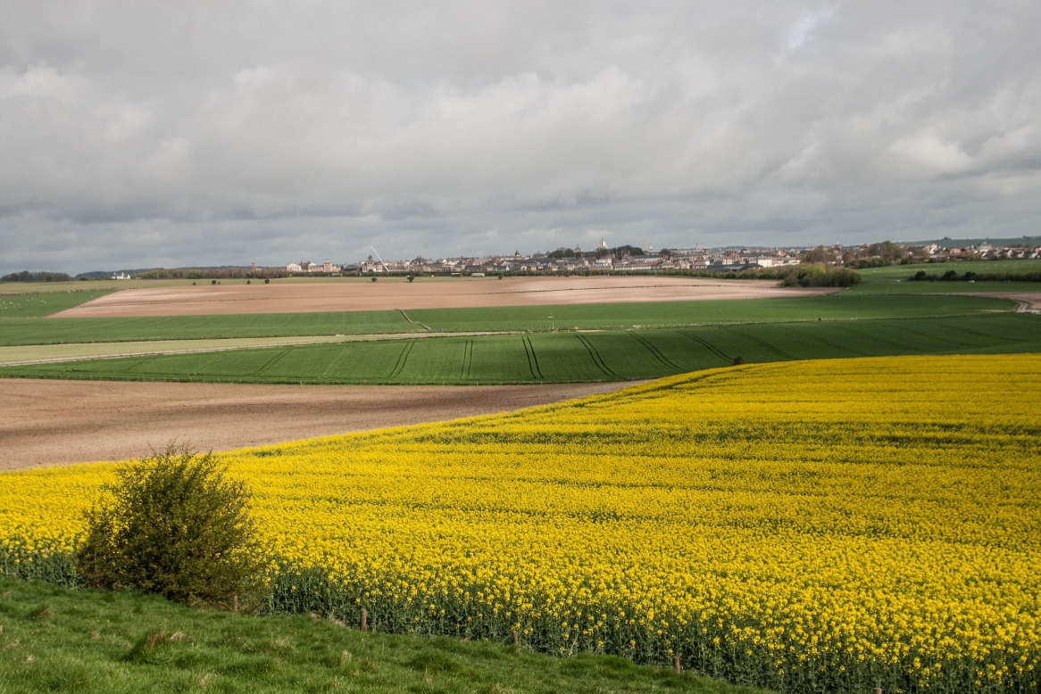
Within a few minutes of setting off my ears picked up the distinctive call of the Corn Bunting amongst the exaltation of Skylarks. "Hark!" I stopped in my tracks and tried to work out where the call was coming from. After some time I spotted it singing its little spotted breasted heart out atop a Hawthorn bush. Apparently this is one of the last remaining Dorset breeding sites for this farmland bird and it was comforting to see it here. Whilst battles raged on this ancient site these birds would have been singing and now, over 2000 years later, they continued to sing and their constancy reassured me that amidst tumultuous times, some things remain the same, despite man's best efforts to obliterate them.
 |
| Rape field at Maiden Castle where the Corn Bunting still sings - SY6788 |
 |
| Eastern ramparts of Maiden Castle - SY6788 |
As we continued eastward looking for our footpath south, a herd of young cows ran towards us expectantly, most of them uniform, but a couple of them sporting an endearing white love heart on their foreheads.
 |
| Cows at Maiden Castle - SY6788 |
Maiden Castle is now owned by English Heritage and is one of the largest Iron Age hill forts in Europe, amazingly the same size as 50 football pitches. It's a great place for children to expend some energy and use their imagination to take them back to days of battles before the technological age. It's hard to imagine now, but this verdant fort, though still prominent in the landscape, was a blinding white feature when it was first built from freshly excavated chalk.
 |
| Eastern ramparts of Maiden Castle - SY6788 |
 |
| Eastern ramparts of Maiden Castle - SY6788 |
We exited the site through a small gate and descended to the minor road which followed the South Winterborne on its east/west course. The hamlet of Winterborne Monkton is very small and we followed the road to the church of St Simon and St Jude. There are few houses here apart from the farm so we were surprised when a landrover came us behind us and slowed to a halt. I opened the door and the middle-aged driver asked us if we were just heading to the church? We answered in the affirmative and he asked if we'd be wanting to look round. Affirmative once more, "if it's not too much trouble," I added, picking up on a slight reluctance on his part to be interrupted in his daily round of chores. "I'll go and get the key," he said, his manner not unfriendly, but we certainly weren't going to be invited in for coffee!
I didn't regret my boldness though I did offer to return the key to the farmhouse when we'd finished. "It's not as simple as that," he explained as he opened the door, set off the alarm and went to switch it off. "It's alarmed." He left us with an information sheet and said he'd return to lock up when we'd finished. I was so glad we'd nearly been run over by the land rover as I'd wanted to visit this church for ages, but there are no other footpaths to it so you have to go out on a limb to visit it. "I'm unlikely to return," I said to Jane as I wandered round with a trigger happy camera, wanting to make the most of this rare opportunity.
 |
| St Simon and St Jude, Winterborne Monkton - SY6787 |
 |
| St Simon and St Jude, Winterborne Monkton - SY6787 |
 |
| Altar, St Simon and St Jude, Winterborne Monkton - SY6787 |
 |
Effigy of Miss Ellerie Bessie Williams of nearby Herringston,
St Simon and St Jude, Winterborne Monkton - SY6787 |
 |
Stained glass window dedicated to St George (fitting as we visited on St George's Day - also the day that the Duchess of Cambridge gave birth to her third child, a son whom she probably wished she could name George but that name had already been used)
St Simon and St Jude, Winterborne Monkton - SY6787 |
Apparently Oliver Cromwell stabled his horses here and straw and hay were found in the Rood loft giving some credence to this story.
It being too early on in our walk, we didn't linger for a drink here, choosing instead to continue to Martinstown for lunch, and choosing to walk along the road rather than reascend to Maiden Castle.
 |
| Manor House, Winterborne Monkton - SY6787 |
 |
| Churchyard and Manor House, Winterborne Monkton - SY6787 |
I had visited gridsquare SY6687 on a previous walk in August 2017, so took a quick photo as we passed Ashton Farm, there being nothing else of interest to photograph.
 |
| Entrance to Ashton Farm - SY6687 |
The arable fields in SY6587 were not very interesting either.
 |
| Arable crops near Higher Ashton Farm - SY6587 |
"We're reaching the foot of the first leg," I said to Jane, checking my map as we turned westwards and then almost immediately north towards Eweleaze Barn. I had described the route as looking like 'a pair of trousers' when I'd drawn it out on the map earlier. The foot of the first leg stopped just short of the South-west Coast Path (South Dorset Ridgeway) in square SY6486.
The first thing we noticed as we turned northwards was the strange substrate beneath our feet. "Is this real grass?" Jane questioned, bending down to touch it. It wasn't and the remnants of a painted football pitch further on confirmed its erstwhile usage. We mused on its provenance. "Perhaps someone who works at the farm is a keen runner and doesn't like running through mud and they also work at a school where they had a surplus of astro turf which needed a good home." That was my suggestion. "Look, there's the farmer on his quad bike; go and ask him!" I urged Jane. Before she'd had chance to think of a reason why she didn't want to go and speak to a strange farmer, the quad bike turned into a field and we were left to draw our own conclusions about the reason for artificial turf and the question as to whether it was killing off vegetation beneath it and depriving fauna of a much needed food source.
 |
| Strange astro-turf covering on entrance to Eweleaze Barn Farm. - SY6486 |
This was my second new gridsquare of the day and at first I thought I was going to have to settle for an unimaginative photo of an ubiquitous farmyard, but as we turned the corner we were surprised to see a veritable car merchant's yard with the name Cool It Automotive emblazoned on the erstwhile barn.
 |
| Cool It Automotive (Eweleaze barn) _ SY6487 |
Several vehicles passed us as we continued northwards, pausing to admire the view of Grove Hill Bottom with some cows enjoying the season's fresh pasture.
 |
| Grove Hill Bottom - SY6487 |
We thus approached Martinstown from the south along a very civilised road. I think in fact that this was my least muddiest walk of the year so far. I look forward of course to many more even less muddier walks, having spent far too much time over the past few months entrenched in mud.
 |
| Martinstown from SY6588 |
 |
| Approaching Martinstown from the south - SY6588 |
A small, docile, and very handsome herd of Highland Cattle did not budge as we went up to greet them.
 |
| Highland Cattle, Martinstown - SY6588 |
I photographed an attractive building which I later learned was a care home - not a bad place for a care home is what I thought.
 |
| Park House Care Home, Martinstown - SY6588 |
"We're at the trouser's crotch," I enlightened Jane as we wended our way into the village itself, having decided to make our walk more of a figure of eight as the village green provided us with an excellent and convenient place to eat our lunch. "We'll go up to the waistband and then down the second leg," I went on, more to myself than to Jane, feeling quite smug at my 'discovery'. But there were dandelions to admire before lunch - a proliferation of them adorning East Hill and Grove Hill Bottom.
 |
| Field of Dandelions, East Hill - SY6588 |
 |
| Dandelions at Grove Hill Bottom - SY6488 |
We turned northwards to the Church.
 |
| Martinstown - SY6488 |
After an uneventful lunch, disturbed only by the continual buzz of the churchyard strimmer, we found a footpath behind the church and walked along the 'waistband' to Manor Farm, stopping only to say hello to a noisy pig in a field which he shared with a horse, some goats and a sheep. "They get used to each other if they're introduced to each other early enough in their lives," Jane explained, "otherwise pigs and horses do not tolerate each other very well." The pig grunted its disapproval as we left it foodless and continued our walk.
 |
| Pig near Martinstown - SY6489 |
 |
| Church path, Martinstown - SY6489 |
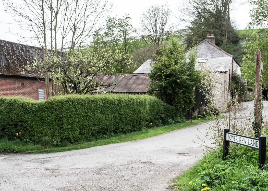
At Manor Farm we ignored a byway which would have taken me into yet another new gridsquare, one which i'll have to contrive a reason to enter another day.
 |
| Lower Rew Lane, Manor Farm - SY6389 |
We were both delighted to see Cowslips in blossom, a flower I rarely saw on Islay and the foodplant of the rare Duke of Burgundy butterfly which I hoped to see in a week's time.
 |
| Cowslips, Manor Farm - SY6389 |
Our walk today had been very easy underfoot, with little mud and mostly on farm tracks, just as well as our tongues were going ten to the dozen all day leaving little time to negotiate difficult ground. The track continued up Kit Hill Bottom to Ballarat Farm.
 |
| Kit Hill Bottom - SY6388 |
 |
| Approaching Ballarat Farm - SY6288 |
We turned just short of the prominent Hardy Monument, being now at the foot of the second trouser leg and needing to turn eastwards once more.
 |
| Hardy Monument - SY6187 |
We might have missed out on Hardy Monument, but we were finally getting to go on the South-west Coast Path and Bronkham Hill, the length of the South Dorset Ridgeway which is adorned with probably the most tumuli and barrows in Dorset.(I say probably because I'm not qualified to say so with any authority!)
 |
| Entering Bronkham Hill - SY6187 |
Despite having walked many times in some of these gridsquares, I had not yet set foot in SY6387, and was about to do so. We turned left onto the virtual inner leg of the pair of trousers I have repeatedly referred to in this description and towards Pen Barn Farm.
 |
| Approaching Pen Barn Farm Cottages - SY6387 |
 |
| Pen Barn Farm Cottages - SY6387 |
We then joined a bridleway at Grove Hill Bottom which took us once more into Martinstown.
 |
| Grove Hill Bottom - SY6488 |
At the church we sat for a quick cuppa (tea in my case, water in Jane's) as despite the length of the walk, there had been few hills and good paths and we had made good time, walking as fast as we talked!
We crossed a delightful stone stile from the churchyard north onto the same path we'd been on earlier, Blackthorn blossom providing an Anne of Green Gables
White Way of Delight.
 |
| Church, Martinstown and stone stile - SY6489 |
 |
| Blackthorn and the 'White Way of Delight' - SY6589 |
But Jane had spotted something else of interest, "What's that little castle?" she asked. I'd already peered through my binoculars and was able to confirm that it wasn't a castle; "It's a bush." I said decidedly. "It might look like a hobbit's castle, but it definitely isn't. With apologies for disappointing you." The hobbit's castle/bush in question was Clandon Hill, a Bronze Age barrow which lies on the same ridge as Maiden Castle. When it was excavated in 1882 some gold objects were found including the Clandon Lozenge.
 |
| Clandon Hill barrow/Hobbit's Castle - SY6589 |
Despite its interest, Clandon Hill was not in the 'right' gridsquare for me, or rather it was little uncertain into which gridsquare the hill fell, half of it seems to be in SY6589 and half in SY6588. Just to be sure, I took, a boring photo of a farmyard at Clandon as well.
 |
| Clandon - SY6589 |
There were just two squares left now and, as if to mark the circular nature of our route (albeit a trouser-like circle), the Corn Buntings started singing again and accompanied us all the way back to the car park where our chariots awaited - not a knight in shining armour or strapping great warrior to be seen though!
 |
| Tumulus north of Maiden Castle - SY6689 |
 |
| Maiden Castle Road - SY6789 |
 |
| Corn Bunting at Maiden Castle - SY6789 |
Number of new gridsquares: 9
Number of miles walked: 12.5
Number of Corn Buntings seen: 12
Number of churches visited: 2