"It'll be a boring walk through muddy fields and all I know is we'll start at Hardy's Cottage and walk north for as far as we like." Or words to that effect - that's how I'd enticed Jane to accompany me on what was to prove the muddiest walk of the year so far. Then I had to borrow money to pay the car park fee. A word of advice - in the unlikely event that anyone will actually want to repeat this walk - make sure you take change for the car park (£3 all day). I took my car park ticket and laughed - "Well, we've only got till 5 pm, Jane. Then they lock the gates!"
With the map spread out on one of the picnic tables at the Visitor Centre, we planned our route, realising that although we were bound to be back before 5 pm, we were unlikely to make it back to the Visitor Centre for closing time at 3 pm. "No tea and cake," then I said reluctantly, "we'd better get going.
 |
| Thomas Hardy's Cottage, Higher Bockhampton - SY7292 |
Hardy's Cottage is a delightful place to visit, but maybe only if you're as avid a Thomas Hardy fan as I am One of my dream jobs would be to work as a Visitor Experience member or whatever name they now give to tour guides. Several times I've been tempted to apply for this type of job and have only been put off by the fact that the wages would mean I'd probably be out of pocket by the time I'd deducted fuel costs!
The one thing that worked in our favour today was the weather. I'd almost emailed Jane to suggest tea and cake in Dorchester instead after viewing the forecast this morning,but it turned out to be one of those most wonderful surprises when the weather in reality is much better than the weather predicted. OK, so we had hail, rain, sun, rainbow and wind in the 24 hours we were out. Did I say 24 hours? I mean 7.
We walked past Hardy's Cottage into Puddletown Forest as Jane told stories of how she'd got lost in this forest in a maze of paths. There is a plethora of paths in this forest, as well as tumuli, swallet holes and pits; it is easy to get lost or vanish forever more into the swampy understorey or it would be if you didn't have the wonders of modern technology. I scrutinised my phone to make sure we took the right turning and to ensure I didn't miss a gridsquare. "We're only in it for five minutes," I explained. I'm sure Jane is getting used to my interrupting her mid-sentence just so I can take a photo. I hate having to do it and always try to go back to the conversation to show that it's not that I'm not interested, just I don't want to miss the photo opportunity of a muddy footpath!
 |
| Crossroads of footpaths, Puddletown Forest - SY7392 |
I just managed to snap the award-winning photo before another walker appeared and bade us good morning, commenting on the glorious weather. It was the last person we were to see on foot for a while.
"So, how do we cross the A35?" Jane ventured to ask as we wandered towards the roar of the traffic. "Sorry, didn't hear you," I shouted above the din, snapping the requisite photo for the square. "We are only in this square for three minutes," I laughed. Really, truly, why do people put up with me!?
 |
| Footpath in Puddletown Forest - SY7293 |
"I've checked the map and there's a footpath both sides of the road," I reassured Jane as we ambled side by muddy side drawing closer to the source of the constant noise. Jane remained unconvinced. "I know there's a tunnel further up and a bridge further down,but I don't know how you cross here," she continued to voice her concerns. With good reason it turned out. It also turned out that we were going to be in SY7293 for a lot longer than I thought.
We arrived at the busy dual carriage way to discover no tunnel, no bridge a million cars a minute going by and crash barriers preventing all but the suicidal from considering playing chicken. This is when I wish I'd checked Google map beforehand. Ever the sensible one (I was all for playing chicken), Jane insisted we walk back to the bridge. This makes her sound bossy; she isn't and wasn't - just a lot more safety conscious than I am. And now I'm still alive to thank her for it.
We walked along the re-rooted 'footpath', incredulous at the appearance of a footpath sign which has managed to stay put on a perilous muddy slope above a four-lane highway/motorway/two lane dual carriage way.
 |
| Perilous slope and footpath on A35 - SY7293 (bridge that we crossed just out of sight) |
Conscious that this detour was going to add another mile on to an already long walk, we pushed forward swiftly and then thwang! A branch bounced back into my face, thankfully missing my eye. It hurt like crazy, but I kept going, hardy soul that I am, blood gushing from my wound.
"It's easier walking down here on the verge," I announced to Jane, keen to escape any more rebounding branches. Jane made her way down to join me. "You're bleeding," she noticed. Despite the significant loss of blood, I hadn't noticed. OK, so I might just be exaggerating; it was possibly just a dribble. "A branch hit me," I explained, dabbing my wounds with a snotty tissue.
We were glad to reach the bridge and be finally out of SY7293. We walked along the minor road back to where the footpath should have been. There was only a faint sign of a track leading down form another perilous slope below the busy road. "There's one to report," we agreed.
 |
| Former footpath beneath A35 - SY7393 |
I made that photograph do for that gridsquare as I completely forgot to take another photo; I was so traumatised by my war wound and by the fact we had been walking for over an hour and I didn't feel we had yet begun our walk. Some wonderful tree roots helped calm me down as we wandered into Yellowham Woods.
 |
| Tree roots in Yellowham Woods - SY7393 |
We past the Keeper's Lodge and emerged at the crossroads between the local Ridgeway and Gaddy's Lane.
 |
| Joining the Ridgeway - SY7394 |
Thankfully we were joining the Ridgeway and it looked less muddy!
 |
| Ridgeway - SY7394 |
We were grateful for the lack of mud on this footpath and to finally be able to make good progress, unhindered by uncertainty, traffic and branch weapons. We continued on the Ridgeway for about a mile before crossing Slyer's Lane (B3143) at Waterston Ridge.
 |
| Ridgeway - SY7294 |
My photograph for this gridsquare was a conveniently placed trigpoint, just on the other side of the hedge and under the grip of ivy.
 |
| Ridgeway trigpoint - SY7194 |
Our spirits were lifting, aided by the views and the glorious sunshine.
 |
| View west on Waterston Ridge - SY7094 |
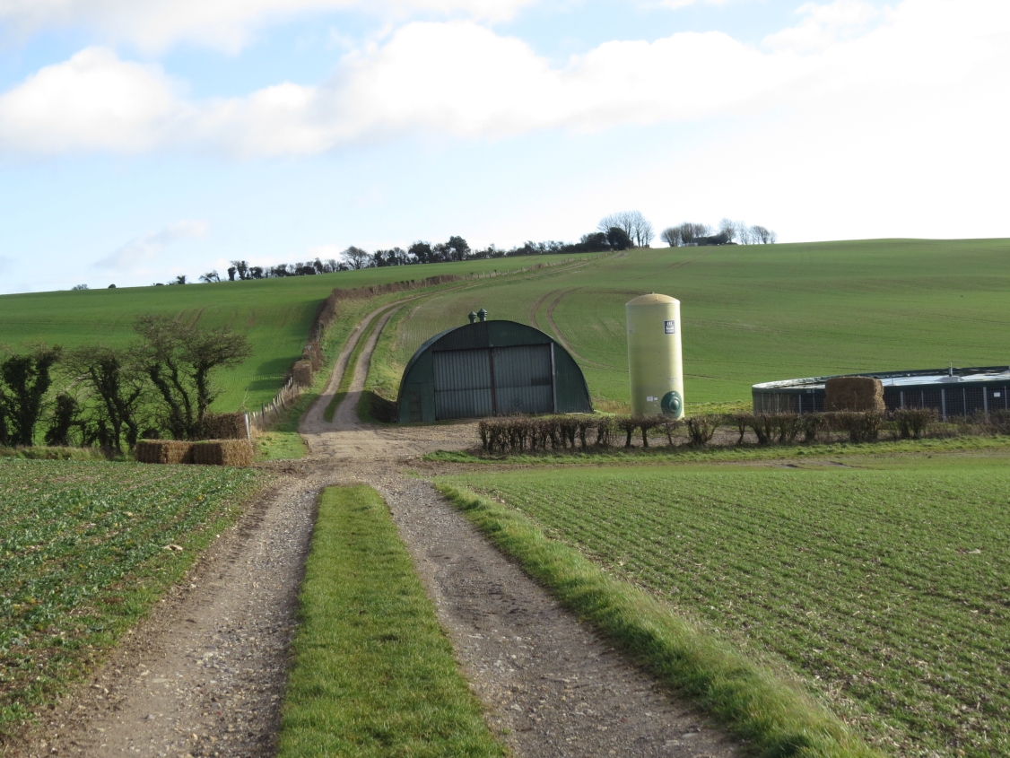
We passed a huge farm building and storage tank with a possible slurry store. It looked more like a hangar than a barn.
 |
| Huge barn on Waterston Ridge - SY7094 |
We continued on the Ridgeway until we reached a T junction, at which point we turned northwards.
 |
| T-junction on Waterston Ridgeway - SY6994 |
I was beginning to think about lunch now; if truth be told, I'd been thinking about it for quite some time. If all had gone well at the beginning of our walk I think we'd have stopped for a coffee break before now, but we were reluctant to do so on the grounds that we were worried about being lock in a car park in the middle of the woods all night.
We'd already decided we'd do the extra mile to Piddlehinton and back, which meant we were aiming to have lunch in the church there - always a useful lunch spot. This just meant walking through a few boring and muddy fields beforehand.
 |
| Farmland, Piddlehinton - SY6995 |
A visible tumulus provided a feature of interest as we walked into SY7095. Yhere are lots of tumuli marked on the map, including a specific one named Robin's Barrow, but few of them are visible from the footpaths or bridleways.
 |
| Tumulus on Little Puddle Hill - SY7095 |
 |
| Bridleway, Little Puddle Hill - SY7095 |
 |
| Barn and bridleway, Little Puddle Hill - SY7095 |
I was just chuckled about the fact we were walking along Little Puddle Hill and Little Piddle Down - there's something so endearing and comical about these names,even if, in reality, Common Lane might be a more appropriate name. Little Puddle Farm was a bit more exciting, as were the earthworks we happened upon as we turned gratuitously north.
 |
| Little Puddle Farm - SY7196 |
 |
| Tree/hedge at Little Puddle Farm - SY7196 |
 |
| Earthworks at Little Puddle Farm - SY7196 |
Apparently the boundary between Piddlehinton and Little Puddle once ran right through these earthworks which cover 32 acres of ground and which represented the settlements of Little Puddle and Combe Deverel. Traces of a chapel at Little Puddle have been detected, dating to the 14th Century, but there is no visible evidence to the untrained eye.
I found a good website about
Piddlehinton, full of history about the area. One interesting anecdote was that a former farmer at Little Puddle, Henry George Mayo used to live at Corton and ride from there to Little Puddle on horseback, always wearing his bowler hat. He farmed Little Puddle until 1941.
 |
| Henry George Mayo and hisbowler hat at Little Puddle Farm - SY7196 (Photo credit: http://www.piddlevalley.info/history/piddlehinton/sop/piddlehinton_chap2.php) |
We followed a local footpath to the B3143 and St Mary's Church, where we collapsed in a heap and delved into our rucksacks. At least I did.
"I am going to look round," I said between mouthfuls as Jane thoughtfully wandered round, pondering the existence of only one stained glass window in the church. "I've just got to eat first!" We actually never did find out why this church only has one stained glass window. Were they short of cash?
We'd just finished our lunch when a lady popped her head round the door and we bade her good afternoon. She was apparently checking that the church had been left in good fettle after the bell-ringing session and enquired as to whether we were bell ringers. We assured her that had we known of the bell ringing session we would have raced round quicker to get here on time, but, sadly, no, we were not bell ringers - and never likely to be, despite my harbouring a secret desire to pull a bell rope and alert the village to danger.
Feeling recuperated, we looked round a bit more and then went out to look for the grave of Ann Wizner, which I'd started to read about on the way in, before hunger got the better of me.
 |
| St Mary's Church, Piddlehinton - SY7197 |
 |
| Ann Wizner's grave, st Mary's churchyard, Piddlehinton - SY7197 |
I remembered having read about this brave heroine of the Battle of Waterloo some time ago, but had forgotten that she was buried here. She died in 1873 aged 82 at which time she was a resident of this parish. Born Ann Keates in Fordington, Dorchester in 1791, she married James Winzer and acted as a nurse to the wounded at the Battle of Waterloo in 1815, about 40 years before Florence Nightingale's famous days pioneering the nursing of the sick and wounded in the Crimean War. Ann came to live in Piddlehinton after her nursing days with the army were over. Her husband, James Winzer, must have seen military service, probably overseas, for he was one of the many Chelsea Pensioners who did not live at the Royal Hospital, Chelsea. Colonel Astell of West Lodge, Piddlehinton took steps to ensure that Ann got a pension in recognition of the service to the army.
Ann’s feats are recorded on her impressive headstone, which was apparently paid for by a group of army officers, notably Lt Col Charles Astell JP who lived at nearby West Lodge and had petitioned for Ann to receive a military pension in her own right in recognition of her services. Ann's husband, James died 18 months later.
We walked back through the attractive village of Piddlehinton, pausing to read a notice about weight limits on a bridge over the River Piddle.
 |
| The River Piddle, Piddlehinton - SY7197 |
 |
| Notice on bridge over River Piddle, Piddlehinton - SY7197 |
Tentatively we turned left onto a bridleway through someone's garden when two dogs, a collie and a Jack Russell alerted their owner to our presence."Hello," I called out whilst gently kicking the snarling Jack Russell whose claws were digging into my thin-trousered legs. "I'm not sure if that's claws or teeth," I winced, trying not to throw the yelping fiend into the tempting bales of hay on the other side of the farmyard and held back only by the sound of approaching human footsteps. "Are we on the footpath?" we asked as a woman appeared and thankfully called her beasts to heel. "Yes, yes," it's perfectly well signposted," she insisted throwing a free arm in the direction from which she'd just come. "There'll be horses!" she added as we thanked her and headed off into the unknown horse-ridden path.
"She's only trying to put us off," Jane said as we found ourselves in a field of horses. "She doesn't realise how intrepid we are!"We navigated our way back to Little Puddle Farm, took a wrong turn, quickly realised it and corrected it and ended up in a vineyard - of sorts. It was a definite eyesore and some distant workers appeared to be trying to salvage some rather non-existent looking shoots. Maybe it will look OK when they've grown a bit more, but at the moment it looks more like a plastic farm than a vineyard or orchard.
 |
| Vineyard? Piddlehinton - SY7195 |
"I know we haven't been in this field before," Jane laughed as we wearily went through a gate into yet another muddy field, "but I'm sure I've seen that blade of grass before!" It was true. Our walk had been dominated by huge, muddy fields where the footpath, shown on the map as going right across the field, has by necessity been diverted to go right round the field. This, of course, lengthens the walk and, as Jane pointed out, for those on horseback an extension to the walk might not be a bad thing,but when you've walked through umpteen fields which all look the same, you really just want to get out of there as quickly as possible and not have to walk round the perimeter yet again. So there may have been a couple of occasions when we strictly followed the footpath/bridleway across the field.
We were now retracing our steps in dimming light and hail showers to Waterston Ridge where we took the footpath south. Jane had been on this footpath many years before and remembered how muddy it was. We felt sorry for a herd of cows swamped in mud with very little food. They looked so thin and sorry for themselves. I didn't think they'd have the energy to chase us even if they tried.
This was the worst mud we'd encountered yet. A couple of times I thought I was going to lift my foot and find my boot wedged in the mud. We squealed and squelched our way round the field, bidding the poor cows a kindly greeting and continued on our way to Higher Kingston Farm.
 |
| When the mud got better, near Higher Kingston Farm - SY7193 |
 |
| Higher Kingston Farm - SY7193 |
At Little Cheam a flood across the road gave us the chance to wash our boots.
 |
| Little Cheam - SY7192 |
Now all we had to do was run the gauntlet of the busy A35 again, thankfully this time just a single carriageway. Then we'd be on the homeward track. Crossing the road took some doing but we were soonon Ice or East Hill where some students from Kingston Maurward were doing some hedgelaying and a rainbow appeared to herald our arrival at our journey's end.
 |
| Rainbow and shadows, Ice Hill - SY7192 |
We got back to our cars at 1621 and were not the last to leave the car park by a long way.
"Thanks for a great walk," I said trying to remove my muddy boots without getting my hands covered in a variety of colours and textures of mud. Jane's gaiters had saved her boots considerably. I really must get back into the habit of wearing gaiters. We parted company with me reassuring Jane that this was not a walk I intended EVER repeating, "although I did like the church and the Ridgeway, so . . ."
Number of new gridsquares: 13
Number of miles walked: 12.8
Number of gratuitous miles: 2
Number of war wounds: 2