When Chris Packham exhorted our nations to get out and look for Hawfinches this winter it was the last straw. I'd heard it once too many times to ignore it. "We're going a walk from Cattistock," I announced boldly to Paul, racing up the stairs two at a time to go and devise said walk.
Hence our departure later that morning from St Peter's and St Paul's Church in the delightful village of Cattistock. Naturally, I'd drawn a route which took in as many 'empty' gridsquares as possible.
 |
| St Peter's and St Paul's Church, Cattistock - SY5999 |
We had barely started our walk when we bumped into two people laden with high quality optical equipment (ie binoculars, cameras and telescopes). "Have you seen the Hawfinches?" we enquired eagerly. "Yes, they're showing well," they replied, which is birding jargon for, well, it's quite obvious really, 'Yes you can see them really well at the moment.' Or, as I interpreted it, "Yes, they're perching obligingly at the end of branches providing unobstructed views, posing for the camera and will even come and feed from your hand if you happen to have a spare sandwich."
I was therefore disappointed. By 'showing well' they meant if you stand for ten minutes you might catch a glimpse of one for two seconds before it flits back into the depths of the foliage of the evergreen tree. Of course they would choose an evergreen tree. Plenty of bare-branched deciduous trees around, but they go and choose one with lots of, well, food. Awkward little things that they are.
Paul was not as disappointed as me, however - fortunately! We did end up seeing good views of these big-beaked rare visitors on this their bumper year in the UK. We had not been alone in our birdwatching; I'd been surprised that there were several other people there feasting their eyes on the skittish behaviour of this handsome finch.
But we had eight miles to walk, or thereabouts. I'd dodged the issue (as usual) when Paul asked the inevitable question about the length of the walk. I'm usually out by about two miles. We walked under the railway bridge on the MacMillan Way, turning off at a 'T-junction' onto a footpath which led to Higher Drove and the Wessex Ridgeway. I have to say this was quite a boring bit of the Wessex Ridgeway, about a mile and a half of one long straight road with not much to see en route.
 |
| Higher Drove near Chilfrome - SY5899 |
 |
| The long, straight Higher Drove - SY5799 |
Lancombe Farm has several holiday cottages attached to it, which we walked past before reaching a T-junction we did not recognise despite having driven past it a multitude of times. There are not many minor roads off the A356 between Crewkerne and Frampton that I have not walked down now, thanks to my gridsquare quest!
 |
| Triangle T-junction, A356 at Lancombe - SY5699 |
 |
| Part of the triangle T-junction - SY5699 |
Toller Porcorum fits into SY5698 and I already had a photograph of the church there, so I could relax about that square and concentrate on the next one. Not before lunch though. We'd set off later today so hadn't walked far before we decided it was lunch time and a conveniently placed fallen tree trunk formed a natural place to stop. Especially as the sun was shining and we could enjoy the apricity as we ate.
I wasn't sure if I had a photo of SY5599 already? Better snap one just in case. The Kingcombe Centre will do nicely. Good job we weren't relying on it being open though.
 |
| Kingcombe Centre - SY5599 |
At this point we could have exchanged the Wessex Ridgeway for the Jubilee Trail and curtailed our walk by about a mile and a half, but naturally that would have meant missing out on three gridsquares so we weren't going to do that. We continued north instead on a local footpath to Middle Farm, which was new territory for us. This was a fish farm and we bade good afternoon to a solitary fisherman who grunted a reluctant reply.
 |
| Middle Farm - SY5499 |
We then met the farmer on his tractor and he dismounted (if that's what you do on tractors) when he saw us. "I don't think you'll get through down there," he told us, for which we read, "I don't want you going that way." "Oh," we said looking very pointedly at our map, "Is it flooded then?" "Yes, the river's flooded." We asked him how deep the water was and he showed us on his welly, making sure to point at a height that he felt sure we'd say we weren't going to risk walking through. It was obvious he didn't want us to walk along what was marked as a footpath on our map, so we turned reluctantly round to walk along the road instead.
This wasn't too unpleasant - or busy - although it was uphill. It wasn't another gridsquare though. For that I had to wait until the entrance to Stapleford Farm (which is marked on the 1:25 000 as manor Farm).
 |
| Stapleford Farm sign - SY5399 |
I'd thought by doing this extra loop Id be gaining at least three gridsquares, but actually it was only one. Glad I didn't realise that at the time. It's getting to the stage now where these isolated gridsquares are beginning to be dotted all over my west Dorset map and it's going to be difficult to work out routes to join them all up. I remember the same thing happening on Islay, except it was a lot more difficult to get to the isolated gridsquares there as it was so much more difficult walking territory.
We turned off Common Lane and headed south towards Mount Pleasant. Thinking I was in a new gridsquare and that I'd only be in it for a few yards, I snapped a boring photo of the field here
 |
| Towards Mount Pleasant - SY5398 |
and then an equally boring one of the next gridsquare, which I also mistakenly thought was a brand new one.
 |
| Redholm Coppice - SY5498 |
We continued on the Jubilee Trail through Kingcombe Meadows nature reserve and trails. I liked the names on the gates which we kept passing.
 |
| Lower Long Ground - SY5498 |
 |
| Jubilee Trail near Lower Kingcombe - SY5598 |
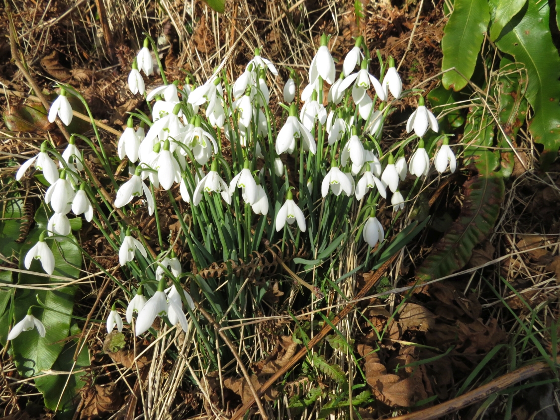
We emerged on the minor road just before the Kingcombe Centre and turned right towards Toller Porcorum and followed this Snowdrop-lined road into that village.
 |
| Snowdrops near Toller Porcorum - SY5598 |
Once in the sleepy village of Toller Porcorum I thought we were back in square SY5698, the square I'd ignored earlier in the day. I've just discovered the church is on the border between SY5698 and SY5697 and in Geograph it falls into SY5697. Don't panic, though; I've got another much more boring photo of SY5698 coming up soon . . .
. . . Today, however, squares aside, we were ready for our last cup of tea so sat on 'our' bench in the churchyard slurping tea, eating shortbread and looking out for Hawfinches. We saw none.
 |
| St Andrew and St Peter Church, Toller Porcorum - SY5697 |
"Please tell me we're not walking along that busy winding road," Paul pleaded. He meant Toller Lane and, yes, we were going along it. "We've no option," I insisted, "until they open up a footpath on the railway. The good news is we get to take a photo of those ducks."
The ducks had been breeding and the display had become much more elaborate from the first time we saw it. Someone (probably local) with a sense of humour admonishes drivers to 'Slow down' in a comical fashion at the bridge over the River Hooke east of the village.
 |
| Comical sign over River Hooke at Toller Porcorum - SY5698 |
We passed the sewage works and ducked and dived across the road making sure we were as visible as possible round bends and in the blinding sunlight. At field entrances we glimpsed the valley below - views we never got to appreciate when driving along this road.
 |
| Towards Maiden Newton from Toller Lane - SY5797 |
Then we scared some sleeping Roe Deer who fled immediately, bounding across the fields to our left with incredible energy and showing their tell-tale white powder puff bottoms.
 |
| Fleeing Roe Does - SY5797 |
I turned to take a photo of our uphill road just before we reached the A356 which we had to cross again.
 |
| Toller Lane - SY5798 |
We had a choice between a bridleway at the top of the hill or a track at the bottom of the hill here. As we were already at the top of the hill, we chose the former and walked past a seldom-seen row of holly bushes towards Chilfrome. I kept looking deep into the valley and wishing we oculd walk both paths at the same time; I felt I was missing something,but would have felt exactly the same had I been walking on the lower path.
 |
| Valley west of Chilfrome - SY5898 |
 |
| Barn in valley west of Chilfrome - SY5898 |
We could see where we'd walked earlier in the day about a kilometre north and parallel to where we were walking now. This was a much more pleasant walk. We approached Holy Trinity Church in Chilfrome eagerly; someone that morning had said Hawfinches had been seen here too.
 |
| Holy Trinity Church, Chilfrome - SY5998 |
There's a lovely bench her beneath a Yew tree and, if it hadn't have been so cold we would have sat and watched a while longer.
 |
| Bench beneath a Yew tree, Chilfrome - SY5998 |
As it was, we paused for a few minutes on our return past Cattistock Church just in case the Hawfinches should charm us with their company, but neither avian or human company was present here - a real contrast to this morning's hubbub of activity. We left the sleeping churchyard and returned to our car.
Number of new gridsquares: 5
Number of miles walked: 9.5
Number of Hawfinches seen: 4
Number of Roe Deer seen: 3
Number of Foxes seen (at some point): 1
Number of badger tracks seen: 1
Number of bird species seen: 25