Friday 27 October 2017

Three Churches revisited - October 26th 2017

Subtitled - In honour of Lorna's 26th on the 26th

Once in everyone's lifetime comes a very special birthday - it's the birthday that you reach the age of the date of your birthday. Everyone gets a chance for this to happen, but if your date of birth is before say the 12th of the month you probably won't appreciate the event. For anyone over the age of 31 - tough, you've missed the opportunity for a big celebration! Mine is on the 6th of the month so I missed out, Paul's is on the 5th of the month so when he was 5 he too missed out. Lorna however, was 26 yesterday, so, partly to celebrate and, more honestly, because I wanted to shed the dregs of my cold and go for a long walk, I chose a route I'd first encountered last February.

Jane was brave enough to accompany me and I greeted her at Maiden Newton with, between coughs, an apology for needing to send a text: "Lorna, it's your 26th birthday on the 26th of the month; I hope it will be an extra special day. Love mum xx" (In case you're interested, it was, she went out for a meal and then went to a concert - Mendelssohn and Brahms)
"What's happened to the weather?" was my next positive contribution to the conversation. "It's supposed to be partially clouded, not cloud cover 8/8!" Engrossed in these riveting topics of conversation whilst Jane booted and gaitered up (gaiters! I knew I'd forgotten something!), I forgot to switch on my GPS and consequently lost the beginning of the walk.
Paul and I had redone this walk subsequent to the first 'Three Churches rendition' and we too had parked on Chilfrome Lane, Maiden Newton as opposed to Eggardon Hill. There is more room for cars here, but it does mean a bit of road walking. Jane was undeterred though, thankfully.

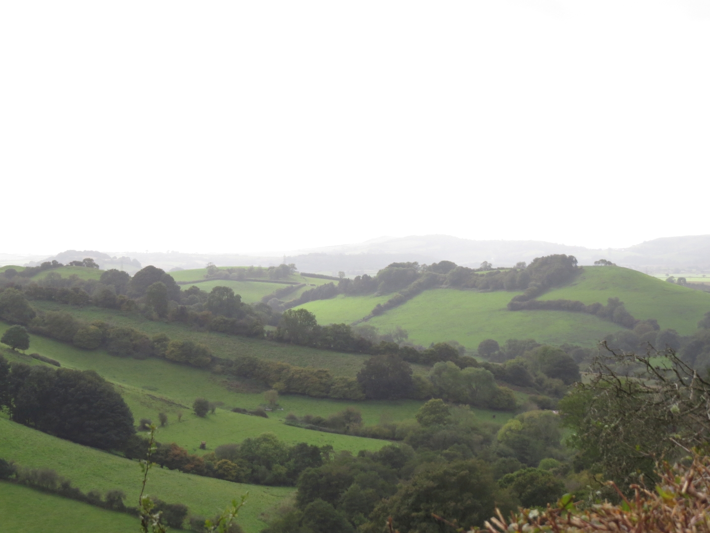
Flooded River Frome at Maiden Newton - SY5997 (taken 20/11//2016)
We crossed the A356 and went straight onto a footpath by the River Frome. Last year when Paul and I did the walk, the river had been much more flooded as per photo above. As it turns out, we were not to be disappointed by dwindling mud levels as a result today!
After the arduous road walking, we arrived in the village of Wynford Eagle where not a soul stirred. The village borders two gridsquares and I'm not exactly sure whether the church falls into SY5895 or SY5896. Having visited the church before, I didn't mind foregoing the privilege this time "as long as I can get the microcache", I said eagerly to Jane, digging in my 'everything but the kitchen sink' rucksack for the pen I invariably carry with me - except for today that is. "I haven't got one either," Jane confessed as I laboriously tapped  digits into my mobile phone. With the clues figured out and the co-ordinates obtained we realised we'd either worked it out wrong or the cache was a quarter of a mile in the direction we'd just come. Just that little bit too far to feel bothered enough to retrace our steps.
St Lawrence's Church, Wynford Eagle - SY5895 (July 2016)
Inside Wynford Eagle Church - SY5895 (taken July 2016)
We left the churchyard and wandered uphill past more cottages and then headed north towards Toller Fratrum. Opposite us, on Blanchard's plantation we could see the clearly defined pits.

Pits in Blanchard's Plantation - SY5896 (taken Feb 2016)
We descended High Hill into the delightful village of Toller Fratrum which is dominated at the moment by extensive renovation works on Little Toller Farm. These had been underway when Paul and I visited a year ago and seemed to have made little progress. Perhaps it's one of Kevin McCloud's 'Grand Design' projects!

"The church door is very stiff," I warned Jane as we approached. "A kind gentleman helped me open it last time," I confessed as Jane walked up to the door, turned the handle and walked in without exerting any muscle power whatsoever. "It must have been oiled since my last visit," I whispered begrudgingly.

Toller Fratrum church is one of only three in the country to be dedicated to St Basil, the patron saint of hospitals. The name 'Toller Fratrum' is a combination of the erstwhile name for the Hooke river - Toller. 'Fratrum' is Latin for 'brothers' and refers to the mediaeval ownership of the manor by the Knights Hospitaller. It is sobering to think that the population of this tiny hamlet is now only about a sixth of what it was in 1841. (67 in 1841, 10 in 2013.)
View from High Hill - SY5796 (Feb 2016)

St Basil's Church, Toller Fratrum - SY5797 (Feb 2016)
We sat with a cup of tea inside the church as there were no benches outside and then headed westwards, under the conduit which had us scratching our heads on my last visit. I never did manage to find out anything about it.
Conduit at Toller Fratrum - SY5797
We left the village and followed a winding route through Prestwood to Ferndown Farm, where I remembered having got confused on my first visit and wandering through the farmyard. It was easier coming this way though and we walked straight to the gate and onto the road.
Prestwood - SY5697 (Feb 2016)

Prestwood - SY5697 (Feb 2016)
Last time there had been a sign warning drivers of the gully.
Near Ferndown Farm - SY5696 (Feb 2016)
I'd forgotten about that sign! We continued onto Shatcombe Lane where several cars passed us and we dodged into the verge. A prominent tree had made a good photograph for the gridsquare on my first visit. (I barely had to take any photographs today!)

Prominent tree in SY5695 (Feb 2016)
We turned off toward Higher Wynford Farm and I immediately remembered two things: one, that I couldn't remember which way the path went - down an impossibly narrow and overgrown footpath or through the field? Inevitably we took the wrong option and had to retrace our steps to the impossibly narrow, muddy and overgrown footpath which led into the impossibly muddy woods and sadly the fly tipped white goods, now very rusty had still not been removed.

We were getting hungry now and had promised ourselves lunch at West Compton, now just down the road. I told Jane the story of my first visit here, how I'd met a lovely couple having a cup of tea outside their cottage and how I'd approached the lord of the manor to enquire about visiting the church and had been told he was too busy that day repairing his cottagers' roofs, but would be happy to show me round on another occasion. I had never plucked up courage to phone to ask about that tour, despite this now being my third or fourth visit to the church. I think this is the most times I've visited a church without actually having been able to enter - such a disappointment. As we walked round, we noticed several boards in the windows and wondered whether the church had been the subject of a recent break in. We hoped it was just a form of damp-proofing, but as we sat with our lunch outside the church, we became aware of a humming noise.

St Michael's Church, West Compton - SY5694
"What's that noise?" I asked Jane, looking round expecting to see a swarm of bees nearby. "I think it's machinery of some sort," she decided. "Yep, definitely a strimmer," she confirmed, "It's getting closer. It's right by that wall. We're probably going to be accosted at any moment and questioned as to our intentions in being here." She munched away on her cheese and beetroot sandwich, then had a painful flashback, "As long as he's not wearing a green swimming costume," she laughed, holding her mouth lest a piece of beetroot escaped.

Just recovering from this information, we realised the humming noise was now above our heads and looked up to see a drone circling above us. Someone had obviously heard our voices and wanted to make sure we weren't up to any nefarious business. I surmised it must be the lord of the manor too busy to come and see us in person so sending his drone instead. It's a sad indictment of the times we are in that there is the need to be suspicious of people in a churchyard and that everyone's too busy to be friendly these days.

Reflecting on this, I asked Jane to tell me the green swimming costume story, which she did and which I won't repeat here as I want everyone who reads this to be able to walk freely in the countryside without fear.

After our prolonged lunch we continued through the village of West Compton to the ponds where we disturbed Moorhens and Mallards and where autumn was looking beautiful

West Compton pond - SY5694
We wandered through SY5693 without paying much attention and I missed the footpath we were supposed to take so I didn't get a photograph of this square and I don't have one to represent the path we ended up mistakenly taking!
We were now at the most southerly point of our walk today and walked along the straight Roman road until turning off into a boring field whose only feature I remembered from last time (again!) being a reservoir, which was now out of sight. At some point earlier in the day we had passed what was probably a reservoir in the middle of a field and I had pointed it out to Jane saying that it might be a nuclear bunker, but I wasn't sure. I assured her this was definitely not a nuclear bunker, but it was interesting if only because it provided a feature for my gridsquare photograph.

Reservoir in field near Compton Barn - SY5793 (Feb 2016)
Despite having done variations of this walk several times now, I never seem to be able to remember which gate to go through at the settlement near Compton Barn in order to join the Jubilee Trail. I got it wrong again and we waded through long, wet grass in a churned up field (with the settlement) whilst Jane was answering a call from her boiler service man!
Settlement near Compton Barn - SY5794
Jane reminded me that whilst it might be tedious walking through ploughed fields, the view up here was tremendous and I chastised myself for my lack of gratitude. Again I recalled my first visit, on a clearer day, when I'd been able to spot my parked car on Shatcombe Lane from several points throughout the day. Despite looking, we couldn't make out the lonely tree which had featured in my earlier photograph and which was on the lane where I'd parked my car on the 'please shut up about it now' visit I've alluded to far too many times!

Jubilee Trail, Round Hill - SY5795
As we approached Wynford Eagle again, I asked Jane whether she wanted the longer route or the shorter route. Foolishly she opted for the longer route. "We've got to get you some new gridsquares today," she laughed. True, I wouldn't have got a single one otherwise, so with a growing sense of excitement we re-entered the village and turned right at Manor Farm. "Now, this is new territory," I hastened to explain to Jane. "That means if we go wrong from hereonin it's not my fault." Within minutes we'd gone wrong! I blame tiredness. We'd made the easy mistake of following the farm track instead of looking out for footpath signs. We retraced our steps as soon as we realised, having already discussed the merits of always doing so as opposed to continuing on in a foolhardy, stubborn and invariably 'soon to be regretted' manner.
As we got to the top of the hill and passed a barn I remembered I had been on this footpath before and admitted so to Jane. "I remember photographing that barn," I exclaimed as if this was revolutionary news. "But I've definitely not been in the next square," I added, eager to get into it now.
At Greenford Farm a tractor was hedge cutting and we walked in vain along the edge of the field looking for the footpath sign and exit of the field. If there ever was one, it was no more, so once again we retraced our steps and went through the gate, along the road only to find the footpath sign clearly pointing into the field from which we'd just come. There was no way you could get into the field through the hedge as it was, so that's another one to report. I seldom go for a walk without having to report at least one blocked entrance, locked gate, or missing or broken footpath sign.
As we stood on the verge of SY5995 I tingled with excitement, especially as there before us was a glorious valley. We'd been walking through rather monotonous farmland and now we were going downhill (yippee) and were surrounded by the rolling hills of Dorset.
Valley near Cruxton - SY5995

My spirits lifted despite being tired and wishing we could have another coffee break.
It wasn't just us that were excited about being in the field. The goliath sheep herd were also excited and ran over to us immediately in anticipation of being fed. "You've been hand-reared, haven't you?" Jane asked them as she stroked their woolly backs, oblivious to the fact that her map was about to be eaten. They didn't reply but neither did they leave us alone. Just when we thought they'd got the message, they came hurtling after us again and I have to admit I was a little unnerved by this. I'm not normally scared of sheep but they were humungus and could easily have knocked a tired walker down.

Jane and the Goliath sheep - SY5995
We escaped the gluttonous sheep and reached a stile which looked as if it hadn't been used in a while, despite Jane having declared (for at least the second time that day) that this was the valley she'd walked through a few weeks ago on a walk with the group of which we are both members. (She later retracted that statement - the bit about having been in the valley before, that is.)
With the sheep safely behind us we had only pheasants and partridges to worry about and we chatted away about a multitude of topics as we entered my second new gridsquare of the day - SY5996.

Pheasant run in SY5996
This was obviously pheasant breeding territory and a crop run had been left for them with feeding stations in between. We managed to leave the footpath once again, but when we retraced our steps this time, we found that the path must have been diverted and we were actually on it. We just wondered what would happen when we reached Cruxton Manor. As it turned out, it wasn't obvious, but we wended our way onto the footpath we'd both been on before which follows the River Frome.
Bridge over the River Frome - SY6096
We walked along the road this time, guessing it would be easier than yet another muddy field. Our feet were well and truly caked in a variety of species of mud and I intended taking a photo, but forgot. We turned towards Lower Frome Vauchurch, but at 5 pm I reckoned it was too late to start figuring out enough microcache, particularly as we hadn't yet found a pen so we peered inside this cute little church and then left it for another occasion.

St Francis Church, Lower Frome Vauchurch - SY5997
We got back to the cars shortly before 5.30 pm just as the sun had decided to emerge before going to bed.
Number of miles walked: 12.6
Number of new gridsquares: 2
Number of gluttonous sheep encountered: 13 Number of drones that spied on us: 1 (as far as we know!)
Number of churches visited: 4

Thursday 5 October 2017

Halstock Circular - 7th September 2017

I didn't want to travel far today as we were setting off the next day for our long Dales Way walk and I had last minute packing to do, but it seemed a waste of a day not to get out somewhere - always my philosophy - so I chose Halstock as I still had some squares to fill in there, despite having walked from there several times.

Phew! That was a long sentence! I parked on the street and set off in a south-westerly direction down Common Lane.

House on Common Lane, Halstock - ST5307

This is a lovely wooded lane that runs for about two miles between Halstock and Corscombe and was probably used to drive cattle in days of yore. It also passes the site of a Roman villa near the village golf course, but that's quite a common thing in these parts so nothing to get excited about, particularly as there's nothing left to see anyway.

Common Lane, Halstock - ST5207
 I turned right at Ocean Hill and headed for Brackett's Coppice, a reserve managed by the Dorset Wildlife Trust in an area of mixed woodland with a river running through it. It's a lovely pocket of land and largely unvisited compared with other more popular sites.

Near Ocean Hill - ST5206
I entered the next gridsquare before turning right into the reserve proper.

Near Brackett's Coppice - ST5106
I was not alone in the reserve; some of DWT staff were monitoring the success of the Marsh Fritillary butterfly by counting their caterpillars. I was surprised to see anybody else out that day, but pleased that the site was being managed and watched and enjoyed by others. We have sometimes wondered if we were the only people other than dog walkers to come here.


Brackett's Coppice - ST5107
There's only one flaw with Brackett's Coppice that I can see and that is the lack of anywhere to sit with your picnic. We have encountered this problem before and ended up sitting on the bridge with our sandwiches - and that's exactly what I did today in the hope that, as with the last visit, a Kingfisher would fly by. It didn't. But I sat enchanted by the orchestral sound of the river, listening for each ripple and deep boom and laughter of the river as it flowed eternally on. There is something very soothing about a river's course. I think, for me, it has something to do with its energy, its life and its temporal nature; there is nothing stagnant about a river (unless there's been a drought); it is always moving, always going somewhere and never lingering, dwelling on obstacles. It is a metaphor for life - or should be. I find a river at once inspiring to and energising and yet soothing and quietening. I'm not sure how that is possible,but it is and I found it so today as I sat and listened to its message.

After deciding that the Kingfisher was not going to honour me with a visit that day, I exited the reserve via the route I am familiar with and turned right at the triangle, northwards towards Sydney Farm. I'd never walked along this bit before and i always find new territory exciting.

I turned left at Baker's Farm and entered a new gridsquare, a very muddy one in parts too. With Paul's written words ringing in my ears ("Don't get muddy!") I managed to swerve most of the mud keeping the newly cleaned and waxed boots as pristine as I could ready for our holiday.


Gate near Baker's Farm - ST5007
I walked under the pylons and into the next gridsquare - the one which contains the Dorset/Somerset border - ST5008. A gap in the hedge made an adequate subject for a photograph of this square, albeit not a very exciting one!

Near Higher Halstock Leigh and the Somerset border - ST5008
I deliberately detoured so as to enter another bordering gridsquare - ST5108, using a new build at Pear Tree House as my subject for this square.

Pear Tree House - ST5108
There is only about a mile between Higher and Lower Halstock Leigh and I walked most of it on the road, returning to the Brackett's Coppice square between the two hamlets and passing Winford Farm.

Overland Farm had an attractive barn to photograph for ST5207.

Barn at Overland Farm - ST5207
I was supposed to walk through a field here but there was an electric fence and horses in the way, so I walked round the field and briefly entered ST5208 near Halstock Mill.

Field near Halstock Mill - ST5208
 I turned right towards Halstock instead of left to Halstock Mill.

Sign to Halstock Mill - ST5308
I was near my beginning now and walked across a final field to the church, pausing to take a photograph of a rather broken footpath sign.

Footpath sign near Halstock Church - ST5308

The last time I visited St Juthware and St Mary's Church in Halstock, there had been a wedding there and I had been mightily disappointed not to be able to look round and shelter from the snow shower. This time I lingered longer, taking time to work out the clues for the microcache that is hidden nearby and to look once more at John Pitt's grave and muse on longevity, on villages and forthcoming holidays - then away I must for my next walk would be a long one!

St Juthware and St Mary's Church, Halstock - ST5308

The grave of John Pitt whose life spanned three centuries, Halstock churchyard - ST5308

Number of new gridsquares: 6
Number of miles: 7.6


Wednesday 4 October 2017

Beaminster to Loscombe - 30th September 2017

My Memory Map is awash with red routes from Beaminster. It's in the heart of Dorset and one of my favourite places to start walking from. Having read in Louise Hodgson's book about Loscombe and realising I had some unvisited squares to photograph in that area, I devised my new route and set off with Paul on a rather dreary looking Saturday morning.

Having fixed the parking metre at Yarn Barton car park, we set off south, following the River Brit on a much walked route. We anticipated mud today; it's always better to anticipate it, to revel in it actually, rather than be disappointed if you encounter it, especially at this time of year, because, let's face it, you're going to encounter it, so don't be a wimp! Gaiter up and go for it!

Except we didn't have gaiters on. I'm not unduly concerned about this - where's the hardship in throwing the trousers into the wash afterwards. I hate getting all grubby at the end of a walk when you start to take off those caked-in-mud and cow slurry garments. I'd rather just get mud on my trousers.

We followed the Jubilee Trail as far as Netherbury, which was all familiar territory. Then we continued south on the minor road to an attractive bridge over the River Brit, where we veered left  towards Lower Yondover Farm.

SY4799 - River Brit at Netherbury
I was now in my first new gridsquare and eager to take a photo after three previously photographed gridsquares. Problem was, there wasn't much to photograph so I had to settle for one of the footpath, despite craning my neck for a glimpse Slape Manor. We could have walked through the grounds of this manor house, but it would have been a diversion, an indulgence even, for the sake of my anal hobby, so we walked on through rather uninspiring scenery for a time - that would soon change!

Near Slape Manor - SY4798
We joined a minor road near Oxbridge and then turned off again at Oxbridge Farm.

Oxbridge Farm turn off - SY4797
It was a short walk now to Melplash, a village we'd never actually stopped in but had driven through many times. I have to admit, there's never been an incentive to stop in the village; it just doesn't look that attractive, but I needed to photograph something within the village and the church was my natural choice.

Christ Church, Melplash - SY4897
We sat in the church for a late coffee break, resisting the temptation to eat lunch here - we wanted to wait for a half way point. The church is very sparse, with not much to commend it, but you can play badminton here as there is a court housed within the vastness. It is a shame that such a relatively young church (built in the nineteenth century) is already heading towards redundancy. I hope it manages to avoid being closed down and converted into a dwelling house as so many church buildings are these days - and beautiful dwellings they make too; it just seems we've lost something when that happens somehow.

Amusing sign in Christ Church, Melplash - SY4897
We crossed the A3066 and joined a footpath we'd seen from the car many times. It has been diverted since my map was published (2014), which confused us for a bit until we realised we were simply going to head round the south flanks of Hincknowle Hill, instead of the north flanks. Aha!

There is a small clump of trees on Hincknowle Hill's modest summit, which at 114 metres we did not attain, choosing to save our energy for the many miles ahead. There was another slight diversion at Walnut Farm which had us walking up and down the holloway two or three times in confusion. An attractive holloway it is though (when is a holloway not attractive?)

Lane near Walnut Farm - SY4997
We were heading east now and entered a rather derelict orchard where someone had been picking and bagging crab apples. We picked up a couple of windfallen eaters and munched them as an aperitif for our lunch. Yummy!

Orchard near Walnut Farm - SY4997
We were climbing now, as well as following a trail we'd never heard of before - Dorset Wildlife Trust's Anthill Trail, which is advertised as being a 'challenging 6 km trail' through three nature reserves - South Poorton, Loscombe and West Milton. We saw evidence of anthills - apparently they're yellow ants, but no ants, not that we were looking to be honest!

We were, however, looking for a lunch spot and having decided the rain had chosen not to fall in torrents, we opted for a conveniently placed tree trunk on top of the hill near Marlpits Farm. This afford a glorious view, albeit cloudy, of Hincknowle Hill, Bull's Hill and Pen Well Hill. I gave Paul a bit of a tour whilst we munched our sandwiches, pointing out that there were no footpaths through SY4998 so we'd either have to walk along the minor road or stop the car whilst driving along. Pen Well Hill looks an attractive hill and it's a shame there's no footpath up it.

Hincknowle Hill from SY4997

Pen Well Hill from SY4997
After lunch we were greeted by three very masculine tups who posed beautifully for a photograph but did not object to our passing.

Tup at Marlpits Farm - SY4997

Posing beautifully at Marlpits Farm - SY4997
We then joined the road we'd have to walk along for the aforementioned footpathless gridsquare, but turned off towards Loscombe. I felt quite excited about reaching Loscombe as Louise Hodgson describes it so evocatively in her book, Secret Places of West Dorset. It certainly feels like a secret place, deep in the heart of Dorset. One of those places you would have to be earnestly seeking rather than stumble across as it is miles from anywhere down wiggly windy roads, the sort I adore.

The road ends at Loscombe, but a farm track continues to Sunnyside Farm and what must have once been an old drovers' lane heads over to North Poorton.

Lane between Loscombe and North Poorton - SY5098

It is a beautiful lane with hazels bending over to meet each other across the deeply rutted track. We discussed whether any motorised vehicle could still negotiate such deep ruts and decided it could provided it kept itself perfectly poised on the narrow channels and did not sink into the ruts. For evidence we saw a tyre at the top of the lane and, feeling like school children again,  I'm afraid we committed a bit of a crime here. "Wouldn't it be fun to ...." So, in need of a bit of a laugh we rolled it down the hill and watched as it bounced its way all the way down. We'd expected it to fall a long time before the end - perhaps it did!

This was the land the Dorset Wildlife Trust owned, at least it adjoins it and we vowed to return in the spring to find the delicate Snake's Head Fritillary which blooms in the valley below. We looked longingly over the gate to the 'poor land' which is still difficult to farm, but which makes for such beautiful scenery.

View from Loscombe - SY5098

View from Loscombe - SY5098

View from Loscombe - SY5098
Greenway Barn provided a photogenic subject for the next square.

Greenway Barn - SY5198

We made a good decision not to continue on to North Poorton, although I cannot recall having visited the church there before. Our walk was long enough without prolonging it in this way. I shall have to include it on future walks though.

We curtailed the walk yet more by cutting across before reaching Burcombe. I was not going to miss any gridsquares so it didn't matter too much. There is a prominent enclosure in SY5198.

Enclosure - SY5298
We headed down the steep hill towards Mapperton Estate, walking now in a north-westerly direction and entering Burcombe Wood where we encountered a new species for us - Reeves' Pheasant.

Reeves Pheasant in Burcombe Wood - SY5098

These are bred no doubt for shooting and were surprisingly incredibly tame, almost allowing us to stroke them!

We were walking parallel now to the drovers' track near Loscombe and could see the chimneys of Loscombe Farm. We would not be walking that way, however as we turned off  to join the Jubilee Trail after finding a delightful little waterfall and a ruinous building of unknown origin.

Waterfall in Burcombe Wood - SY5098
We were in familiar territory now, having walked this way several times before. We were going to go on a different path once beyond Mapperton House though - a decision which proved to be our undoing, unless you count the opportunity to report faults on footpaths as a good thing!

Mapperton House - SY5099
Instead of continuing west on the Jubilee Trail we headed northwards on local council footpaths wh which obviously had not been walked in a long time. All was well until we reached Marsh Farm.

Marsh Farm ST5000
We plodded northwards through a field when Paul asked where the exit was and I confidently pointed to the corner of the field. Well, it was there - perhaps 50 years ago! Sleeping Beauty's prince would have his work cut out for him trying to get through the thicket that lay between us and the B-road and our next footpath. With only Paul's small penknife to serve as a much-needed machete, we admitted defeat and turned back to walk through the long grass in search of another exit. We found a gate into the neighbouring field and then another gate onto the road. We then had to walk along this quite busy road to our next footpath, which was also blocked. Fortunately there was an alternative entrance which we negotiated with some inconvenience as it was obstructed with chicken wire and debris. Phew! Our relief was short-lived however, as our next turning was barred with barbed wire - right across a public right of way!

We walked through the neighbouring field and back into Beaminster, not before washing our very muddy boots in the river before entering the housing estate on the east side of town.

Field near Storridge Farm - ST4900
A walk to be repeated in sunnier weather and amended at Mapperton - otherwise a lovely walk with a lot to commend it.

Number of footpaths reported: 3
Number of friendly tups: 3
Number of new gridsquares: 7
Number of miles walked: 11.5