One such place was Lulworth Castle. We'd visited Lulworth Cove in the height of the summer last year and, having read so much about it, I have to confess I was disappointed. Any potential views were marred by a muddy field of uniformly grey cars, ice-cream stalls and throngs of people on every square inch of beach. Despite its legendary status as one of Dorset's beauty spots, Lulworth has quite an ugly beach; viewed from above it is attractive and admittedly sheltered as it is nearly entirely enclosed and protected from the elements on all but the most southerly side, which, along with its accessibility, make it an attractive spot for families. Of course these families have to pay the price for such facilities with expensive car parking. The beach itself is difficult to walk on and there is hardly any sand and seemingly nowhere to investigate rockpools, so it's not what I remember from my childhood days as being a typical family beach. Nevertheless, the surrounding area is beautiful and we decided to revisit on a winter's day and visit Lulworth Castle as well.
The attraction of Lulworth Castle was its Roman Catholic chapel. Apparently in the eighteenth century catholics could be persecuted for their faith so the Weld family, practising catholics, were advised they could build a catholic chapel on their estate provided it did not resemble a religious building. Hence the building which stands there to this day under which, thankfully there is no longer any threat of persecution.
Our day began in glorious sunshine at St Andrew's Church at East Lulworth, where a wren had found its way into the building and seemed trapped. We kept the doors open whilst we were there and assume it got away; we certainly could not find it when we exited the church.
 |
| St Andrew's Church, East Lulworth - SY8582 |
Our next stop was the Castle, just next door to the church. At first we were reluctant to spend any daylight hours indoors on a day like today, but our reservations were soon swept away by the wonder of the Castle.
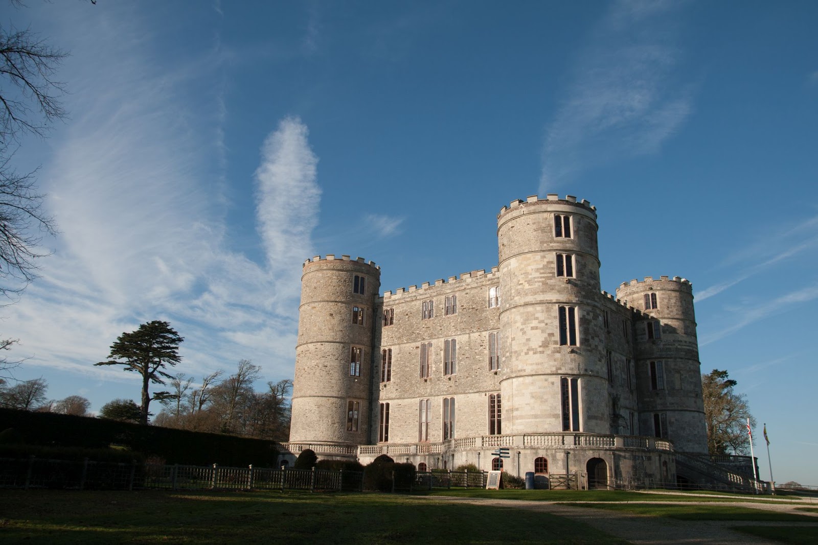 |
| Lulworth Castle - SY8582 |
The Castle was completed in 1609 and bought by Humphrey Weld in 1641. Almost completely destroyed by a fire in 1929, the castle has been restored by English heritage and reopened in 1998. Still owned by the Weld family, it is now a major tourist attraction with mediaeval-themed events. The current Weld family reside in a separate building on the same estate.
 |
| Christmas tree inside Lulworth Castle - SY8582 |
 |
| Suit of armour inside Lulworth Castle - SY8582 |
 |
| Door buckled by fire inside Lulworth Castle - SY8582 |
 |
| Inside Lulworth Castle - SY8582 |
 |
| King Charles' bedroom - inside Lulworth Castle - SY8582 |
 |
| St Mary's Roman Catholic church, East Lulworth - SY8582 |
No photography was allowed inside the ornate church, but it is well worth a visit to see the exquisitely painted roof and unusual yew chairs.
We spent longer than anticipated inside the Castle and chapel and then left for the coast, where we planned a short walk through the ranges, with the hope of finding Smugglers' Cave.
Having ascertained that the ranges were open, we started our walk just slightly inland, passing a radar station, which made a good feature for gridsquare SY8380.
 |
| Radar station within the Ranges - SY8380 |
We walked to Mupe Bay and had lunch overlooking this beautiful beach, equally as beautiful in my opinion as the much more popular Lulworth Cove.
 |
| Mupe Bay - SY8479 |
 |
| Mupe Bay - SY8479 |
We were disappointed to discover that, unless you wanted to risk life and limb, access to Smugglers' Cave was impossible. This coastline is dotted with a myriad of caves which were probably all used in days of yore for storing contraband goods. My mind returned to the wonders of 'Moonfleet', a book I have to confess I have only read this year and thoroughly recommend. There is a wonderful description of how young John Trenchard is shot in the leg on the cliffs here by the excise men and struggles with a broken leg and is urged on by his companion Elzevir Block. They shelter in caves (perhaps Winspit). In lieu of Smugglers' Cave, I took a photo of a radar station for gridsquare SY8379.
 |
| Radar Station near Mupe Bay - SY8379 |
Again we were to be disappointed, this time by the inaccessibility of the Fossil Forest near Lulworth. The footpath has been closed due to the path being deemed unsafe. We viewed the fossilised trees from a distance.
 |
| Fossil forest, Lulworth - SY8379 |
 | |
We looked down on, and then descended to Lulworth Cove, which we tramped across with difficulty, eager to reach Stair Hole before it got dark. On our last visit, we had not known of the existence of Stair Hole and others spoke highly of it, saying it had been quiet compared to the crowded nature of Lulworth where we had eaten our picnic, not knowing any better. So we were keen to see it for ourselves.
  
Lulworth Cove and Stair Hole - SY8279
|
We continued to Hambury Tout and then, tired after a full day, we turned back, retracing our steps to the car.
 |
| Hambury Tout trigpoint - SY8180 |
Number of new gridsquares: 6
Number of miles walked: 5.6
Number of churches visited: 2
Number of trigpoints: 1
Number of cuddly bats seen: 8
Number of cuddly bats missed:2


