Sunday, 26 June 2016

East Fleet via Langton Herring

We were looking for an easier option today as Paul's back is not recovered yet from his injury on holiday (bending down to lift my suitcase!) I had visited East Fleet before and was keen to see if we could make a decent walk of it for the Dorset Walkers. Our plans were thwarted immediately by a temporary sign on the gatepost of the new Fleet church which kindly asked no-one to park there as there was a wedding there today. We parked on the road instead which added a total of a quarter of a mile to our walk.

Having seen the old church at Fleet before, I decided we'd 'save the best till last' and go inland first, retracing my steps of a previous walk in April. We headed north-east from the church at Fleet and crossed the B3157. We then headed north towards Higher Barn where we sat with our lunch on upturned buckets, sheltering from the rain. All day we donned light rain jackets, only to take them off minutes later because the rain had stopped and we were too hot. I much prefer a heavy, know-where-you-stand downpour where you can wear your waterproofs all the time and have the satisfaction of taking them off and getting muddy fingers at the end. OK, so maybe I don't 'much' prefer it, but there is a certain certainty about that situation. Showers lend themselves well to photography, on the other hand, or can do if the scenery and cloud landscape permits.

We assumed the footpath had been diverted just after Tatton Coppice because the signs ran out and we ended up taking a longer route. Looking at the newer map when we got back, we realised the path hadn't been diverted; there just weren't the right signs in the right place - grrrhhh! We managed to get out onto the road at Langton Cross, but it involved doubling back on ourselves for a tiny bit - another reason the walk was longer than my predicted 6.5 miles!

Somehow we managed to miss the Mediaeval Cross at Langton Cross, but we did spot a Butterfly Orchid which someone had fenced round.

Greater Butterfly Orchid at Langton Cross

We passed a circular building  in a field which I later found out used to be a lime kiln; there are, or were, a few in this area.

Lime kiln near Langton Herring - SY6282

We had walked through Langton Herring before. It is a very attractive village which has a sign announcing it is 'doubly thankful'. After some research I discovered the meaning of the sign. Apparently Langton Herring is one of 13 villages in England and Wales which did not lose a single man in either the First or Second World War.

Bus stop at Langton Herring - SY6182

It has also got a very nice pub, The Elm Tree, where we sat in the garden with a drink to gather strength for the next part of the walk.

At the church we learnt a sad story. In 1830 four young boys, aged between 6 and 8 were playing at the village lime kiln when they were overcome by fumes from the kiln and were killed. They are all buried in the church graveyard.

Grave to four boys at Langton Herring churchyard - SY6182


We were now walking south towards the coast and I was suddenly glad we'd saved this bit till last. I think it's a good policy to employ; just when your energy is waning and you need something to keep you distracted, there is the Fleet lagoon.

The Fleet from near Langton Herring - SY6181

I was very pleased to hear and see the Corn Bunting, a bird we had seen and heard on South Uist, but one I've only seen once before in Dorset. Its call is quite distinctive, a bit like rattling keys, and it alerted me to its presence. This photo is from our holiday in South Uist, so I'm cheating a bit.

Corn Bunting
We joined the South-west coast path and continued to Gore Cove, right at the edge of the Fleet.

Gore Cove and the south-west coast path - SY6180

We passed the curious Moonfleet Manor Hotel, named no doubt after J Meade Falkner's children's novel set in this area. It seems to be a mish-mash of architectural design, with some strange castellations, but the eastern most part of the building looked quite attractive.

We passed briefly through SY6280 and I photographed what used to be a pit for extracting minerals, but is now barely discernible as such.

SY6280 - pit for extracting minerals

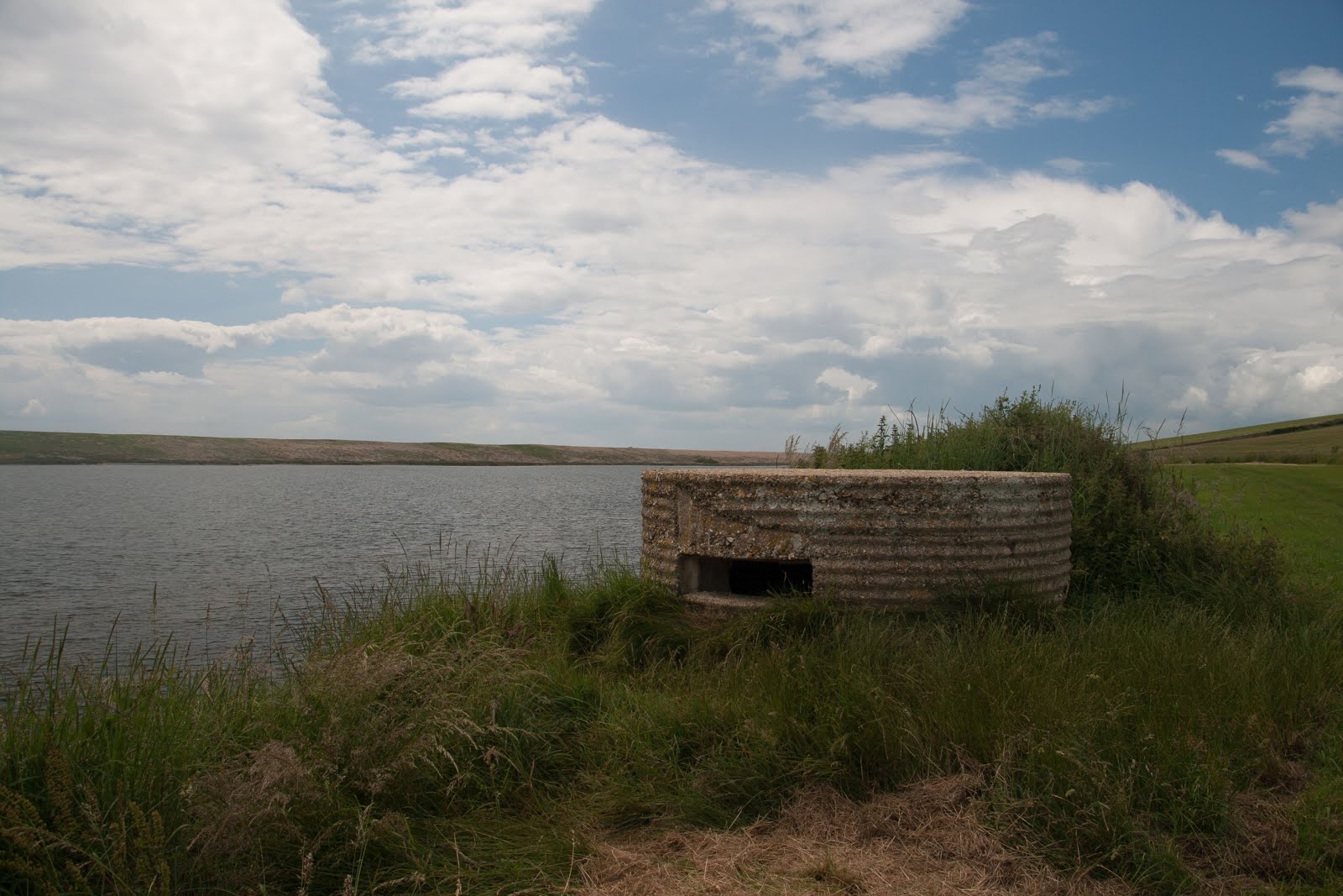
There were two pill boxes in the next gridsquare, both different types - one circular and one octagonal. It is still possible to enter the rectangular one, and probably the circular one too, but we didn't attempt that (not with Paul's back!)

Type 22 Second World War pill box on The Fleet - SY6279
Type 25 Second World War pill box on The Fleet - SY6279
The Fleet is a nature reserve, but other than the Corn Bunting, Mute Swan and Cormorant, we didn't see many birds. We did see seven species of butterflies, however - Painted Lady, Small Tortoiseshell, Meadow Brown, Large White, Red Admiral. Large Skipper and Speckled Wood.

There was just one more gridsquare to photograph before we reached East Fleet and there was no question of the subect for my photograph. Who can resist photographing a bay with the name of Butterstreet Cove? Butter Street is the name of what appears to be the only street in East Fleet. Most of the village was washed away in the great storm of November 1824, as was the church. All that is left standing now is the chancel, the nave having been completely washed away.

Butterstreet Cove - SY6379
East Fleet old church - SY6380

We sat on a bench at the church and drank the last of our tea from our flask and then plodded our weary way back along the road to the car.

Trigpoints - 0 (one narrowly missed)
Miles - 7.9
Churches - 3
Mediaeval crosses - 1 (even though we missed it)
Cups of tea (3 for me; 2 for Paul)
Pints of beer - 1 (Paul)
Gridsquares - 6 new

Friday, 27 May 2016

Portland

Some places endear themselves to you first time, others take a while and others, bless them, just never manage it. Portland falls into the middle category. It has taken a while, but this almost-island has finally managed to raise its triangular-shaped landmass in my esteem. Of course, visiting in May when the island is a mass of colour - sea-pinks, Valerian and Horseshoe Vetch - helps, as do the myriad of butterflies and friendly faces.

I'd set off  early with a mission. The Great Spotted Cuckoo. This bird, like many others before it, had lost its way back to the Continent and found itself on this tiny land-mass instead and had been photographed and goggled at many times. Armed with my usual set of debilitating accouterments, I arrived at ground zero, having followed Sean's careful instructions, at 9.30 am and set up at my vantage point, together with a fellow hopeful Cuckoo-watcher.

Reap Lane - where the Great-spotted Cuckoo has been seen (SY6870)
We soon noticed the reason for the Cuckoo's lengthened vacation here - the bushes were stripped of their foliage and the ground was swarming with Brown-tail moth caterpillars, part of the cuckoo's favourite menu.

Brown-tail moth larva

The ground might have looked like an inviting platter, but there was no sign of the Cuckoo and so, after a couple of hours of waiting, I set off on my travels, having quickly devised a circular walk which would ensure I didn't miss the Cuckoo if indeed it were still around.

Wall Brown - seen whilst waiting for the Great Spotted Cuckoo

I wandered towards the coast and joined the Portland Coast path and photographed my second gridsquare - SY6770.

Portland coastal path between Mutton Cove and Wallsend Cove - SY6770.

I cut inland at Wallsend Cove - a square I had photographed on a previous occasion - and continued southwards to the Bird Observatory. There had been no news of the coveted Cuckoo from here either this morning, but I popped in anyway and had my lunch in the garden there, in the company of a few other people and an Eyed Hawk Moth which the warden had caught in the mot trap the night before.

Eyed Hawk Moth at Portland Bird Observatory

I had decided to walk to Broadcroft Quarry Butterfly Reserve and was trying not to think too much about the possibility of seeing an Adonis Blue butterfly. We had had several failed attempts to see this beautiful butterfly last year, and more than one false alarm. You think it's going to be obvious, but there are always quite a few 'Is it? Isn't it?' moments before that decisive 'It definitely IS!' moment.

I looked back towards the bird observatory through the many beach huts which adorn this stretch of coast, but I preferred to look at the glorious carpet of Thrift which made me wistful as I thought how pink Islay's coastline would also be at the moment.

Beach huts at Portland with Portland Old Lighthouse/Bird Observatory in the background - SY6868

Thrift on Portland's coastline - SY6868
There are quite a few big caves along this stretch of coastline as well as plenty of evidence of quarrying work, past and present. I was intrigued by the amazing balancing acts of some of the huge blocks of Portland Stone.


Caves and winch, Portland - SY6869
Winches and Portland Stone - SY6869

Portland Coastal Path dips ever so slightly into SY6969 at an curiously named place called God Nore.

Portland coastal path at God Nore - SY6969


At Freshwater Bay the path turns inland and joins the road for a short stretch, before descending steeply down Southwell landslip. Intrigued by the name, I did some research and discovered that The Great Southwell Landslip occurred here in 1734. Named after Portland's southerly village Southwell, the landslip occurred between Durdle Pier and Freshwater Bay, a distance of 1 1/2 miles (2 km). It remains Britain's second largest recorded historical landslide.

Descending Portland's Coast Path at Southwell landslip - SY6970
With gorgeous Red Valerian and Horseshoe Vetch growing in profusion on the path's edges, I saw plenty of Common Blues here, which made my heart skip a beat or two!

Common Blue, Portland

I remembered the steep descent and equally steep ascent at Church Ope,  where the path ascends to reach Rufus Castle, Portlands's oldest castle, dating from the late 15th Century. Romantically, it is also known as Bow and Arrow Castle. 


Rufus Castle, Portland - SY6971
 I stopped halfway up to investigate the ruined St Andrew's Chapel here, the first parish church on Portland, the existing ruins dating back from the 1400s and much of the building having been demolished during the aforementioned landslip. It is said that there are pirates buried in the graveyard here, but that's only because several of the graves have skull and crossbones on them, which was actually quite a common icon in centuries gone by. There's plenty to photograph here with lizards and beetles scurrying around, basking on the sun-kissed stones. The lizards were always too quick for me, but I did manage to photograph the Bloody-nosed Beetle.

Pirate's Grave - St Andrew's churchyard - SY6971

St Andrew's church and churchyard - SY6971
St Andrew's churchyard - the crypt - used for smuggling contraband? - SY6971

Bloody-nosed Beetle near St Andrew's Church - SY6971
Red Valerian and dandelion clocks at St Andrew's Churchyard - SY6971

I turned inland at the delightfully-named Shepherd's Dinner, imagining brave shepherds of days gone by negotiating these treacherous cliffs and stopping for a bite of lunch. 


The Portland coastal path at Shepherd's Dinner - SY7071
At last I was at Broadcroft Quarry - or was I? At least the ground was ablaze with yellow, more Horseshoe Vetch than I have ever seen and a paradise for the Adonis Blue, whose larvae feed on this plant.


Horseshoe Vetch at Silklake Quarries - SY6971

I watched a Common Blue fly by and suddenly it was joined by a butterfly a shade of blue I had never seen before, a shimmery, powder blue. There was nothing 'powdery' about this feisty creature, however, as it fought tooth and nail to chase the Common Blue away. With my heart in my mouth I knew I was in the presence of the Adonis Blue and my moment of joy took my breath away.

Adonis Blue - more beautiful in flight than when perched

I watched for quite some time and took many photographs before moving away and leaving this pair to their fight, not wanting to see its conclusion.

Tiring now in the heat of the day, I decided I would return to the car. It amazes me how nature lives alongside our destructive processes. Here in this quarry the Horseshoe Vetch thrives and provides a home for this most delicate of butterflies. It is not us who are 'giving nature a home'; we are all part of nature after all. The arrogance of that statement infuriates me. Nature has a home; sometimes and in many ways humans have destroyed nature's home (ourselves included) and now we're fumbling to return some of that home. 

I ponder on that quite often.

I walked wearily long the streets of Easton, past Pennyslvania Castle - a most luxurious home, back to my car at Reap Lane, where I met the only grumpy person of my day. He either lied about the Great Spotted Cuckoo, or genuinely didn't know that it had been seen earlier that afternoon. If he didn't know about it it's probably because he never stopped to find out from anyone - if his refusal to stop to chat to me was anything to go by.

Still, I was content - given the choice between the Adonis Blue and the Great Spotted Cuckoo, I'd have chosen our resident butterfly any day.

Miles: 6
Gridsquares: 7 
Butterfly species: 5 - Common Blue, Dingy Skipper, Small Heath, Wall Brown, Adonis Blue


Wednesday, 11 May 2016

Godmanstone to Charminster

For my birthday walk, I decided to treat myself with a trigpoint as well as lots of new squares. of course, there's always a risk in drawing a route on a map - it might not turn out to be as nice as it looks on the map. I'm also discovering with circular walks that there's usually half the walk which is particularly scenic and the other half not quite as scenic. That was not the case with John's Ringstead walk (last post) and I told him so - both the coastal route out and the return inland route were scenic. but in Pembrokeshire the same thing happened, we enjoyed walking the coastal path, but as soon as we turned inland we were walking through arable fields, dusting ourselves with pollen as we waded through Rapeseed or corn fields.

Anyway, enough of the negativity. It was a lovely day, I had my new camera (Canon SX60 Powershot) and we saw Ashy Mining Bee at Godmanstone Church as we began our travels. (When I say 'we', I mean Paul and me). This is another historic church in a delightful location.

Godmanstone Church - SY6697

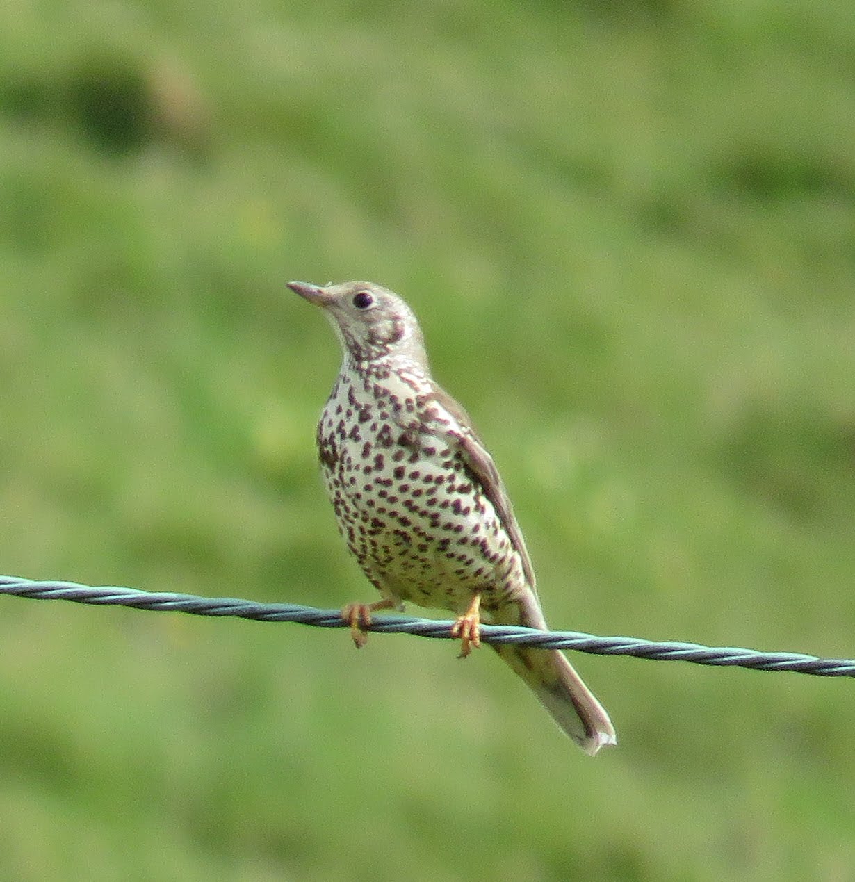
We crossed the River Cerne with its glorious Weeping Willow and turned southwards, ascending Cowdon Hill, where we saw Mistle Thrush and Grey Heron.

Weeping Willow and River Cerne at Godmanstone - SY6697


Ascending Cowdon Hill - SY6696

Mistle Thrush
Grey Heron

We lost the path a little at the ruined Forston Barn, but soon found it again and made our way eastwards across fields towards the north-south minor road between Middlemarsh and Charminster.


SY6796
SY6896
 We crossed one road and went straight into another field, following the edge of a small copse. I caught sight of my first Holly Blue of the year. They are the earliest blues in the UK to emerge.

Holly Blue
We crossed another minor road just west of Little Piddle Farm (delightful name) and continued through yet another field to Charlton Higher Down trigpoint. There's not a lot I can say about this one really. There's nothing wrong with it, per se, it's just not in the most scenic spot, but then we're spoilt by some of the ones we've visited on the Dorset coast.

Charlton Higher Down trigpoint - SY6895 - rapeseed fields in the background

We had to do a tiny diversion to reach the trigpoint so we retraced our steps to the footpath leading east. There are several tumuli and pits (dis) marked on the map in this area and not all of them are obvious. Had the tumuli been ploughed into the ground, we wondered?

Wolfeton Clump made a subject for SY6995 and caused me to ponder on the meaning of the word 'clump'. I mean, is this a genuinely recognised geographical term?

Wolfeton Clump - SY6995

If possible, SY6994 was even more boring than its predecessor with yet more rapeseed fields and just one covert (another unfamiliar term) and a couple of pits (dis) to break the monotony.

Lower Covert - SY6994
SY6993 has at least a blue-bell bordered track (an ORPA - Other Route with Public Access) to make it more interesting and we came across our first fellow-walker here - naturally a dog-walker. This suggested we were approaching Charminster for we have discovered that dog-walkers often stick to paths of only about a mile radius from their hometown.


Bluebell adorned track - SY6993
SY6893 and SY6892 were photographed on our way back. We were now in the bustling metropolis of Charminster. I'd remembered this being quite an attractive town, but the outskirts are really the same as any other small town - housing estates with nothing remarkable to write home about. The centre of the town is attractive though, not least because on this day 6th May 2016 at 12 noon, the new bridge had been opened and we had missed the opening ceremony by a few hours. The original bridge had suffered from severe damage in the 2013/2014 floods and it had taken several years to rebuild. We had commented on its 'newness' as we crossed it, before we saw the flier advertising the opening ceremony earlier that day. I somehow felt quite honoured that this had happened on my birthday, if simultaneously a little disappointed that we had missed it. I was pleased that the old Fooks sign had been replaced on the bridge, warning against wilfully injuring the bridge.

Charminster bridge opening ceremony advert
River Cerne at Charminster and the newly opened bridge - SY6792
I was a little anxious lest the church be closed as it had just gone 5 pm and someone often comes to lock churches at that time, but the door was open and we were able to have a wander round, though not as long as I would have liked as we knew we had a long walk back.
St Mary the Virgin church, Charminster  - SY6792
Windows inside St Mary the Virgin church, Charminster
We revised our return route in order to shorten it. Originally we were going to cross the A352 and walk north, but we decided it would be shorter to walk eastwards of the A road, following the River Cerne on its eastward banks.

We crossed the River via a wooden footbridge, although there obviously used to be a ford here.

Ford over River Cerne - SY6792
Signs for The Lost Garden intrigued me and reminded me of  Frances Hodgson Burnett's The Secret Garden with its beehive and rusty bike.


The Lost Garden - SY6892

A brief sojourn at a tempting bench in SY6893 and then we were into SY6793 where there is evidence of an ancient farmstead. We were immediately enamoured with this valley walk with the attractive clear river running through it - much more attractive than our outward walk.

Bench by River Cerne - SY6893
Sheep by the River Cerne - SY6793

Old farmstead - SY6793

We continued westwards past the complex at Herrison, which I think is now residential flats and then through a gate into wheat fields.

Wheat fields - SY6794
I managed to miss our brief entry into SY6694 (it's easily done when there's nothing distinctive about a gridsquare!), then we walked through woodland into Forston, a small hamlet just south of Godmanstone.

Footpath to Forston - SY6695
Derelict Pulston Barn near Forston - SY6695

A rather broken rowing boat lay on its side by the banks of the River Cerne as we walked through the extensive grounds of Forston Farm, making an attractive photo. I am always drawn to the ruined, the broken, the derelict and the hopeless. Give me the four (or even two) ruined walls of a roofless cottage by the sea on a Scottish Island any day and I'd take it over an enormous mansion in suburbia. I'd forget about practicalities like keeping dry and warm - as long as I could hear the ocean I think I'd be happy!

Broken boat - the stuff of poetry - at Forston - SY6695

Then it was back into SY6696 and the Godmanstone square itself, SY6697. Our return walk was about half the distance of the outward walk - and much nicer - something to bear in mind.

Distance - 9.7 miles
Trigpoints - 1
Churches - 2
Broken boats - 1
Repaired bridges - 1
Missed opening ceremonies - 1
Gridsquares - 12