For my birthday walk, I decided to treat myself with a trigpoint as well as lots of new squares. of course, there's always a risk in drawing a route on a map - it might not turn out to be as nice as it looks on the map. I'm also discovering with circular walks that there's usually half the walk which is particularly scenic and the other half not quite as scenic. That was not the case with John's Ringstead walk (last post) and I told him so - both the coastal route out and the return inland route were scenic. but in Pembrokeshire the same thing happened, we enjoyed walking the coastal path, but as soon as we turned inland we were walking through arable fields, dusting ourselves with pollen as we waded through Rapeseed or corn fields.
Anyway, enough of the negativity. It was a lovely day, I had my new camera (Canon SX60 Powershot) and we saw Ashy Mining Bee at Godmanstone Church as we began our travels. (When I say 'we', I mean Paul and me). This is another historic church in a delightful location.
 |
| Godmanstone Church - SY6697 |
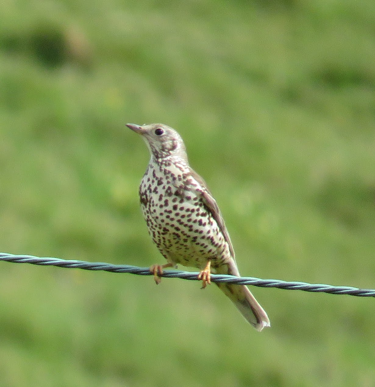
We crossed the River Cerne with its glorious Weeping Willow and turned southwards, ascending Cowdon Hill, where we saw Mistle Thrush and Grey Heron.
 |
| Weeping Willow and River Cerne at Godmanstone - SY6697 |
 |
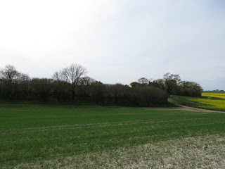
Ascending Cowdon Hill - SY6696
|
 |
| Mistle Thrush |
 |
| Grey Heron |
We lost the path a little at the ruined Forston Barn, but soon found it again and made our way eastwards across fields towards the north-south minor road between Middlemarsh and Charminster.
 |
| SY6796 |
 |
| SY6896 |
We crossed one road and went straight into another field, following the edge of a small copse. I caught sight of my first Holly Blue of the year. They are the earliest blues in the UK to emerge.
 |
| Holly Blue |
We crossed another minor road just west of Little Piddle Farm (delightful name) and continued through yet another field to Charlton Higher Down trigpoint. There's not a lot I can say about this one really. There's nothing wrong with it, per se, it's just not in the most scenic spot, but then we're spoilt by some of the ones we've visited on the Dorset coast.
 |
| Charlton Higher Down trigpoint - SY6895 - rapeseed fields in the background |
We had to do a tiny diversion to reach the trigpoint so we retraced our steps to the footpath leading east. There are several tumuli and pits (dis) marked on the map in this area and not all of them are obvious. Had the tumuli been ploughed into the ground, we wondered?
Wolfeton Clump made a subject for SY6995 and caused me to ponder on the meaning of the word 'clump'. I mean, is this a genuinely recognised geographical term?
 |
| Wolfeton Clump - SY6995 |
If possible, SY6994 was even more boring than its predecessor with yet more rapeseed fields and just one covert (another unfamiliar term) and a couple of pits (dis) to break the monotony.
 |
| Lower Covert - SY6994 |
SY6993 has at least a blue-bell bordered track (an ORPA - Other Route with Public Access) to make it more interesting and we came across our first fellow-walker here - naturally a dog-walker. This suggested we were approaching Charminster for we have discovered that dog-walkers often stick to paths of only about a mile radius from their hometown.
 |
| Bluebell adorned track - SY6993 |
SY6893 and SY6892 were photographed on our way back. We were now in the bustling metropolis of Charminster. I'd remembered this being quite an attractive town, but the outskirts are really the same as any other small town - housing estates with nothing remarkable to write home about. The centre of the town is attractive though, not least because on this day 6th May 2016 at 12 noon, the new bridge had been opened and we had missed the opening ceremony by a few hours. The original bridge had suffered from severe damage in the 2013/2014 floods and it had taken several years to rebuild. We had commented on its 'newness' as we crossed it, before we saw the flier advertising the opening ceremony earlier that day. I somehow felt quite honoured that this had happened on my birthday, if simultaneously a little disappointed that we had missed it. I was pleased that the old Fooks sign had been replaced on the bridge, warning against wilfully injuring the bridge.
 |
| Charminster bridge opening ceremony advert |
 |
| River Cerne at Charminster and the newly opened bridge - SY6792 |
I was a little anxious lest the church be closed as it had just gone 5 pm and someone often comes to lock churches at that time, but the door was open and we were able to have a wander round, though not as long as I would have liked as we knew we had a long walk back.
 |
| St Mary the Virgin church, Charminster - SY6792 |
 |
| Windows inside St Mary the Virgin church, Charminster |
We revised our return route in order to shorten it. Originally we were going to cross the A352 and walk north, but we decided it would be shorter to walk eastwards of the A road, following the River Cerne on its eastward banks.
We crossed the River via a wooden footbridge, although there obviously used to be a ford here.
 |
| Ford over River Cerne - SY6792 |
Signs for The Lost Garden intrigued me and reminded me of Frances Hodgson Burnett's
The Secret Garden with its beehive and rusty bike.
 |
|
 |
| The Lost Garden - SY6892 |
A brief sojourn at a tempting bench in SY6893 and then we were into SY6793 where there is evidence of an ancient farmstead. We were immediately enamoured with this valley walk with the attractive clear river running through it - much more attractive than our outward walk.
 |
| Bench by River Cerne - SY6893 |
 |
| Sheep by the River Cerne - SY6793 |
 |
| Old farmstead - SY6793 |
We continued westwards past the complex at Herrison, which I think is now residential flats and then through a gate into wheat fields.
 |
| Wheat fields - SY6794 |
I managed to miss our brief entry into SY6694 (it's easily done when there's nothing distinctive about a gridsquare!), then we walked through woodland into Forston, a small hamlet just south of Godmanstone.
 |
| Footpath to Forston - SY6695 |
 |
| Derelict Pulston Barn near Forston - SY6695 |
A rather broken rowing boat lay on its side by the banks of the River Cerne as we walked through the extensive grounds of Forston Farm, making an attractive photo. I am always drawn to the ruined, the broken, the derelict and the hopeless. Give me the four (or even two) ruined walls of a roofless cottage by the sea on a Scottish Island any day and I'd take it over an enormous mansion in suburbia. I'd forget about practicalities like keeping dry and warm - as long as I could hear the ocean I think I'd be happy!
 |
| Broken boat - the stuff of poetry - at Forston - SY6695 |
Then it was back into SY6696 and the Godmanstone square itself, SY6697. Our return walk was about half the distance of the outward walk - and much nicer - something to bear in mind.
Distance - 9.7 miles
Trigpoints - 1
Churches - 2
Broken boats - 1
Repaired bridges - 1
Missed opening ceremonies - 1


No comments:
Post a Comment