My Memory Map is awash with red routes from Beaminster. It's in the heart of Dorset and one of my favourite places to start walking from. Having read in Louise Hodgson's book about Loscombe and realising I had some unvisited squares to photograph in that area, I devised my new route and set off with Paul on a rather dreary looking Saturday morning.
Having fixed the parking metre at Yarn Barton car park, we set off south, following the River Brit on a much walked route. We anticipated mud today; it's always better to anticipate it, to revel in it actually, rather than be disappointed if you encounter it, especially at this time of year, because, let's face it, you're going to encounter it, so don't be a wimp! Gaiter up and go for it!
Except we didn't have gaiters on. I'm not unduly concerned about this - where's the hardship in throwing the trousers into the wash afterwards. I hate getting all grubby at the end of a walk when you start to take off those caked-in-mud and cow slurry garments. I'd rather just get mud on my trousers.
We followed the Jubilee Trail as far as Netherbury, which was all familiar territory. Then we continued south on the minor road to an attractive bridge over the River Brit, where we veered left towards Lower Yondover Farm.
 |
| SY4799 - River Brit at Netherbury |
I was now in my first new gridsquare and eager to take a photo after three previously photographed gridsquares. Problem was, there wasn't much to photograph so I had to settle for one of the footpath, despite craning my neck for a glimpse Slape Manor. We could have walked through the grounds of this manor house, but it would have been a diversion, an indulgence even, for the sake of my anal hobby, so we walked on through rather uninspiring scenery for a time - that would soon change!
 |
| Near Slape Manor - SY4798 |
We joined a minor road near Oxbridge and then turned off again at Oxbridge Farm.
 |
| Oxbridge Farm turn off - SY4797 |
It was a short walk now to Melplash, a village we'd never actually stopped in but had driven through many times. I have to admit, there's never been an incentive to stop in the village; it just doesn't look that attractive, but I needed to photograph something within the village and the church was my natural choice.
 |
| Christ Church, Melplash - SY4897 |
We sat in the church for a late coffee break, resisting the temptation to eat lunch here - we wanted to wait for a half way point. The church is very sparse, with not much to commend it, but you can play badminton here as there is a court housed within the vastness. It is a shame that such a relatively young church (built in the nineteenth century) is already heading towards redundancy. I hope it manages to avoid being closed down and converted into a dwelling house as so many church buildings are these days - and beautiful dwellings they make too; it just seems we've lost something when that happens somehow.
 |
| Amusing sign in Christ Church, Melplash - SY4897 |
We crossed the A3066 and joined a footpath we'd seen from the car many times. It has been diverted since my map was published (2014), which confused us for a bit until we realised we were simply going to head round the south flanks of Hincknowle Hill, instead of the north flanks. Aha!
There is a small clump of trees on Hincknowle Hill's modest summit, which at 114 metres we did not attain, choosing to save our energy for the many miles ahead. There was another slight diversion at Walnut Farm which had us walking up and down the holloway two or three times in confusion. An attractive holloway it is though (when is a holloway
not attractive?)
 |
| Lane near Walnut Farm - SY4997 |
We were heading east now and entered a rather derelict orchard where someone had been picking and bagging crab apples. We picked up a couple of windfallen eaters and munched them as an aperitif for our lunch. Yummy!
 |
| Orchard near Walnut Farm - SY4997 |
We were climbing now, as well as following a trail we'd never heard of before - Dorset Wildlife Trust's Anthill Trail, which is advertised as being a 'challenging 6 km trail' through three nature reserves - South Poorton, Loscombe and West Milton. We saw evidence of anthills - apparently they're yellow ants, but no ants, not that we were looking to be honest!
We were, however, looking for a lunch spot and having decided the rain had chosen not to fall in torrents, we opted for a conveniently placed tree trunk on top of the hill near Marlpits Farm. This afford a glorious view, albeit cloudy, of Hincknowle Hill, Bull's Hill and Pen Well Hill. I gave Paul a bit of a tour whilst we munched our sandwiches, pointing out that there were no footpaths through SY4998 so we'd either have to walk along the minor road or stop the car whilst driving along. Pen Well Hill looks an attractive hill and it's a shame there's no footpath up it.
 |
| Hincknowle Hill from SY4997 |
 |
| Pen Well Hill from SY4997 |
After lunch we were greeted by three very masculine tups who posed beautifully for a photograph but did not object to our passing.
 |
| Tup at Marlpits Farm - SY4997 |
 |
| Posing beautifully at Marlpits Farm - SY4997 |
We then joined the road we'd have to walk along for the aforementioned footpathless gridsquare, but turned off towards Loscombe. I felt quite excited about reaching Loscombe as Louise Hodgson describes it so evocatively in her book,
Secret Places of West Dorset. It certainly feels like a secret place, deep in the heart of Dorset. One of those places you would have to be earnestly seeking rather than stumble across as it is miles from anywhere down wiggly windy roads, the sort I adore.
The road ends at Loscombe, but a farm track continues to Sunnyside Farm and what must have once been an old drovers' lane heads over to North Poorton.
 |
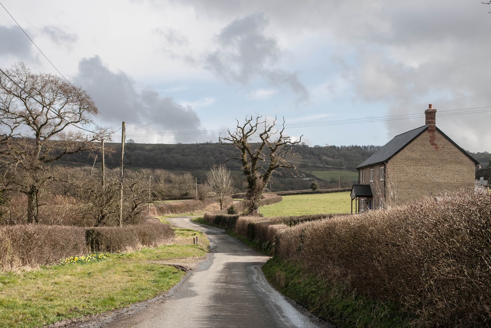
| Lane between Loscombe and North Poorton - SY5098 |
It is a beautiful lane with hazels bending over to meet each other across the deeply rutted track. We discussed whether any motorised vehicle could still negotiate such deep ruts and decided it could provided it kept itself perfectly poised on the narrow channels and did not sink into the ruts. For evidence we saw a tyre at the top of the lane and, feeling like school children again, I'm afraid we committed a bit of a crime here. "Wouldn't it be fun to ...." So, in need of a bit of a laugh we rolled it down the hill and watched as it bounced its way all the way down. We'd expected it to fall a long time before the end - perhaps it did!
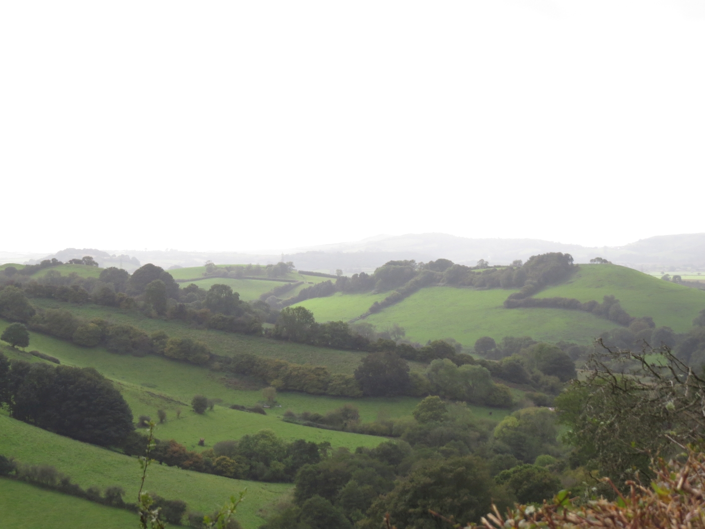
This was the land the Dorset Wildlife Trust owned, at least it adjoins it and we vowed to return in the spring to find the delicate Snake's Head Fritillary which blooms in the valley below. We looked longingly over the gate to the 'poor land' which is still difficult to farm, but which makes for such beautiful scenery.
 |
| View from Loscombe - SY5098 |
 |
| View from Loscombe - SY5098 |
 |
| View from Loscombe - SY5098 |
Greenway Barn provided a photogenic subject for the next square.
 |
| Greenway Barn - SY5198 |
We made a good decision not to continue on to North Poorton, although I cannot recall having visited the church there before. Our walk was long enough without prolonging it in this way. I shall have to include it on future walks though.
We curtailed the walk yet more by cutting across before reaching Burcombe. I was not going to miss any gridsquares so it didn't matter too much. There is a prominent enclosure in SY5198.
 |
| Enclosure - SY5298 |
We headed down the steep hill towards Mapperton Estate, walking now in a north-westerly direction and entering Burcombe Wood where we encountered a new species for us - Reeves' Pheasant.
 |
| Reeves Pheasant in Burcombe Wood - SY5098 |
These are bred no doubt for shooting and were surprisingly incredibly tame, almost allowing us to stroke them!
We were walking parallel now to the drovers' track near Loscombe and could see the chimneys of Loscombe Farm. We would not be walking that way, however as we turned off to join the Jubilee Trail after finding a delightful little waterfall and a ruinous building of unknown origin.
 |
| Waterfall in Burcombe Wood - SY5098 |
We were in familiar territory now, having walked this way several times before. We were going to go on a different path once beyond Mapperton House though - a decision which proved to be our undoing, unless you count the opportunity to report faults on footpaths as a good thing!
 |
| Mapperton House - SY5099 |
Instead of continuing west on the Jubilee Trail we headed northwards on local council footpaths wh which obviously had not been walked in a long time. All was well until we reached Marsh Farm.
 |
| Marsh Farm ST5000 |
We plodded northwards through a field when Paul asked where the exit was and I confidently pointed to the corner of the field. Well, it was there - perhaps 50 years ago! Sleeping Beauty's prince would have his work cut out for him trying to get through the thicket that lay between us and the B-road and our next footpath. With only Paul's small penknife to serve as a much-needed machete, we admitted defeat and turned back to walk through the long grass in search of another exit. We found a gate into the neighbouring field and then another gate onto the road. We then had to walk along this quite busy road to our next footpath, which was also blocked. Fortunately there was an alternative entrance which we negotiated with some inconvenience as it was obstructed with chicken wire and debris. Phew! Our relief was short-lived however, as our next turning was barred with barbed wire - right across a public right of way!
We walked through the neighbouring field and back into Beaminster, not before washing our very muddy boots in the river before entering the housing estate on the east side of town.
 |
| Field near Storridge Farm - ST4900 |
A walk to be repeated in sunnier weather and amended at Mapperton - otherwise a lovely walk with a lot to commend it.
Number of footpaths reported: 3
Number of friendly tups: 3
Number of new gridsquares: 7
Number of miles walked: 11.5