Showing posts with label Beaminster. Show all posts

Thursday, 29 March 2018

Bimble in the blizzard - 18th March

It's hard now to believe writing this on a day when I've walked without a coat all day, but this time last week it was a very different scene. We awoke to find a pristine blanket of snow covering the ground and I was eager to explore - safely of course!

Now where could we go that was safe, scenic and not too far away? (Of course I was naturally also asking, "Where can we go that I can gain some more gridsquares?") A compromise was necessary. I just couldn't adjust to the idea of another walk to Hinton St George - even if it did promise tea and cake - oh, that was another criteria, where could we go that was safe, scenic, not too far away and that could offer tea and cake? Or soup? Or both?

"Beaminster," Paul suggested. "OK," I acquiesced. It was getting late (9 am) and if we didn't get our skates on (perhaps even literally) we'd end up talking round in circles and never getting out. "I'll drive," I offered, grabbing the keys and making a bolt for the door.

The roads were a tinsy bit scary, but we arrived safely in the village square and set off into a winter scene of whiteness.

Beaminster - ST4701
Beaminster - ST4701
We approached Gerrard's Hill as the snow started falling faster, covering our way in a glorious white blanket of softness.

Gerrard's Hill in snow - ST4601
Wessex Ridgeway near Higher Burrowbridge Farm - ST4601

Woods near Gerrard's Hill - ST4601

Snow tunnel approaching Gerrard's Hill - ST4601

Snow tunnel approaching Gerrard's Hill - ST4601
Sign in woods on Wessex Ridgeway - ST4601

 As we started our ascent to the familiar landmark of the lonely tree, I gasped in wonder as its beauty. Our much-loved tree is said to be  'flying' - a tree,  seeded by bird or wind in a lofty place.
Stile and 'flying' tree on Wessex Ridgeway on lower slopes of Gerrard's Hill - ST4601
I spent some time getting cold hands photographing one of my favourite trees, whilst Paul waited patiently, blowing on his chilled fingers.


 Then we finished our ascent to the trigpoint. I wonder if there's a word for the way snow lays only on one side of a tree's trunk?
Trigpoint on Gerrard's Hill - ST4601
A sheep was watching us and we were envious of its fleece!

Sheep on Gerrard's Hill - ST4601


It was taking us a long time to get out of ST4601, but we eventually made it into the next gridsquare west - ST4501 at Chart Knolle.

Chart Knolle Farm - ST4501

We had been vaguely following the footprints of another human and a dog, surprised that we were not the only ones mad enough to venture out into a snowstorm. As we approached Stoke Knapp Farm, we caught up with our fellow explorer and his Jack Russell - on his return jog from Lewesdon Hill! So much for thinking we were intrepid! I commented on his footwear (one of those occaisons when you speak before thinking!) "Aren't you cold with your trainers on?" He assured us he wasn't, that they had studs on and ran off leaving us wondering if the studs were a weapon or a walking aid!

We managed to find a huge tyre to sit on with a warming cup of tea at stoke Knapp farm before turning onto a new bridleway for us north to Clanden Hill. We were now leaving the Wessex Ridgeway. I have to admit it's difficult whilst out walking to remember whether I have walked a particular path or not. Paul confirmed we had not done this path before so we strode out with extra tea-fuelled energy and even took a slight detour to investigate an interesting piece of rusty farm machinery.

Rust in snow, Clavendon Hill - ST4401
When we finally got to the B3163 to Broadwindsor, we found it to be very quiet, for which we were glad as we wanted to walk right down its middle for safety and ease.

B3163 to Broadwindsor - ST4402

I took a very rare photograph of a cricket club. (Let's face it they're seldom the most photographic of places!)

Broadwinsdor Cricket Club - ST4402
And then we were on the outskirts of the major city of Broadwindsor where we would find that warming bowl of soup at the Craft Centre. We passed a few brave souls traipsing miserably through the snow, but when we reached the Craft Centre, it looked decidedly closed and that's because it was. What a disappointment! Hungry and weary, we plodded on. Paul had the brilliant brainwave of getting soup at the White Lion pub.

We pushed past some cigarette-smoking patrons, did our best to get most of the snow out of our hair and boots and walked into an almost empty pub where a sign read 'Only Roast Dinners served today'. Just to be sure, we asked and just to be sure we also asked about the signs on the empty tables by the roaring fire (which read 'RESERVED'). "Does that mean the same on snowy days as it does in the sunshine?" I asked hopefully. After all, it was past  pm and there was nobody there. Surely they couldn't still be expecting people to turn up on a day like this.

Soupless and fireless, we sat at our specially designated table and drank tea hot chocolate (me) and beer (Paul). Then it was on with the waterproofs once more and finding somewhere to eat our appetising lunch.

"It'll have to be the church," I said and we wandered in and ate our sandwiches, afterwards realising that it was probably colder inside than out.

St John the Baptist Church, Broadwindsor - ST4302
Having decided to chicken out of the Lewesdon Hill return option, we headed north to Common Water Lane and joined the Monarch's Way. We had walked this way before.Not long after turning onto this lane we got out of the way of a vehicle approaching us. It wasn't until we'd walked the entire length of this lane that we expressed our surprise at how this 'pretend 4 x 4' (as Paul put it) had managed to get all the way down that rutted lane in the snow. It certainly wasn't designed to do it as it hadn't been a farm vehicle. Once committed on these tiny lanes, though, there is often no way of turning back. You've just got to keep on going. Which is also what we had to do and it was about now that our fingers finally gave into the cold. I had been taking my gloves on and off all day and suddenly began to feel absolutely frozen. Then I remembered, with sheer delight, the Hotties' packed away in the top of my rucksack for just such an occasion. I was actually glad to be cold in order to give these a trial as I'd never felt justified in using them up before.

Well, it's no wonder Blacks had sold out of them when we tried to buy some more the following week. These little things are a Godsend (and I'm not on commission to say so!) We actually had two types of hand warmer with us and selfishly I tried the one which I thought would be the best. It served me right that it wasn't; it was rubbish. That was the reusable one. The disposable ones (yes, I know - littering the planet and all that) were filled with tiny iron filings which, when shakes and pressed into the palm of the hand, gradually give off a very comforting heat. "It's like a hot water bottle for your hands!" I exclaimed to Paul after stealing his hottie. (I didn't really; we had two of each types)

Revived, we continued to take photos of the glistening scene before us.

Stream on Common Water Lane - ST4402
We began our descent along a very muddy bridleway at Foxholes Plantation.
Clay Coppice - ST4602

Clay Coppice - ST4602
Trees had formed an incredible web of snow and branches.

Clay Coppice - ST4602
 At a clearing we could look back across to Gerrard's Hill, now unobscured by snow clouds.
Looking towards Gerrard's Hill from Clay Coppice - ST4602
The snow came over our boots in places as we walked through Common Wood.

Common Wood - ST4602
And so we trudged back into Beaminster where cars were now tootling through the streets as if nothing had happened, as if he snow had not just transformed our world, but we knew from our wet feet and snow-laden woolly hats and still glowing hottie-fired fingers that we had just experienced a magic day.

Later I found a beautiful description of a similar day in the States, written by Jean M Hughes and this passage sums it up perfectly.

From 'Walking Around the Sun' by Jean M Hughes.
Number of new gridsquares: 0
Number of miles walked: 7.26


Wednesday, 4 October 2017

Beaminster to Loscombe - 30th September 2017

My Memory Map is awash with red routes from Beaminster. It's in the heart of Dorset and one of my favourite places to start walking from. Having read in Louise Hodgson's book about Loscombe and realising I had some unvisited squares to photograph in that area, I devised my new route and set off with Paul on a rather dreary looking Saturday morning.

Having fixed the parking metre at Yarn Barton car park, we set off south, following the River Brit on a much walked route. We anticipated mud today; it's always better to anticipate it, to revel in it actually, rather than be disappointed if you encounter it, especially at this time of year, because, let's face it, you're going to encounter it, so don't be a wimp! Gaiter up and go for it!

Except we didn't have gaiters on. I'm not unduly concerned about this - where's the hardship in throwing the trousers into the wash afterwards. I hate getting all grubby at the end of a walk when you start to take off those caked-in-mud and cow slurry garments. I'd rather just get mud on my trousers.

We followed the Jubilee Trail as far as Netherbury, which was all familiar territory. Then we continued south on the minor road to an attractive bridge over the River Brit, where we veered left  towards Lower Yondover Farm.

SY4799 - River Brit at Netherbury
I was now in my first new gridsquare and eager to take a photo after three previously photographed gridsquares. Problem was, there wasn't much to photograph so I had to settle for one of the footpath, despite craning my neck for a glimpse Slape Manor. We could have walked through the grounds of this manor house, but it would have been a diversion, an indulgence even, for the sake of my anal hobby, so we walked on through rather uninspiring scenery for a time - that would soon change!

Near Slape Manor - SY4798
We joined a minor road near Oxbridge and then turned off again at Oxbridge Farm.

Oxbridge Farm turn off - SY4797
It was a short walk now to Melplash, a village we'd never actually stopped in but had driven through many times. I have to admit, there's never been an incentive to stop in the village; it just doesn't look that attractive, but I needed to photograph something within the village and the church was my natural choice.

Christ Church, Melplash - SY4897
We sat in the church for a late coffee break, resisting the temptation to eat lunch here - we wanted to wait for a half way point. The church is very sparse, with not much to commend it, but you can play badminton here as there is a court housed within the vastness. It is a shame that such a relatively young church (built in the nineteenth century) is already heading towards redundancy. I hope it manages to avoid being closed down and converted into a dwelling house as so many church buildings are these days - and beautiful dwellings they make too; it just seems we've lost something when that happens somehow.

Amusing sign in Christ Church, Melplash - SY4897
We crossed the A3066 and joined a footpath we'd seen from the car many times. It has been diverted since my map was published (2014), which confused us for a bit until we realised we were simply going to head round the south flanks of Hincknowle Hill, instead of the north flanks. Aha!

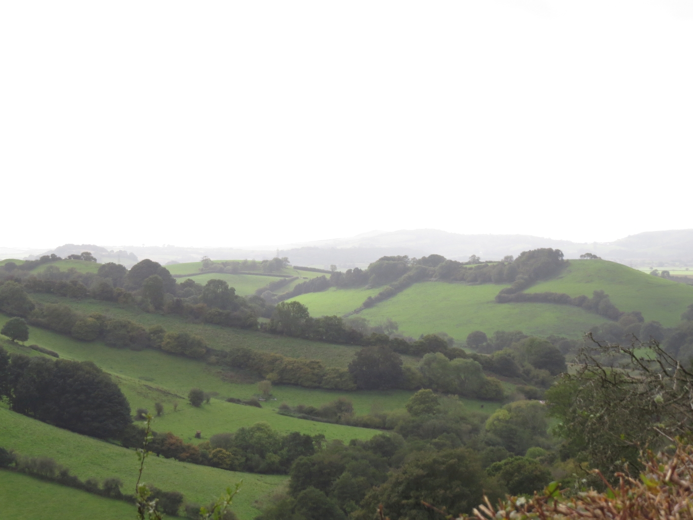
There is a small clump of trees on Hincknowle Hill's modest summit, which at 114 metres we did not attain, choosing to save our energy for the many miles ahead. There was another slight diversion at Walnut Farm which had us walking up and down the holloway two or three times in confusion. An attractive holloway it is though (when is a holloway not attractive?)

Lane near Walnut Farm - SY4997
We were heading east now and entered a rather derelict orchard where someone had been picking and bagging crab apples. We picked up a couple of windfallen eaters and munched them as an aperitif for our lunch. Yummy!

Orchard near Walnut Farm - SY4997
We were climbing now, as well as following a trail we'd never heard of before - Dorset Wildlife Trust's Anthill Trail, which is advertised as being a 'challenging 6 km trail' through three nature reserves - South Poorton, Loscombe and West Milton. We saw evidence of anthills - apparently they're yellow ants, but no ants, not that we were looking to be honest!

We were, however, looking for a lunch spot and having decided the rain had chosen not to fall in torrents, we opted for a conveniently placed tree trunk on top of the hill near Marlpits Farm. This afford a glorious view, albeit cloudy, of Hincknowle Hill, Bull's Hill and Pen Well Hill. I gave Paul a bit of a tour whilst we munched our sandwiches, pointing out that there were no footpaths through SY4998 so we'd either have to walk along the minor road or stop the car whilst driving along. Pen Well Hill looks an attractive hill and it's a shame there's no footpath up it.

Hincknowle Hill from SY4997

Pen Well Hill from SY4997
After lunch we were greeted by three very masculine tups who posed beautifully for a photograph but did not object to our passing.

Tup at Marlpits Farm - SY4997

Posing beautifully at Marlpits Farm - SY4997
We then joined the road we'd have to walk along for the aforementioned footpathless gridsquare, but turned off towards Loscombe. I felt quite excited about reaching Loscombe as Louise Hodgson describes it so evocatively in her book, Secret Places of West Dorset. It certainly feels like a secret place, deep in the heart of Dorset. One of those places you would have to be earnestly seeking rather than stumble across as it is miles from anywhere down wiggly windy roads, the sort I adore.

The road ends at Loscombe, but a farm track continues to Sunnyside Farm and what must have once been an old drovers' lane heads over to North Poorton.

Lane between Loscombe and North Poorton - SY5098

It is a beautiful lane with hazels bending over to meet each other across the deeply rutted track. We discussed whether any motorised vehicle could still negotiate such deep ruts and decided it could provided it kept itself perfectly poised on the narrow channels and did not sink into the ruts. For evidence we saw a tyre at the top of the lane and, feeling like school children again,  I'm afraid we committed a bit of a crime here. "Wouldn't it be fun to ...." So, in need of a bit of a laugh we rolled it down the hill and watched as it bounced its way all the way down. We'd expected it to fall a long time before the end - perhaps it did!

This was the land the Dorset Wildlife Trust owned, at least it adjoins it and we vowed to return in the spring to find the delicate Snake's Head Fritillary which blooms in the valley below. We looked longingly over the gate to the 'poor land' which is still difficult to farm, but which makes for such beautiful scenery.

View from Loscombe - SY5098

View from Loscombe - SY5098

View from Loscombe - SY5098
Greenway Barn provided a photogenic subject for the next square.

Greenway Barn - SY5198

We made a good decision not to continue on to North Poorton, although I cannot recall having visited the church there before. Our walk was long enough without prolonging it in this way. I shall have to include it on future walks though.

We curtailed the walk yet more by cutting across before reaching Burcombe. I was not going to miss any gridsquares so it didn't matter too much. There is a prominent enclosure in SY5198.

Enclosure - SY5298
We headed down the steep hill towards Mapperton Estate, walking now in a north-westerly direction and entering Burcombe Wood where we encountered a new species for us - Reeves' Pheasant.

Reeves Pheasant in Burcombe Wood - SY5098

These are bred no doubt for shooting and were surprisingly incredibly tame, almost allowing us to stroke them!

We were walking parallel now to the drovers' track near Loscombe and could see the chimneys of Loscombe Farm. We would not be walking that way, however as we turned off  to join the Jubilee Trail after finding a delightful little waterfall and a ruinous building of unknown origin.

Waterfall in Burcombe Wood - SY5098
We were in familiar territory now, having walked this way several times before. We were going to go on a different path once beyond Mapperton House though - a decision which proved to be our undoing, unless you count the opportunity to report faults on footpaths as a good thing!

Mapperton House - SY5099
Instead of continuing west on the Jubilee Trail we headed northwards on local council footpaths wh which obviously had not been walked in a long time. All was well until we reached Marsh Farm.

Marsh Farm ST5000
We plodded northwards through a field when Paul asked where the exit was and I confidently pointed to the corner of the field. Well, it was there - perhaps 50 years ago! Sleeping Beauty's prince would have his work cut out for him trying to get through the thicket that lay between us and the B-road and our next footpath. With only Paul's small penknife to serve as a much-needed machete, we admitted defeat and turned back to walk through the long grass in search of another exit. We found a gate into the neighbouring field and then another gate onto the road. We then had to walk along this quite busy road to our next footpath, which was also blocked. Fortunately there was an alternative entrance which we negotiated with some inconvenience as it was obstructed with chicken wire and debris. Phew! Our relief was short-lived however, as our next turning was barred with barbed wire - right across a public right of way!

We walked through the neighbouring field and back into Beaminster, not before washing our very muddy boots in the river before entering the housing estate on the east side of town.

Field near Storridge Farm - ST4900
A walk to be repeated in sunnier weather and amended at Mapperton - otherwise a lovely walk with a lot to commend it.

Number of footpaths reported: 3
Number of friendly tups: 3
Number of new gridsquares: 7
Number of miles walked: 11.5

Monday, 8 August 2016

Beaminster to Stoke Abbott

I actually gained quite a few gridsquares over the weekend, but am finding it hard to keep up with all this writing so am restricting myself to the one with all the dappledness! One thing that Dorset has over Islay is the dappledness - and I feel sure there's a better word for it.

We parked at Beaminster, walked past the church, as we've done many times before, but this time headed south and then slightly west.


Beautiful and massive oak tree at the path's junction - ST4700
I'd heard a story about Knowle Farm, that James Daniel, a non-conformist in the seventeenth century, hid in the straw in a barn at this farm, and thus avoided capture by the King's troops. He consecrated the ground by the farmhouse and vowed to be buried there. We went to enquire at the farm about the place of burial but sadly  were not invited to look at the burial ground.

Knowle Farm - where James Daniel is buried in a private burial ground - ST4600
Looking slightly north-west the distinctive shape of Gerrard's Hill was prominent and remained so throughout our walk.

Gerrard's Hill

We continued south to Nethbury, where a swarm of honey bees were flying round their hives.

Near Nethbury -  the bees' hives - SY4799
I was quite excited about visiting Netherbury as I'd not been before and we stopped at the church for a cup of tea.

St Mary's Church, Netherbury - SY4799
There is a funeral bier inside the church.

Funeral bier inside St Mary's Church, Nethbury

We headed west form here, towards Stoke Abbott and were delighted to find a naturally carved bench overlooking Lower Woods Coppice. This would make an ideal picnic spot.It always seems that we find benches when we don't need one and don't find them when we do!

Bench overlooking Lower Woods Coppice - SY4699
Lower Woods Coppice - SY4699

By now the clouds over Gerrard's Hill were looking almost threatening - but didn't amount to anything.
Clouds over Gerrard's Hill

The footpath between Netherbury and Stoke Abbot is very narrow and was very overgrown so we got prickled by brambles and stung by nettles and thistles quite a bit! But hey ho, we didn't mind!

Narrow and overgrown footpath near Stoke Abbott - ST4500
Then there was a tree on the path.

Tree across path near Stoke Abbott - ST4500
Beautiful holloway near Stoke Abbott - ST4500
Bracket fungi on footpath near Stoke Abbott
I'd heard that Stoke Abbott is a lovely village, and indeed it is. This was our first visit to the village and we were intrigued to later learn that the church in the village is one of the few remaining in England to maintain the custom of ringing a curfew bell. Once rung at 5.30 am every day throughout the year, the bell is now rung by the same volunteer who rings it 100 times every day at 7 am, despite protests from some sources that it should be at least 45 minutes later. The villagers won the battle and the custom is maintained.

St Mary's Church, Stoke Abbott - ST4500
The weights for the bells in Stoke Abbott church - it must take some doing to ring them 100 times!
Also in this lovely village is a horse's trough, beneath a fresh water spring which, until 1961 was used as the water supply for the village. The lion's head spout and cup replaced a much older one in 1953.

Horse's trough and fresh water supply at Stoke Abbott - ST4500
Lion's head and cup, Stoke Abbott - ST4500

We left the village and headed back eastwards, past Horsehill Farm, through a forest of Himalayan Balsam which has sadly invaded the whole of this area. I've never seen so much of it.

Himalayan Balsam - ST4500
Fighting our way past the Balsam we headed south-east along Long Barrow Lane, down to the River Brit where there are a couple of footbridges to cross - or rather one which we crossed and one which we were grateful we didn't have to cross as there were cows guarding the other side of it.

Cow on the Jubilee Trail by the River Brit - ST4600
We were now at our crossing point of our basic figure of eight shaped walk and walked on the west side of Parnham Park, through dappled sunlight and trees back to Beaminster.

Dappled Jubilee Trail - ST4700

Miles walked: 6.5
No. of naturally carved benches: 1
No. of other benches: at least 2 (Netherbury and Stoke Abbott churches)
No. of horse troughs: 1
No. of churches: 2
No. of unhelpful people we met: 1
No. of new gridsquares: Actually only 4 (didn't realise that until I counted them just then!)