Showing posts with label Wessex Ridgeway. Show all posts

Monday, 5 March 2018

Trudge in the sludge - Maiden Newton to Sydling St Nicholas - 3rd March

After the deluge of snow that fell on Thursday afternoon which sent everyone scurrying indoors for cover, and after a day of sledging and walking locally on Friday, we woke up to the great thaw on Saturday and decided it was time to try the car.

"Let's walk to Sydling St Nicholas from Maiden Newton," said Paul eagerly. Of course that warranted a consultation with my map and Geograph, which confirmed in fact that, despite several walks between these two places, I hadn't  photographed all the gridsquares. That would have to be rectified.

Now, I'm not sure what has happened in our household, but I'm finding it unnerving that our routine has been reversed. Recently it has gone from me always being the first to be ready to Paul being the first to be ready. And I blame that disconcerting turn of events for my forgetting my phone (and thus the map) as we drove off into the already melting snow. By the time I realised I was without it, we were approaching Crewkerne Station. I immediately indicated and turned left into the station thinking I'd do a U-turn there to go back to collect my phone. But that was not to be, at least it was not to be without Paul getting out to push as the car skidded on the remnant of ice and snow at the top of the hill there.

With the phone and map now in my pocket, we set off once again and without further incident (except for some oohing and ahhing at the snow drifts on Toller Down) we arrived and Parked on Chilfrome Lane in Maiden Newton.

It was already raining when we set off along the disused railway track and past the Dragon's Teeth.

Dragon's Teeth, disused railway line, Maiden Newton - SY5998
We missed the Wessex Ridgeway turn off first time round and back tracked to find it. This is an attractive path beside the River Frome which we hadn't walked along before and it emerges at the church.

Wessex Ridgeway by the River Frome, Maiden Newton - SY5998

St Mary's Church, Maiden Newton - SY5998
Of the church itself a lot could be said; I spent a long time photographing an ancient door there, this being the principle reason for our detour. I've been to Maiden Newton many times and never been inside the church. It's always a little too far off the path. "I know it's a detour, but we're definitely doing it today," I'd insisted when Paul had looked at the map and noticed that there was a quicker way to get to the path we wanted. "Don't forget it's got the oldest door in the world," I added as it this was an incentive, "Or is it Britain? Perhaps just England, or maybe Dorset. I can't remember which," I admitted as we opened the huge door and tiptoed our way into the church.

I couldn't help feeling disappointed as soon as we entered. "It might have the oldest door in the world," I whispered to Paul, "but it's got the most modern chairs!" "And lighting system," Paul added as he tried to follow some printed instructions on how to use these tiny buttons to switch on the lights. If he couldn't easily fathom it, there was no hope for an octogenarian giant.

I'm going to save photos of the church for a future date - the reason? Turns out after spending ages photographing the door of the church, I realised afterwards I'd photographed the wrong door! I also had difficulty in definitely seeing the bullet hole that was mentioned from the Civil War. So another visit is called for!

We left the church and finally felt we were embarking on our walk proper. We went under the railway and photographed a huge icicle that had formed on the tunnel wall.

Gate on Break Heart Hill - SY6198

Stile and footpath on Break Heart Hill - SY6199
We then started our descent proper into Sydling St Nicholas. We were beginning to feel in need of a hot cup of tea, but there really wasn't anywhere suitable to sit, so we decided to wait until we reached the village and have an early lunch there and then a drink in the pub.

Descending to Sydling St Nicholas - SY6299
 After warming up, eating our lunch and learning about Sydling's very own millenium capsule buried beneath the church floor to be opened by future generations, we left the comfort of St Nicholas' Church and wandered into the village. Immediately my visions of a picturesque snowy scene were shattered as the streets were almost bereft of snow and looked quite drab and dreary. Not that this village can ever really be ugly; I just had pictured it white and crisp and calling out to be photographed. Perhaps another time. We were glad of a drink in The Greyhound where the bar tender chatted away to us and invited us to take off our boots and warm our feet by the fire whilst we drank our hot chocolate/beer. We managed to resist the temptation (twice) of looking at the menu and were quite relieved that the central heating had broken as it would have been even more difficult to resist the menu and get up to leave. I wish all bar tenders were this friendly and accommodating. He said because he lived in the village he had been obliged to work the past couple of days otherwise the village, like many other places locally, would have been inaccessible.

Reluctantly we re-donned our boots and headed out again. We had decided to revise the route slightly in order to shorten it a bit. Paul had already tentatively asked me if I'd taken into account the difficulty of walking in snow when I had devised the route. "Yep,"I'd replied confidently. "It's just under 7 miles. That takes into account the steepness of the route and the snow difficulty." Paul knows me well though, and knows that my seven miles could easily stretch by another couple of miles and it was a good thing we chose a different route for our return path.

Sweet Chestnut tree at Sydling Cross - note the way the moss has covered the northern side of the trunk - a useful navigation aid - SY6399

We walked by the Sydling Water for a bit, trying to visualise it in the spring when I'd just read that the annual duck race will take place - something they do at Easter time at Bridgend on Islay. It was hard to imagine spring now with the many patches of snow still visible (I know I said earlier that the village was bereft of snow, but that was for dramatic effect because I like the word 'bereft'.)
By Sydling sewage works - SY6398
Beyond the watercress beds we turned right onto a path we'd not walked along before. This was Hog Cliff National Nature Reserve, a Natural England nature reserve which we had not heard of before.

Hog Cliff National Nature Reserve - SY6398
It was hard to imagine on a day like today, but there are hopefully hundreds of tiny Marsh Fritillary caterpillars hibernating under the protection of vegetation on this Reserve. This area of chalk downland is good habitat for this, and other rare butterflies like the Adonis Blue. We would have to return in the late spring to explore some more. There are so many parts of Dorset even now that I have not explored, despite having walked in over a half of the gridsquares of west Dorset.

We were not alone on the nature reserve today. A hungry flock of sheep spotted us and our rucksacks from afar and ran as fast as their cold little four feet would carry them in our direction to bleat and baa as loudly as they could muster. It's unusual for sheep to get this close and we felt so sorry for them, but we really could do no more than utter an apology in sheep language and keep walking They kept following and bleating pathetically. We kept walking. They kept following and so it continued to the top of the hill. At least it took our minds off the climb.


Sheep on Hog Cliff  National Nature Reserve - SY6298
There is no footpath shown on the map through Park Coppice, but this is open access land and there was a stile into the woods and we thought it might be less snowy in there. We thought wrong!


Park Coppice - SY6297
Again this would be a lovely walk in spring with all the spring birds calling and possibly a carpet of bluebells covering the woodland floor. We vowed to return. For now we made do with badger footprints in the snow.

Badger prints in Park Coppice - SY6297
"Watch out for badger sets!" I exhorted Paul as we walked past several large and hidden holes in the snow. It was hard enough walking through the snow as it was without having to worry about falling down a hole.

There is no obvious gate at the other end of the woodland so we had to climb over a barbed wire fence (rather than retrace our treacherous steps). We were now on South Field Hill and scared a couple of Roe Deer does, their white powder puff behinds bobbing elegantly along in front of us.

Deer prints near Park Coppice - SY6297
We passed a half building and couldn't decide if it was a ruin or something in the middle of construction. There were no tell tale signs either way.

Building at South Field Hill - SY6297

Back at the main road for some reason I thought we had to turn right. So we did. Paul following me meekly like one of those sheep and not questioning my decision. After all, I had the map, right? Wrong! At least he was wrong to follow me so unquestioningly. "How far do we have to walk along this road?" Paul shouted to be heard above the din of the oncoming traffic. It was with a sinking heart that I consulted my phone map and announced that we had to turn around. Thankfully we hadn't gone far at all, but any distance is too far along that road. Traffic seldom slows down or manouevres for pedestrians on any road, and it is more important than ever on an A road like this one. Not that we ever deliberately walk along such roads, but there should always be a right of way provided on both sides of the road. Otherwise what's the point?

Back on track, we took a bridleway at Farm Hill Bottom, land which is still managed by Natural England as Hog Cliff Nature Reserve. We were glad to now be going down hill.

Descending Farm Hill Bottom - SY6197

Sheep at Farm Hill Bottom - SY6197
We joined the sheep but were unmolested this time as we navigated our way along the hidden footpath. We were now climbing again, past Parson's Coppice to Fore Hill and the edge of Langcombe Bottom.We managed to take a short cut here by crossing a field diagonally. This saved us passing a herd of cows huddled by our exit and just under a quarter of a mile in distance. Not bad, eh?

Parson's Coppice - SY6197

Fore Hill - SY6097
Rabbit prints - SY6097
Again the snow drifts here were very high - as high as the hedge and we played 'I'm the King of the Castle' here for a while, juveniles that we are! Our snow angels did not work out very well though - and that's something we can't repeat in a hurry!

I was now in my final gridsquare of the day and took a photograph of Maiden newton as we descended into the village.

Maiden Newton from the east - SY6097

Fox prints - SY6097
 Children had gathered with their sledges on these slopes to eke out the remaining snow. We went to look at a pill box we'd never seen before (and to try and find our footpath).

WW2 pill box, Maiden Newton - SY6097
Pheasant's footprints - SY6097
The footpath across the railway line seemed to have disappeared so we returned to where we'd started, underneath the railway tunnel, where the icicle was melting fast. Would we make it back to the car before it had all dripped away like the sand in an hour glass?


Number of new gridsquares: 8 (surprisingly)
Number of miles walked: 7.25
Number of times we resisted taking a look at a menu: 2
Number of animal prints we saw in the snow: 5

Thursday, 8 February 2018

Inspired by Hawfinches - Cattistock Circular - 4th Feb

When Chris Packham exhorted our nations to get out and look for Hawfinches this winter it was the last straw. I'd heard it once too many times to ignore it. "We're going a walk from Cattistock," I announced boldly to Paul, racing up the stairs two at a time to go and devise said walk.

Hence our departure later that morning from St Peter's and St Paul's Church in the delightful village of Cattistock. Naturally, I'd drawn a route which took in as many 'empty' gridsquares as possible.

St Peter's and St Paul's Church, Cattistock - SY5999

We had barely started our walk when we bumped into two people laden with high quality optical equipment (ie binoculars, cameras and telescopes). "Have you seen the Hawfinches?" we enquired eagerly. "Yes, they're showing well," they replied, which is birding jargon for, well, it's quite obvious really, 'Yes you can see them really well at the moment.' Or, as I interpreted it, "Yes, they're perching obligingly at the end of branches providing unobstructed views, posing for the camera and will even come and feed from your hand if you happen to have a spare sandwich."

I was therefore disappointed. By 'showing well' they meant if you stand for ten minutes you might catch a glimpse of one for two seconds before it flits back into the depths of the foliage of the evergreen tree. Of course they would choose an evergreen tree. Plenty of bare-branched deciduous trees around, but they go and choose one with lots of, well, food. Awkward little things that they are.

Paul was not as disappointed as me, however - fortunately! We did end up seeing good views of these big-beaked rare visitors on this their bumper year in the UK. We had not been alone in our birdwatching; I'd been surprised that there were several other people there feasting their eyes on the skittish behaviour of this handsome finch.

But we had eight miles to walk, or thereabouts. I'd dodged the issue (as usual) when Paul asked the inevitable question about the length of the walk. I'm usually out by about two miles. We walked under the railway bridge on the MacMillan Way, turning off at a 'T-junction' onto a footpath which led to Higher Drove and the Wessex Ridgeway. I have to say this was quite a boring bit of the Wessex Ridgeway, about a mile and a half of one long straight road with not much to see en route.


Higher Drove near Chilfrome - SY5899
The long, straight Higher Drove - SY5799
Lancombe Farm has several holiday cottages attached to it, which we walked past before reaching a T-junction we did not recognise despite having driven past it a multitude of times. There are not many minor roads off the A356 between Crewkerne and Frampton that I have not walked down now, thanks to my gridsquare quest!

Triangle T-junction, A356 at Lancombe - SY5699

Part of the triangle T-junction - SY5699
Toller Porcorum fits into SY5698 and I already had a photograph of the church there, so I could relax about that square and concentrate on the next one. Not before lunch though. We'd set off later today so hadn't walked far before we decided it was lunch time and a conveniently placed fallen tree trunk formed a natural place to stop. Especially as the sun was shining and we could enjoy the apricity as we ate.

I wasn't sure if  I had a photo of SY5599 already? Better snap one just in case. The Kingcombe Centre will do nicely. Good job we weren't relying on it being open though.

Kingcombe Centre - SY5599
At this point we could have exchanged the Wessex Ridgeway for the Jubilee Trail and curtailed our walk by about a mile and a half, but naturally that would have meant missing out on three gridsquares so we weren't going to do that. We continued north instead on a local footpath to Middle Farm, which was new territory for us. This was a fish farm and we bade good afternoon to a solitary fisherman who grunted a reluctant reply.

Middle Farm - SY5499
We then met the farmer on his tractor and he dismounted (if that's what you do on tractors) when he saw us. "I don't think you'll get through down there," he told us, for which we read, "I don't want you going that way." "Oh," we said looking very pointedly at our map, "Is it flooded then?" "Yes, the river's flooded." We asked him how deep the water was and he showed us on his welly, making sure to point at a height that he felt sure we'd say we weren't going to risk walking through. It was obvious he didn't want us to walk along what was marked as a footpath on our map, so we turned reluctantly round to walk along the road instead.

This wasn't too unpleasant - or busy - although it was uphill. It wasn't another gridsquare though. For that I had to wait until the entrance to Stapleford Farm (which is  marked on the 1:25 000 as manor Farm).

Stapleford Farm sign - SY5399
I'd thought by doing this extra loop Id be gaining at least three gridsquares, but actually it was only one. Glad I didn't realise that at the time. It's getting to the stage now where these isolated gridsquares are beginning to be dotted all over my west Dorset map and it's going to be difficult to work out routes to join them all up. I remember the same thing happening on Islay, except it was a lot more difficult to get to the isolated gridsquares there as it was so much more difficult walking territory.

We turned off Common Lane and headed south towards Mount Pleasant. Thinking I was in a new gridsquare and that I'd only be in it for a few yards, I snapped a boring photo of the field here

Towards Mount Pleasant - SY5398
and then an equally boring one of the next gridsquare, which I also mistakenly thought was a brand new one.

Redholm Coppice - SY5498
We continued on the Jubilee Trail through Kingcombe Meadows nature reserve and trails. I liked the names on the gates which we kept passing.

Lower Long Ground - SY5498
Jubilee Trail near Lower Kingcombe - SY5598
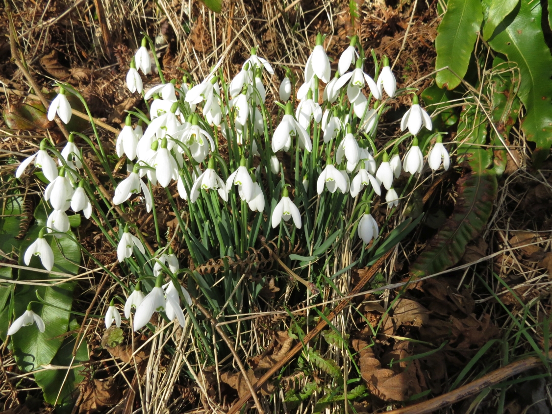
We emerged on the minor road just before the Kingcombe Centre and turned right towards Toller Porcorum and followed this Snowdrop-lined road into that village.

Snowdrops near Toller Porcorum - SY5598
Once in the sleepy village of Toller Porcorum I thought we were back in square SY5698, the square I'd ignored earlier in the day. I've just discovered the church is on the border between SY5698 and SY5697 and in Geograph it falls into SY5697. Don't panic, though; I've got another much more boring photo of SY5698 coming up soon . . .

. . . Today, however, squares aside, we were ready for our last cup of tea so sat on 'our' bench in the churchyard slurping tea, eating shortbread and looking out for Hawfinches. We saw none.

St Andrew and St Peter Church, Toller Porcorum - SY5697
"Please tell me we're not walking along that busy winding road," Paul pleaded. He meant Toller Lane and, yes, we were going along it. "We've no option," I insisted, "until they open up a footpath on the railway. The good news is we get to take a photo of those ducks."

The ducks had been breeding and the display had become much more elaborate from the first time we saw it. Someone (probably local) with a sense of humour admonishes drivers to 'Slow down' in a comical fashion at the bridge over the River Hooke east of the village.

Comical sign over River Hooke at Toller Porcorum - SY5698
 We passed the sewage works and ducked and dived across the road making sure we were as visible as possible round bends and in the blinding sunlight. At field entrances we glimpsed the valley below - views we never got to appreciate when driving along this road.

Towards Maiden Newton from Toller Lane - SY5797
Then we scared some sleeping Roe Deer who fled immediately, bounding across the fields to our left with incredible energy and showing their tell-tale white powder puff bottoms.


Fleeing Roe Does - SY5797
I turned to take a photo of our uphill road just before we reached the A356 which we had to cross again.

Toller Lane - SY5798
We had a choice between a bridleway at the top of the hill or a track at the bottom of the hill here. As we were already at the top of the hill, we chose the former and walked past a seldom-seen row of holly bushes towards Chilfrome. I kept looking deep into the valley and wishing we oculd walk both paths at the same time; I felt I was missing something,but would have felt exactly the same had I been walking on the lower path.

Valley west of Chilfrome - SY5898

Barn in valley west of Chilfrome - SY5898
We could see where we'd walked earlier in the day about a kilometre north and parallel to where we were walking now. This was a much more pleasant walk. We approached Holy Trinity Church in Chilfrome eagerly; someone that morning had said Hawfinches had been seen here too.

Holy Trinity Church, Chilfrome - SY5998
There's a lovely bench her beneath a Yew tree and, if it hadn't have been so cold we would have sat and watched a while longer.

Bench beneath a Yew tree, Chilfrome - SY5998
As it was, we paused for a few minutes on our return past Cattistock Church just in case the Hawfinches should charm us with their company, but neither avian or human company was present here - a real contrast to this morning's hubbub of activity. We left the sleeping churchyard and returned to our car.

Number of new gridsquares: 5
Number of miles walked: 9.5
Number of Hawfinches seen: 4
Number of Roe Deer seen: 3
Number of Foxes seen (at some point): 1
Number of badger tracks seen: 1
Number of bird species seen: 25