Showing posts with label Jubilee Trail. Show all posts

Thursday, 8 February 2018

Inspired by Hawfinches - Cattistock Circular - 4th Feb

When Chris Packham exhorted our nations to get out and look for Hawfinches this winter it was the last straw. I'd heard it once too many times to ignore it. "We're going a walk from Cattistock," I announced boldly to Paul, racing up the stairs two at a time to go and devise said walk.

Hence our departure later that morning from St Peter's and St Paul's Church in the delightful village of Cattistock. Naturally, I'd drawn a route which took in as many 'empty' gridsquares as possible.

St Peter's and St Paul's Church, Cattistock - SY5999

We had barely started our walk when we bumped into two people laden with high quality optical equipment (ie binoculars, cameras and telescopes). "Have you seen the Hawfinches?" we enquired eagerly. "Yes, they're showing well," they replied, which is birding jargon for, well, it's quite obvious really, 'Yes you can see them really well at the moment.' Or, as I interpreted it, "Yes, they're perching obligingly at the end of branches providing unobstructed views, posing for the camera and will even come and feed from your hand if you happen to have a spare sandwich."

I was therefore disappointed. By 'showing well' they meant if you stand for ten minutes you might catch a glimpse of one for two seconds before it flits back into the depths of the foliage of the evergreen tree. Of course they would choose an evergreen tree. Plenty of bare-branched deciduous trees around, but they go and choose one with lots of, well, food. Awkward little things that they are.

Paul was not as disappointed as me, however - fortunately! We did end up seeing good views of these big-beaked rare visitors on this their bumper year in the UK. We had not been alone in our birdwatching; I'd been surprised that there were several other people there feasting their eyes on the skittish behaviour of this handsome finch.

But we had eight miles to walk, or thereabouts. I'd dodged the issue (as usual) when Paul asked the inevitable question about the length of the walk. I'm usually out by about two miles. We walked under the railway bridge on the MacMillan Way, turning off at a 'T-junction' onto a footpath which led to Higher Drove and the Wessex Ridgeway. I have to say this was quite a boring bit of the Wessex Ridgeway, about a mile and a half of one long straight road with not much to see en route.


Higher Drove near Chilfrome - SY5899
The long, straight Higher Drove - SY5799
Lancombe Farm has several holiday cottages attached to it, which we walked past before reaching a T-junction we did not recognise despite having driven past it a multitude of times. There are not many minor roads off the A356 between Crewkerne and Frampton that I have not walked down now, thanks to my gridsquare quest!

Triangle T-junction, A356 at Lancombe - SY5699

Part of the triangle T-junction - SY5699
Toller Porcorum fits into SY5698 and I already had a photograph of the church there, so I could relax about that square and concentrate on the next one. Not before lunch though. We'd set off later today so hadn't walked far before we decided it was lunch time and a conveniently placed fallen tree trunk formed a natural place to stop. Especially as the sun was shining and we could enjoy the apricity as we ate.

I wasn't sure if  I had a photo of SY5599 already? Better snap one just in case. The Kingcombe Centre will do nicely. Good job we weren't relying on it being open though.

Kingcombe Centre - SY5599
At this point we could have exchanged the Wessex Ridgeway for the Jubilee Trail and curtailed our walk by about a mile and a half, but naturally that would have meant missing out on three gridsquares so we weren't going to do that. We continued north instead on a local footpath to Middle Farm, which was new territory for us. This was a fish farm and we bade good afternoon to a solitary fisherman who grunted a reluctant reply.

Middle Farm - SY5499
We then met the farmer on his tractor and he dismounted (if that's what you do on tractors) when he saw us. "I don't think you'll get through down there," he told us, for which we read, "I don't want you going that way." "Oh," we said looking very pointedly at our map, "Is it flooded then?" "Yes, the river's flooded." We asked him how deep the water was and he showed us on his welly, making sure to point at a height that he felt sure we'd say we weren't going to risk walking through. It was obvious he didn't want us to walk along what was marked as a footpath on our map, so we turned reluctantly round to walk along the road instead.

This wasn't too unpleasant - or busy - although it was uphill. It wasn't another gridsquare though. For that I had to wait until the entrance to Stapleford Farm (which is  marked on the 1:25 000 as manor Farm).

Stapleford Farm sign - SY5399
I'd thought by doing this extra loop Id be gaining at least three gridsquares, but actually it was only one. Glad I didn't realise that at the time. It's getting to the stage now where these isolated gridsquares are beginning to be dotted all over my west Dorset map and it's going to be difficult to work out routes to join them all up. I remember the same thing happening on Islay, except it was a lot more difficult to get to the isolated gridsquares there as it was so much more difficult walking territory.

We turned off Common Lane and headed south towards Mount Pleasant. Thinking I was in a new gridsquare and that I'd only be in it for a few yards, I snapped a boring photo of the field here

Towards Mount Pleasant - SY5398
and then an equally boring one of the next gridsquare, which I also mistakenly thought was a brand new one.

Redholm Coppice - SY5498
We continued on the Jubilee Trail through Kingcombe Meadows nature reserve and trails. I liked the names on the gates which we kept passing.

Lower Long Ground - SY5498
Jubilee Trail near Lower Kingcombe - SY5598
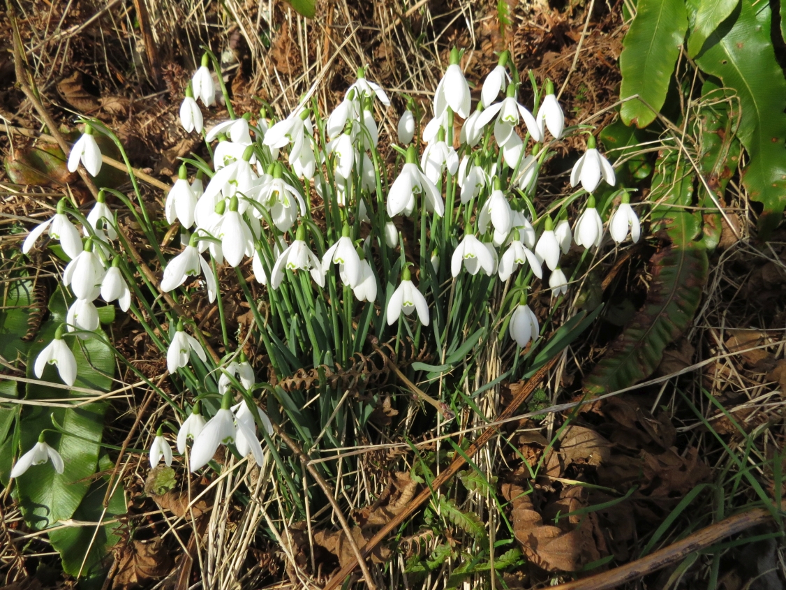
We emerged on the minor road just before the Kingcombe Centre and turned right towards Toller Porcorum and followed this Snowdrop-lined road into that village.

Snowdrops near Toller Porcorum - SY5598
Once in the sleepy village of Toller Porcorum I thought we were back in square SY5698, the square I'd ignored earlier in the day. I've just discovered the church is on the border between SY5698 and SY5697 and in Geograph it falls into SY5697. Don't panic, though; I've got another much more boring photo of SY5698 coming up soon . . .

. . . Today, however, squares aside, we were ready for our last cup of tea so sat on 'our' bench in the churchyard slurping tea, eating shortbread and looking out for Hawfinches. We saw none.

St Andrew and St Peter Church, Toller Porcorum - SY5697
"Please tell me we're not walking along that busy winding road," Paul pleaded. He meant Toller Lane and, yes, we were going along it. "We've no option," I insisted, "until they open up a footpath on the railway. The good news is we get to take a photo of those ducks."

The ducks had been breeding and the display had become much more elaborate from the first time we saw it. Someone (probably local) with a sense of humour admonishes drivers to 'Slow down' in a comical fashion at the bridge over the River Hooke east of the village.

Comical sign over River Hooke at Toller Porcorum - SY5698
 We passed the sewage works and ducked and dived across the road making sure we were as visible as possible round bends and in the blinding sunlight. At field entrances we glimpsed the valley below - views we never got to appreciate when driving along this road.

Towards Maiden Newton from Toller Lane - SY5797
Then we scared some sleeping Roe Deer who fled immediately, bounding across the fields to our left with incredible energy and showing their tell-tale white powder puff bottoms.


Fleeing Roe Does - SY5797
I turned to take a photo of our uphill road just before we reached the A356 which we had to cross again.

Toller Lane - SY5798
We had a choice between a bridleway at the top of the hill or a track at the bottom of the hill here. As we were already at the top of the hill, we chose the former and walked past a seldom-seen row of holly bushes towards Chilfrome. I kept looking deep into the valley and wishing we oculd walk both paths at the same time; I felt I was missing something,but would have felt exactly the same had I been walking on the lower path.

Valley west of Chilfrome - SY5898

Barn in valley west of Chilfrome - SY5898
We could see where we'd walked earlier in the day about a kilometre north and parallel to where we were walking now. This was a much more pleasant walk. We approached Holy Trinity Church in Chilfrome eagerly; someone that morning had said Hawfinches had been seen here too.

Holy Trinity Church, Chilfrome - SY5998
There's a lovely bench her beneath a Yew tree and, if it hadn't have been so cold we would have sat and watched a while longer.

Bench beneath a Yew tree, Chilfrome - SY5998
As it was, we paused for a few minutes on our return past Cattistock Church just in case the Hawfinches should charm us with their company, but neither avian or human company was present here - a real contrast to this morning's hubbub of activity. We left the sleeping churchyard and returned to our car.

Number of new gridsquares: 5
Number of miles walked: 9.5
Number of Hawfinches seen: 4
Number of Roe Deer seen: 3
Number of Foxes seen (at some point): 1
Number of badger tracks seen: 1
Number of bird species seen: 25

Friday, 4 August 2017

Bincombe to Whitcombe Circular - 3 August 2017

Driving to our agreed meeting place, both Jane and I separately had our windscreen wipers at full pelt to drive away the allegedly 0.3 mm of rain which threatened to put an end to our walk before it had begun. I willed the rain away and looked desperately for a break in the cloud. Nope, it wasn't there! So the forecast was wrong again. I tried not to feel disappointed; there was surely joy to be derived from walking in the rain, wasn't there?

I pulled into the small parking area at Came Wood- the only occupant unless you count the charred remains of an erstwhile traveller's vehicle. When Jane arrived and we shared rain stories. The rain had stopped now but we struggled to hear each other talk above the sound of the wind.

I'd warned Jane of the strong possibility of my route being thwarted by removed footpaths or overgrown stiles. She claimed she didn't care and that her recent reccy of a Milton Abbas walk had rendered her immune to fazability.

We began walking south on the Jubilee Trail towards the mast on Bincombe Hill. I could relax a bit about the gridsquares as I'd photographed most of them already. I love the descent into Bincombe Village and I'd love to see it in winter with snow.

Bincombe Village - SY6884
It is a village I have spent a lot of time in and written a lot about, it being the setting of Thomas Hardy's  The Melancholy Hussar, based on the tragic true love story of Phyllis Gould and her Captain Tina of the Hussars. We went to pay homage to the tiny church, chuckling at some of the book titles for sale there - In the Shadow of Death and Murder at the Vicarage. Jane was reluctant to touch anything after a bad experience in Iwerne church when she had put her hand against an inner door to push it open and set off an alarm. She had later been told that the alarm would have been heard at the local fire station. Oh dear! At least she could laugh about it now and, by the time we'd reached our fourth church, she'd regained her courage to push aside the curtain to the Bell Tower - without any alarm bells ringing!

Holy Trinity Church, Bincombe - SY6884
We continued on the Jubilee Trail/South Dorset ridgeway, heading east and under the great ugly pylons to Coombe Valley Road, where I always get confused with the plethora of footpaths. Not having seen each other for weeks, Jane and I had a lot of catching up to do too, and occasionally I had interrupt (usually at the exciting bit) whilst I consulted my map. Rude, yes, but it saved us going for miles in the wrong direction - and I always reminded her where we'd left off!

Bincombe Down - SY6984

Coombe Valley Road - SY6984

From Bincombe Down - SY6984
Having established our path, we circumnavigated Green Hill and continued on the inland south-west coast path until we reached the interesting bit and then we turned off. Sorry, Jane, but we've got three more churches to visit and they're all in the opposite direction!

So we turned away from the coast, waving it a farewell as we did so, and headed north at Northdown barn, by one of many tumuli on this ridgeway.

Tumulus near Northdown Barn - SY7084
I only had one photo of our next gridsquare - SY7085, and that was of Bank Barrow, a long barrow or burial mound in a field by the road. One day I'm going to have to go and explore this barrow and the Bincombe Bumps nearby. These are known locally as 'music barrows' and it is said that if you put your ear to the top of one at noon, you can hear fairy music. We were too late to visit anyway as it had past noon when Jane and I walked along the minor road after passing several travellers' vans on the track to Northdown Barn.

The track had joined Chalky Road, which is rather a nice name for quite a busy minor road. After a third of  a mile, we turned left towards Poor Lot, which presumably was a name given to a portion of land which was not deemed fertile enough for anyone of more means.

Poor Lot - SY7085
We chose this location for our first stop and then followed the edge of the wheat field rather than walk through on the designated (but now invisible) footpath.

We then walked through six more rather boring fields and two gridsquares before reaching the A352. The fields might have been boring, but we were not bored because we were constantly chatting and I was conscious that we were approaching my first 'new' gridsquare of the day ' SY7186.

Near Broadmayne - SY7186
I was getting excited now; because, although SY7186 was a new gridsquare for me, I had walked through it before, whereas I had not walked through the next gridsquare - SY7287. We had no trouble crossing the road and our footpath was immediately across the road - and it had an amusing sign for us.

Amusing sign on the east side of the A352 - sy7287
Little Mayne Farm - SY7287

We didn't see the earthworks which were marked on the map at this farm, but we did see another interesting stile - this time one using a tyre.

Tyre stile - SY7287
We walked through a field of maize to West Knighton where I inspected a front garden with some burgeoning courgette. I wanted to see if they had more courgettes than me (they didn't!)

St Peter's Church in West Knighton looked delightful as we approached, but we resisted the temptation to have lunch here. I'd promised ourselves we'd picnic at Whitcombe, at William Barnes' church.

St Peter's Church, West Knighton - SY7387

Stained glass window in St Peter's Church, West Knighton - SY7387

Window in St Peter's Church, West Knighton - SY7387
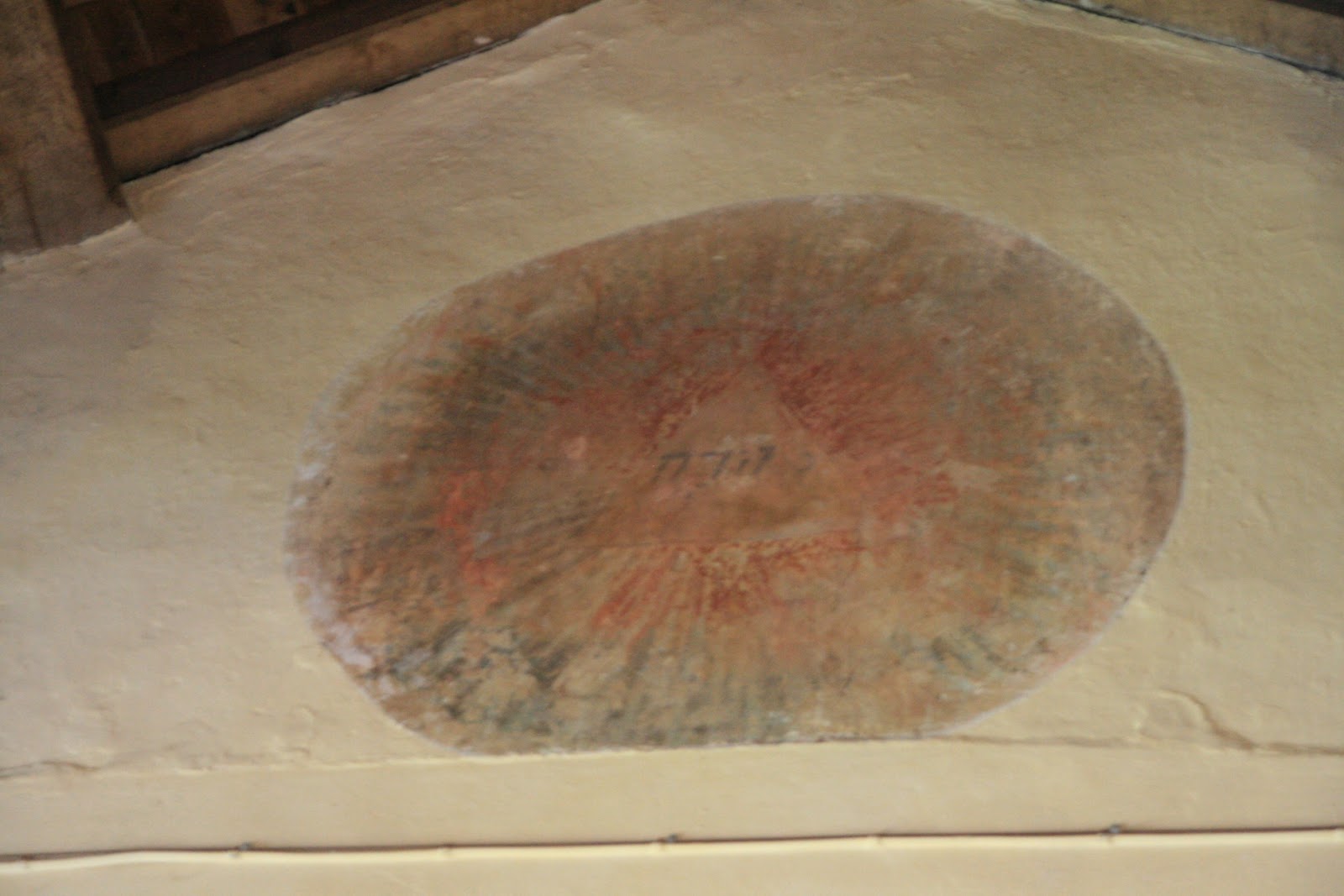
The church was originally built in the 12th Century and underwent some reconstruction work in the 19th century under Thomas Hardy's supervision. My eye immediately glimpsed a circular painting on the east wall. There is an information sheet about this painting which apparently depicts a sun with Hebrew word for Jehovah contained therein.


Picture on the east wall - SY7387

Another nice touch in this church is the two stone mice in the squint.

Mice in the squint, St Peter's Church, West Knighton - SY7387
After leaving the church, we rejoined the Jubilee path and headed north for a short while. At the next junction I took a photograph of another footpath which continued north, just for the sake of being in another gridsquare.

Towards Lower Glebe Farm - SY7387
I was now revisiting territory I'd walked through before, but, for the time being at least, on different footpaths.

Jubilee path to Whitcombe - SY7288
We were in wheat fields again and getting a bit hungry. We both commented that usually we'd have succumbed to hunger pangs long before now (it was 1.30 pm). I blame good conversation and my good flapjack which we'd consumed at Poor Lot. Nevertheless, by the time we reached Whitcombe I suggested to Jane that we eat before going into the church.

Whitcombe Church - SY7188
This seemed a good plan at the time, but unfortunately the wasps thought so too. The moment Jane produced her infamous cheese and beetroot sarnies, the wasps swarmed in in their drones - OK there were only three, but that's three more than either of us were comfortable with. Then my hat blew off and over the wall. I managed to retrieve my hat before we decided to retreat into the church porch (was this why I'd done exactly the same thing almost exactly a year ago when visiting the church?)

We didn't last long in the porch either because the wasp followed us in, so we retreated into the church and managed to scare the wasp out and breathe a sigh of relief. After all, when you've looked forward to your cheese and beetroot sandwiches (ham and cheese in my case), you should be able to eat them in waspless peace!

I love the simplicity of this William Barnes church. It is no longer used for regular worship, but they definitely hold a Christmas service here every year which I think must be very evocative.

We continued on the Jubilee Trail, heading westwards towards Winterborne Came and our final church of the day. This is the final resting place of William Barnes, friend of Thomas hardy, minister and Dorset dialect poet. Despite this, it was our least favourite of the day as it is always so dark and feels a little unwelcoming.

Bible in St Peter's Church, Winterborne Came - SY7088

St Peter's Church, Winterborne Came - SY7088
William Barnes' grave, St Peter's Church, Winterborne Came - SY7088
We headed south on the last leg of our journey, past Cripton Cottage and Cripton Barn, through fields to the unwelcoming Came Wood with all the private and keep out signs I remembered from previous walks. They must have had quite a lot of unwelcome intrusions to warrant the amount of paint and barbed wire which daubed the trees and adorned the gates.

The final part of this walk is along a busyish road, but fortunately not for long. Then we were able to compare notes on socks, boots, butterflies and plan our next walk. Remarkably the walk had consisted of not one single wrong turn and had been almost exactly the length I'd said it was going to be, which is more than can be said of the weather. We'd had not one drop of rain all day since we'd been out of the cars!

Number of species of butterflies: 9
Number of new gridsquares: 4
Number of miles walked: 11.4
Number of churches visited: 4
Number of wasps: 3

Monday, 8 August 2016

Beaminster to Stoke Abbott

I actually gained quite a few gridsquares over the weekend, but am finding it hard to keep up with all this writing so am restricting myself to the one with all the dappledness! One thing that Dorset has over Islay is the dappledness - and I feel sure there's a better word for it.

We parked at Beaminster, walked past the church, as we've done many times before, but this time headed south and then slightly west.


Beautiful and massive oak tree at the path's junction - ST4700
I'd heard a story about Knowle Farm, that James Daniel, a non-conformist in the seventeenth century, hid in the straw in a barn at this farm, and thus avoided capture by the King's troops. He consecrated the ground by the farmhouse and vowed to be buried there. We went to enquire at the farm about the place of burial but sadly  were not invited to look at the burial ground.

Knowle Farm - where James Daniel is buried in a private burial ground - ST4600
Looking slightly north-west the distinctive shape of Gerrard's Hill was prominent and remained so throughout our walk.

Gerrard's Hill

We continued south to Nethbury, where a swarm of honey bees were flying round their hives.

Near Nethbury -  the bees' hives - SY4799
I was quite excited about visiting Netherbury as I'd not been before and we stopped at the church for a cup of tea.

St Mary's Church, Netherbury - SY4799
There is a funeral bier inside the church.

Funeral bier inside St Mary's Church, Nethbury

We headed west form here, towards Stoke Abbott and were delighted to find a naturally carved bench overlooking Lower Woods Coppice. This would make an ideal picnic spot.It always seems that we find benches when we don't need one and don't find them when we do!

Bench overlooking Lower Woods Coppice - SY4699
Lower Woods Coppice - SY4699

By now the clouds over Gerrard's Hill were looking almost threatening - but didn't amount to anything.
Clouds over Gerrard's Hill

The footpath between Netherbury and Stoke Abbot is very narrow and was very overgrown so we got prickled by brambles and stung by nettles and thistles quite a bit! But hey ho, we didn't mind!

Narrow and overgrown footpath near Stoke Abbott - ST4500
Then there was a tree on the path.

Tree across path near Stoke Abbott - ST4500
Beautiful holloway near Stoke Abbott - ST4500
Bracket fungi on footpath near Stoke Abbott
I'd heard that Stoke Abbott is a lovely village, and indeed it is. This was our first visit to the village and we were intrigued to later learn that the church in the village is one of the few remaining in England to maintain the custom of ringing a curfew bell. Once rung at 5.30 am every day throughout the year, the bell is now rung by the same volunteer who rings it 100 times every day at 7 am, despite protests from some sources that it should be at least 45 minutes later. The villagers won the battle and the custom is maintained.

St Mary's Church, Stoke Abbott - ST4500
The weights for the bells in Stoke Abbott church - it must take some doing to ring them 100 times!
Also in this lovely village is a horse's trough, beneath a fresh water spring which, until 1961 was used as the water supply for the village. The lion's head spout and cup replaced a much older one in 1953.

Horse's trough and fresh water supply at Stoke Abbott - ST4500
Lion's head and cup, Stoke Abbott - ST4500

We left the village and headed back eastwards, past Horsehill Farm, through a forest of Himalayan Balsam which has sadly invaded the whole of this area. I've never seen so much of it.

Himalayan Balsam - ST4500
Fighting our way past the Balsam we headed south-east along Long Barrow Lane, down to the River Brit where there are a couple of footbridges to cross - or rather one which we crossed and one which we were grateful we didn't have to cross as there were cows guarding the other side of it.

Cow on the Jubilee Trail by the River Brit - ST4600
We were now at our crossing point of our basic figure of eight shaped walk and walked on the west side of Parnham Park, through dappled sunlight and trees back to Beaminster.

Dappled Jubilee Trail - ST4700

Miles walked: 6.5
No. of naturally carved benches: 1
No. of other benches: at least 2 (Netherbury and Stoke Abbott churches)
No. of horse troughs: 1
No. of churches: 2
No. of unhelpful people we met: 1
No. of new gridsquares: Actually only 4 (didn't realise that until I counted them just then!)