There are some walks I've done so many times I just assume I've photographed every square, but, upon revisiting my now very pink map of gridsquares, I wondered why there was such a blank around Cerne Abbas. "We go there all the time," I thought to myself, "surely I've just forgotten to colour them in pink?" A few clicks later I discovered the horrifying truth (and I know this will shock you) - I had never photographed these squares. No, not once.
Embarrassed by this discovery, and trying to avoid the possibility of more blocked footpaths in the area I'd walked earlier in the week, I suggested a walk round Cerne Abbas to Paul. Now the great thing about Paul is he agrees to whatever I suggest, walkwise that is. I sold it to him quite easily with the plus of having several geocaches which (again embarrassingly) we had never done. What on earth had we been doing on all our previous visits to Cerne Abbas? Looking at the giant? No, I think we've always been absorbed in butterflies, conservation work or walking with other people.
I quickly drew a route out, lugged some geocaches into my GPS, gathered our boots and supplies of suncream, sandwiches and water and off we set. Cerne is one of my favourite places in Dorset. It's easy to park, it's attractive and there's great views and lots of butterflies - what more could one ask? After toing and froing to the public loos, shop, car, donning rucksack, camera, sunhats and suncream, we were finally ready for the off.
We crossed the A352 and walked through fields to Weam Common Hill, past a lovely old tractor.
 |
| Old tractor - ST6601 |
Weam Common Hill is chalk downland with some scrub and covered at its western end with deciduous woodland which once formed Cerne Park. Evidence of the Park Pale is still seen round most of the park and Roe Deer still roam freely here.
 |
| Weam Common Hill - ST6501 |
Being chalk downland it is a great place for butterflies. Sadly the ground is looking very brown right now with the drought of this summer, but we still saw a mixed bag of butterflies today, including lots of Common Blues which seemed to be frantically searching for anything aromatic left on which to nectar.
We ascended up the hill, past the lone Oak tree to the edge of the woodland.
 |
| Oak Tree on Weam Common Hill - ST6501 |
There was a geocache in the woodland, our second of the day, or at least it would have been had we found it. Our search was curtailed by Paul's disturbance of a wasps' nest right where the co-ordinates were directing us to!
 |
| Woodland in Cerne Park - ST6401 |
Emerging from the woodland at what was once the park pale, we crossed by a thin dark line a harvested wheat field to the the telephone mast and boulder which must surely have served as a resting place for many a weary walker. Here we found our second geocache of the day and enjoyed a cup of tea before soldiering on in the searing heat.
 |
| Telephone mast at top of Weam Common Hill - ST6401 |
 |
| Boulder at top of Weam Common Hill - ST6401 |
We joined the Wessex Ridgeway heading south now and were delighted to see a Wall Brown, a butterfly we rarely see as it is mostly a coastal species.
 |
| Wall Brown on Wessex Ridgeway - ST6401 |
I'd now bagged three new gridsquares, albeit not new footpaths. Our next turn off was onto a footpath neither of us had walked on before. It was one I'd seen many times whilst driving to Cerne Abbas and had often wondered where it went. Today we were to discover the answer to that question . Fanfare please! It looked such a lovely footpath from its south-easterly end and at first all was well. We were walking along the Park Pale.
 |
| Park Pale, Cerne Park - ST6400 |
 |
| Cerne Giant from park Pale - ST6400 |
It all started going wrong when we headed south at some barns on top of Hog Hill.
 |
| Barns on Hog Hill - ST6400 |
The footpath became almost invisible.
 |
| Footpath on Rowden Hill - ST6400 |
There was no way we were getting through there. We tried to get in through some woodland (not marked on our older version of the Explorer Map) and fought our way through trees, nettles and brambles to the fence which we managed to get over and then climbed the stile into the field which I've noticed from the road many times. There was a small herd of cows slumbering away in the heat that didn't budge upon our appearance, but we did disturb a Roe Deer doe, who sprinted off before stopping to check us out.
 |
| Park Mead Bottom - ST6500 |
 |
| Roe Deer doe in Park Mead Bottom - ST6500 |
We found another geocache before joining the road into Cerne Abbas and walking up the hill to a footpath we had never noticed before. This led to Dickley Down Farm, or it was supposed to but once more we were thwarted in our efforts by a conglomeration of electric fences erected to keep the horses in. We decided to go through a gate and walk up the road to rejoin the Wessex Ridgeway to Higher City Farm.
 |
| Higher City Farm - ST6400 |
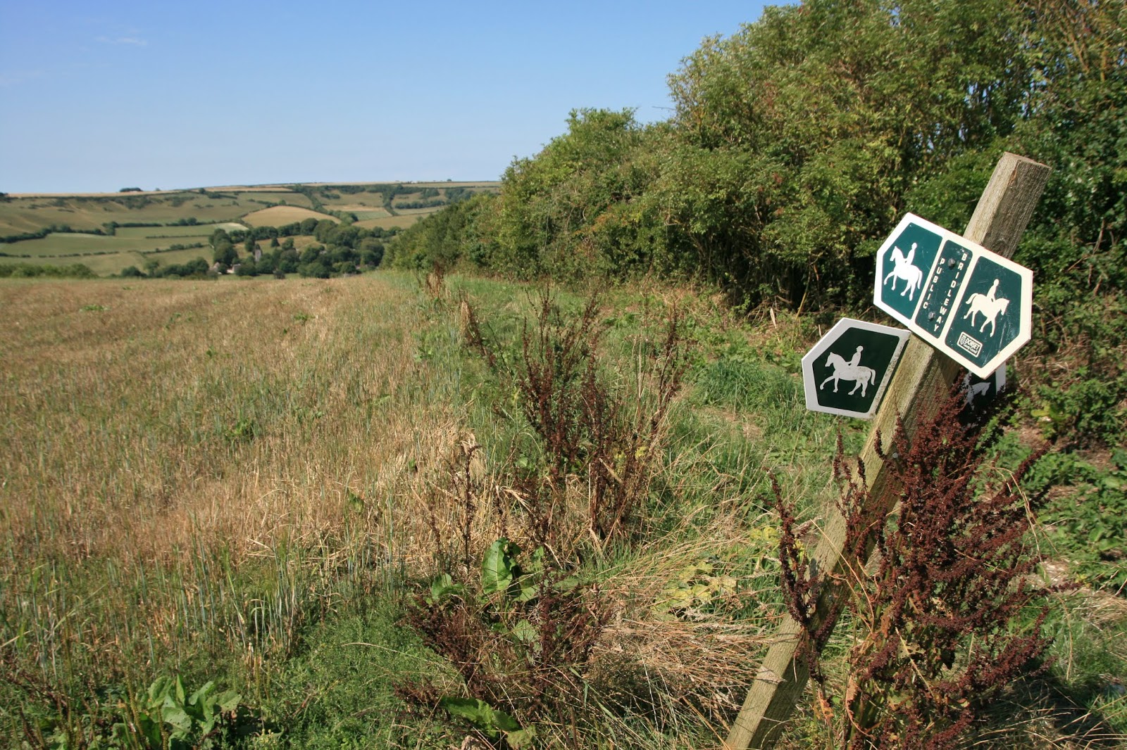
We were back in ST6400, a square we'd walked the length of, but were now turning into SY territory, heading south-west following the Ridgeway down Cowdown Hill. Then we were faced with the choice of three paths.
 |
| Choice of paths at Cowdown Hill - SY6499 |
Ours was the leftmost path, a bridleway across Eastfield Hill. Sydling St Nicholas was just visible at the bottom of the hill.
 |
| Towards Sydling St Nicholas - SY6499 |
Looking westwards we could see Hog Cliff Nature Reserve where we had walked in the winter and later again in the summer.
 |
| Hog Cliff Nature Reserve from Eastfield Hill - SY6499 |
We headed towards a settlement on Shearplace Hill where our path would meet paths we had walked in the past. I was keen to see what was left of the settlement, but was in for a disappointment - not much, and what there was, was overgrown. These archaeological sites are always best visited in the winter. I did manage to find out a bit more
information about it though.
 |
| Settlement on Shearplace Hill - SY6398 (From British History website) |
 |
| Settlement on Shearplace Hill - SY6398 |
Rather than walk what was in effect a tightrope between the edge of the field and the crops on the bridleway, we walked along the track down to Pond Bottom and then discovered this was open access land anyway.
 |
| Bridleway to Pond Bottom - SY6398 |
We had never been to Pond Bottom before and were in for a treat. There are pockets of woodland and undulating chalk downland. The grass had turned brown in the drought though, giving the appearance more of a winter than a summer scene. Something that is especially obvious in photos.
 |
| Pond Bottom - SY6498 |
We headed towards the barn in the photo above thinking this might provide some shelter and shade from the heat of the sun.
 |
| Barn at Pond Bottom - SY6498 |
Hmmm, maybe not - the only shade afforded by the barn was being fought over by panting sheep so, rather than oust them from their welcome cool spot, we sought shade under a few trees and ate our lunch.
We were only briefly to enter SY6598, and though it was a square I had been in many times before, I had inexplicably failed to photograph it on any previous occasion. A small copse provided a subject for today's photograph.
 |
| Reynaud's Copse - SY6598 |
"Is that our path?" Paul foolishly asked, pointing to a very obvious bridleway leading in the direction of Cerne Abbas. "No, we've just got to go a hundred feet further on to enter the next gridsquare and then we'll turn in that direction," I admitted, trying to make light of those few hundred feet.
We continued through the wonderful Pond Bottom, revelling in quietness, raucous Rooks and scorched grass.
 |
| Pond Bottom - SY6597 |
Then we headed westwards ever so slightly towards Crete Bottom and an unusual shaped structure near Bushes Barn. I now know what that structure is, but didn't at the time and we would have had to prolong our walk even more to find out and photograph it so I am going to wait for another time to do that! I had to be content today with a rather boring photograph for SY6497.
 |
| Crete Bottom - SY6497 |
Having photographed the gridsquare, we retraced our steps to the bridleway which led up the hill towards Godmanstone. From here we had a good view of Bushes Barn and the rather thirsty looking land.
 |
| Bushes Barn and Crete Bottom - SY6597 |
We were delighted to be seeing so many Common Blues on our walk today and the Rooks were entertaining us with their persistent calls.
 |
| Rooks on Crete Hill - SY6597 |
 |
| Female Common Blue - SY6597 |
We took one last look down to Crete Bottom before heading down to Godmanstone.
 |
| Crete Bottom from Crete Hill - SY6597 |
Along this bridleway I was delighted to see a Hare. It was our second in as many days and my current number one mammal. I miss them so much. I definitely took them for granted on Islay where I would see them almost on a daily basis. We startled this one as it was lying in its form in a field next to the bridleway and it sprang up, ran a few yards, froze, listened, ran again, stopped briefly once more and then hid in a small bush before heading back up the bridleway in the direction we had come. "We can't turn our back on it," I appealed to Paul who seemed keen to keep going. "It's a bit like turning your back on the Queen. We've got to wait for it to disappear." Eventually the hare was out of sight and we were free to continue our walk.
 |
| Hare near Godmanstone - SY6697 |
Godmanstone is an attractive little village which boasts Britain's smallest pub, albeit now closed. The River Cerne runs through the village and we crossed the river, admired the Willow Tree by the Smith's Arms and turned northwards.
 |
| River Cerne at Godmanstone - SY6697 |
We were well and truly in familiar territory now, and followed the River Cerne for about three-quarters of a mile to Nether Cerne where I insisted we took an afternoon tea break in the church. I'm glad I did because there is a colourful exhibition in there endeavouring to modernise the Bible. It seemed a little incongruous to have what looked like a flimsy and arguably irreverent Wendy House inside such an historic building,but in other ways I applaud the idea of bringing the Bible and the church into the 21st Century. I think perhaps Jesus would approve.
 |
| The Church Inside Out - exhibition in All Saints Church, Nether Cerne - SY6698 |
From here we walked past the logging works at Bow's Hill, work I had been involved in in the winter with EuCAN. There were lots of logs there with a makeshift fence structure keeping them from rolling down the hill.
 |
| Logging at Bow's Hill, Nether Cerne - SY6798 |
From here we walked through Pound Farm farmyard, which is a challenge to walk through with electric fences and obstructed gates. In the winter it is a quagmire so at least we didn't have that to contend with on this occasion.
We walked towards Black Hill through another square, ascending it into the welcome greenery of the patchy woodland.
 |
| Black Hill - SY6699 |
 |
| Footpath to Pound Farm - ST6600 |
We remembered the south facing chalk slope of Black Hill because we had seen lots of butterflies there once before and were thrilled today to see a Chalkhill Blue in flight there seeking out what little nectar was left amongst the parched grass.
 |
| South facing slope of Black Hill - ST6600 |
 |
| Chalkhill Blue on Black Hill - ST6600 |
Then it was a case of walking past the deserted allotments to the New Inn where Paul had a beer and I bought an ice-cream and we sat fighting off the wasps for as long as we could bear it until we retreated to the safety of the car and drove home.
Number of new gridsquares: 10
Number of miles walked: 9.75


No comments:
Post a Comment