Showing posts with label south-west coast path. Show all posts

Friday, 6 January 2017

Tyneham to Kimmeridge - 2nd January 2017

I've decided to add the date to my posts as I've got a little muddled with the dates and my latest posts have not been posted in chronological order and I'm not tech savvy enough to know how to move them around - nor have I the patience to learn! (Paul please don't admonish me!)

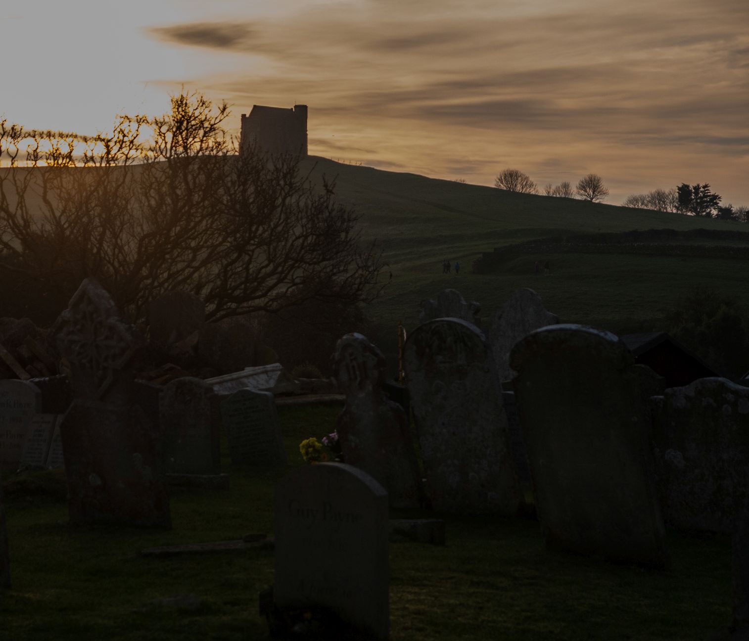
For our very first walk of 2017 (other than from the front door to the car door), we chose to go to the coast and fill in a bit of the south-west coast path that we haven't yet done. We've managed to do quite a bit of the Dorset coastline in different stages, and I'm actually beginning to feel that sinking feeling I get when nearly completing a book I've loved. I find I don't want to finish it; it has become a friend. Likewise the Dorset coastline. Oh well, that was the aim of this game, so off we set with fresh eyes from Tyneham where we joined the throngs of other bank holiday makers who obviously had the same idea as us - get out while the sun is shining - New year's Day, like Christmas Day, having been a complete wash out.

My first new gridsquare was one with a curly red arrow and Worbarrow Tout. We took two steps forward and slid one step back up the hill, past the big red number 3 and did not get much further. I really wanted to get to the top but, at our age, it seemed quite treacherous - not that we're wimps or anything!

What a glorious, amazing view from here!

From Worbarrow Tout - SY8679

Worbarrow Tout - SY8679 (if you look closely you'll see some braver souls than us approaching the summit!)
We turned eastwards now and ascended Gold Down. I wished I'd planned this better and started from Kimmeridge as the view walking westwards is much nicer. I kept turning round to look at Worbarrow Bay, where we seemed to have left most of the other Bank Holiday makers (fortunately).

Ascending Gold Down - SY8779

Worbarrow Bay - SY8679
The signs warning everyone that cliffs are dangerous are a tad overdone. Everywhere you looked there was a sign of some sort - either to warn you that this was a military zone and that you might tread on unexploded ammunition if you stepped outside of the yellow markers or that if you went too close to the edge you might fall off the cliff! I wondered how many people who didn't already know that came to these parts.

Danger Sign - SY8779


Gad Cliff is best viewed from the east, ie, in our case, once we'd walked past it.  Totally inaccessible by foot, we pondered on how much wildlife must thrive in this undisturbed territory.


Gad Cliff - SY8779

We passed a turn off back to Tyneham Farm and continued eastwards in a biting north-easterly wind.

Signpost to Tyneham Farm - SY8879
We found some shelter at Tyneham Cap and sat on a bench with our picnic, which it turned out was not very nice. The pitta bread which we'd defrosted that morning must have been in the freezer for months and was rather stale. Never mind, we munched away at the rest of our lunch and packed our bags to set off again.

Towards Kimmeridge - SY8879
Tyneham Cap - SY8979
Broad Bench stuck out like a photographer's out of bounds paradise. I longed to get down there and take close ups of the well, broad bench or shelf of rock but couldn't for two reasons: 1) it's dangerous (I worked that out for myself despite there being no signs to tell me) 2) It's forbidden territory outwith the Ranges walks (there was a sign to tell me this). This gridsquare would have to be photographed from another one, with a rubbish photo taken just within the gridsquare to count (hopefully) as a geograph for that square (don't worry if you didn't follow all that - it's anorak stuff!)

Broad Bench - SY8978
Kimmeridge Bay was now in sight, a place we'd visited several times before and it proved to be at least as popular with visitors today as Tyneham.


Kimmeridge Bay - SY9079
I ventured a little closer to the edge to get close ups of the amazing rocks.

Rocks at Kimmeridge - SY9079
But something else had drawn our attention, something I don't recall having seen before and that Paul started to get very excited about - a nodding donkey. And it looked like we might be butted by it if we went any closer.

Closing the Ranges gate behind us (which we didn't climb due to it being 'naughty' and 'dangerous' apparently), we went to investigate.

Amusing sign on the gate at the Ranges - SY9079
The Nodding Donkey at Kimmeridge - SY9079
The Nodding Donkey is a pump, in this case it is the oldest continually working oil well pump in the UK, having been continually pumping since 1961 and yielding between 65 and 80 barrels of oil a day .(It used to produce about 350/day.) An unusual feature for my gridsquare photo and an unexpected sighting today.

We were now turning inland to the 'boring' part of the walk. The first part was not quite as interesting, being through very muddy, ploughed fields, past Kimmeridge Coppice where I thought for a second I'd seen a Crossbill, but which turned out to be Chaffinches.

Looking towards Kimmeridge Coppice - SY9179
Then there were some steep steps to climb - and we weren't even on Ridgeway Hill yet!

Steps near Kimmeridge - SY9180
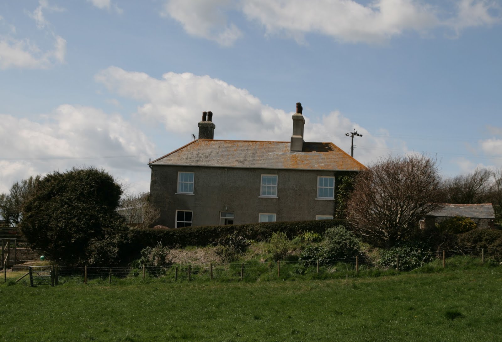
We slipped our way down to Steeple Leaze Farm, our boots getting rather clogged up on the way.

Steeple Leaze Farm - SY9080
Joining the road at SY9081, I decided to take a photo of that gridsquare from the Ridgeway as it was difficult to relax with quite a few  cars rushing by and having to keep ducking into the sides of the road. Being fond of the Dorset signposts, I took a photo of the sign to Steeple, somewhere we'd visited last year.

Sign for Steeple - SY9181
It's quite a slog up to Ridgeway Hill, but the view is worth it when you arrive.

View east from Ridgeway Hill - SY9281

On a previous walk I'd walked east from here towards Corfe Castle; today we were walking westwards on this extension to our original walk. We passed a drunk boundary stone and it was difficult to see exactly what it was boundering these days.

Boundary Stone on Ridgeway Hill - SY9281
I was quite excited about passing the Grange Arch, a feature I'd wanted to see for a long time, although I can't now figure out why. If you look carefully on the right-hand (eastern) pillar of the central arch, you'll see a benchmark (not in the photo, silly - when you're there in real life!)

Grange Arch - SY9181
It's an easy walk along a track from here to the road and the sun was low in the sky. "It's at that annoying height," Paul moaned as we walked into its full glare. i took issue with this statement, claiming that anything that was doing what it was naturally intended to do could not be deemed 'annoying'. "Only things that can be helped can be annoying," I argued, "like someone picking their nose or driving too fast, things like singing out of tune or it getting dark cannot be annoying."

The sun lighting up the track on Ridgeway Hill - most definitely not annoying - SY9081
Soon we were at the car park and a huge puddle with another amusing sign prohibiting motorised vehicles outwith the shooting season. It seemed rather a redundant sign to me as there surely couldn't be much such traffic along the track to warrant a highway sign like that.

Gate and Puddle on Ridgeway Hill - note the rather unnecessary sign - SY9081
We walked through the car park and then along the road until we reached the footpath that runs parallel to the road. Here I took a photo of an unusual building.

Ruined building on West Creech Hill - SY8981
We walked along a leaf-strewn path lit by golden sunlight.

Leaf-strewn path on West Creech Hill - SY8981
Then we walked along the foot of Povington Hill.


Footpath at Povington Hill - SY8881
The late afternoon sun lit our path as we trod the last of our 10 miles back to the car.

Approaching Tyneham from the north - SY8780

Number of signs: innumerable
Number of new gridsquares:14
Number of miles: 10.3 
Number of donkeys: 1

Thursday, 8 December 2016

Short walk at Abbotsbury

Of course, it's all relative. A short walk to us is anything shorter than 10 miles; to some people, a short walk may be anything between 100 yards and 2 miles, whilst we know some people who would perhaps consider anything under 20 miles a short walk. At any rate, in this case, our 'short' walk was 7.5 miles on a beautiful late November day.

I had decided I'd like to explore Abbotsbury. Really, I'd wanted to go the day before on St Catherine's Day but, having discovered that the special service for St Catherine's Day had been held the Sunday before, and not on the actual St Catherine's Day, we decided to go on the day with the better forecast instead.

We'd been several times before, but the only time we'd been up St Catherine's Hill we hadn't ventured inside the chapel. So this was to be our first time. At first I was disappointed, deciding that this barrel-vaulted 14th century chapel was much better viewed externally where it draws the eye from miles around.

St Catherine's Chapel - SY5784
There is not much to see in the interior, but it was here that maidens came to beseech St Catherine, their patron saint, for a husband. Legend has it that there are two hand holds in the south entrance to the chapel with a ledge for the knee where maidens repeated a prayer along the lines of:

'A husband, St Catherine. A handsome one, St Catherine. A rich one, St Catherine, A nice one, St Catherine, And soon, St Catherine.'

P J Harvey, who lives locally, wrote a song about St Catherine, 'The Wind' and apparently came to sing in the chapel. I did discover that the acoustics were good here and wrote my own poem about the patron saint and this particular legend and recorded it on my phone on my next visit.

Having contemplated the patron saint, we left the chapel and admired the strip lynchets on the hill to the west, which was the direction we were now going to walk in the hope of 'filling in a gap' left from previous walks on this stretch of coastline.

Strip lynchets - SY5684
There wasn't much opportunity to get a photo in the next two gridsquares, but some unusual cottages provided a chance.

Cottages on the south-west coast path near Abbotsbury  - SY5584
Lawrence's Cottage with cirrus clouds - SY5585
We ventured onto Chesil beach for the next square - and our lunch, choosing the relative shelter of an old World War 2 pill box to eat our picnic.


Pill box on Chesil Beach - SY5485
The old coastguard cottages here have some amusing names. I wonder whether there's a story here.

Matthew, Mark, Luke and John - SY5485
We didn't really need to go into the next gridsquare before turning north as we had forgotten about the permissive path which leads up to the most beautifully named farm I think I've come across, 'Labour in Vain'. However, needs must! If I didn't walk those few gratuitous steps now, when would I be motivated to do so again?

Coast path near West Bexington - SY5385
We turned northwards now, past a World War 2 gun emplacement and up Long Gully, which is appropriately named!

World War 2 gun emplacement near West Bexington on Long Gully - SY5485
I was disappointed not to see a sign for Labour-in-Vain Farm; perhaps there is one on the other side.

Labour-in-Vain Farm - SY5486
The long, hard slog now became even steeper as we ascended Turk's Hill to the B3157. From here, the distinct profile of Abbostbury Castle, an ancient fort, can be appreciated. 'This would be my choice of fort if I'd lived in those days,' I told Paul

Abbotsbury Castle - SY5586
Although we had walked this part of the south-west coast path before, it had been an incredibly windy day with a large group, so we didn't have a good, unobstructed view of Abbotsbury Castle trigpoint. All on our own today, and with clear views, we got a better photo.

Abbotsbury Castle trigpoint - SY5586

We passed another military relic - this time in the form of an ROC post, or nuclear bunker as I kept calling it. Once open to the public, it has now been well and truly closed off so you can't go down and see the bunk beds and 'stuff''.

ROC post at Abbotsbury Castle - SY5686

Then some ancient history - some tumuli, a reminder that the ridgeway has been used throughout the centuries as a place of defence and burial.

Tumulus, Abbotsbury Castle - SY5686
We were nearly back to our starting point now and had wonderful views of the Fleet and St Catherine's Chapel with a small loch in the foreground.

St Catherine's Chapel and The Fleet with small loch - SY5786
This marked our southwards turning point back to Abbotsbury.

Abbotsbury from the south-west coast path - SY5785
We visited St Nicholas' Church and learned of the marks of the Civil War which are left there in the bullet holes in the pulpit.

Bullet holes from the Civil War on the pulpit in St Nicholas' Church, Abbotsbury - SY5785
St Nicholas' Church, Abbotsbury - SY5785
Watching the descent of the sun over such an inspirational landmark was a fitting end to our day's walk and contemplation.

St Catherine's Hill and Chapel at sunset, from St Nicholas' Church, Abbotsbury - SY5785
Number of new gridsquares - 11
Number of trigpoints - 1
Number of bullet holes - 2
Number of war reminders - 4
Number of miles walked - 7.5
Number of pieces of cake consumed at end of walk - 2
Number of churches - 2

Wednesday, 27 April 2016

Ringstead to Durdle Door

Today's walk was different;  I was doing it with other people, a lot of other people, the Dorset Walkers. This is more sociable walking and I have to adjust - just slightly. It means juggling taking photographs with checking my position on my map and trying to engage in conversation - oh, and looking for all thing wildlife related at the same time. Not easy. Something has to go in these situations and it's usually my binoculars. That means I narrow down my focus to just talking and taking photographs and gasping at the awe-inspiring scenery.

For this was most certainly a day for awe-inspiring scenery and wonderful weather to go with it. A photographer's dream, in fact. We set off eastwards from Ringstead car park with me surreptitiously snapping photos en route.

Brimstone Bottom Barn (left) and Sea Barn Farm (right) - SY7682

We joined the South-west coast path and walked south-westwards towards Whitenothe where there are some coastguard cottages and a World War 2 pillbox.

Joining the south-west coast path - SY76781

Whitenothe from SY7681
We walked in the corner of SY7781 - time for another surreptitious photo of a Gorse bush.

South-west coast path in SY7781

Whitenothe means 'White Nose' and it's easy to see how it got this name. The chalk cliffs were gleaming bright white in the sun. there were stunning views of Portland, Weymouth and Ringstead Bay.

Ringstead Bay from Whitenothe - SY7780
World War II pill box - SY7780
We walked past West Bottom and the Beacon, presumably placed here as landmarks (there is another one further along). Then it was a steep descent to  Middle Bottom with fantastic views en route.

West Bottom beacon - SY7880
View eastwards towards Bat's Head from Middle Bottom - SY7880
Looking towards Whitenothe and Portland from SY7880
There was a steep ascent and then descent to Bat's Head, which juts precariously out into the ocean. I say precariously because none of us dared venture onto this pinnacle of land, especially after the recent landslips here. The family of rocky islets known from west to east as The Calf, The Cow, The Blind Calf and The Bull were visible only as dark shadows under the turquoise sea as it was high tide.

Butter Rock and Bat's Head
Steve told us that Butter or Cheese Rock is so named because at sunset the sun shines on it and turns it into a buttery yellow colour.

Butter Rock and eastwards - SY7980

The coast path has, by necessity, taken a detour inland here because the cliffs eroded away a couple of years ago and indeed continue to erode. It amazes me how there are not more fatalities than there are as people still picnic beneath the cliffs and walk dangerously close to the edge, desipte gaping holes which repeatedly appear.

At the turn off for Scratchy Bottom, we discussed our options - continue on to Durdle Door or head inland now up Scratchy Bottom. Forgetting my desire to see Scratchy Bottom, I voted most decidedly for seeing Durdle Door and there was a consensus on this option. Why waste a good day walking inland more than you need to? One possible reason you might decided on this latter course of action is the crowds. I was not prepared for the Spanish Riviera. Flocks of people of all ages and sizes suddenly crowded our path and were picnicing and lolling around on the beach whilst we laboured on. Then there was the monstrosity of the camp site with its caravans, pods and singular tent pitched puzzlingly next to the path. That's the bad stuff out of the way (oh, apart from the public toilets being closed -glad we hadn't paid to park here to discover that!) Now for the good news - the views! Wow! I am so glad I saw Durdle Door for the first time in brilliant sunshine with blinding white cliffs and diamond-studded sea.
Approaching Durdle Door with the crowds on the beach - SY8080


Durdle Door with the Bull rock visible in the centre of the photo. - SY8080

I liked the fact that Durdle Door was in a memorable gridsquare - SY8080.

We sat with our lunch and were joined by hungry opportunistic Rooks as we bathed in the sun, resisting the temptation to buy an overpriced soft drink or ice-cream.

We then headed north, through the aforementioned campsite, past Newlands Farm (recently converted into holiday cottages), and onto Daggers Gate where we were told the disturbing story about the witch who could turn herself into a hare and whose daughter stabbed the farmer here and how he continues to haunt the area.


House south of Newlands Farm - SY8180


Daggers Gate - SY8181

We turned north-westwards here and walked through fields of Rapeseed. The stunning yellow contrasted vividly with the bright blue sky.


Fields near Newlands Farm - SY8081

Usually I have found that the coastal path far exceeds the inland route in terms of scenery, but I was pleased to discover some hidden gems as we walked through valleys and past Winfrith Hill.


Disused chalk pit near Chaldon Herring - SY8082

There was another field of Rapeseed before we reached the delightfully named village of Chaldon Herring.


Rapeseed field near Chaldon Herring - SY7983

We passed through the sleepy village of Chaldon Herring, (Chaldon meaning a hill where calves graze). I liked the builder's sign on the Old Vicarage Farm. It must be pre1995 as that's when phONE day happened when all phone numbers had a 1 or 2 inserted after the 0.


Old sign on Old Vicarge Farm -SY7983

We resisted the temptation to call in at The Sailor's Return and laughing at the badly placed sign that John pointed out - warning lorry drivers that the footbridge will not bear the weight of their vehicle.


Unsuitable for HGVs - SY7983

Wearying now, we trudged northwards along the road towards The Five Marys, a series of tumuli with an intriguing name, about which I have not been able to discover the origin.


The Five Marys - tumuli - SY7984

Once again we headed westwards, crossing a minor road, more pits and a tumulus. The pits were chalk pits, chalk being widely used in the 1800s as a fertilizer. 


Ridgeway footpath near the Five Marys - SY7884


In SY7784 we crossed another minor road, although it is the same one that runs through West Chaldon and Chaldon Herring and leads onto the main Wareham Road.

The footpath passes the Lord's barrow, though you'd be forgiven for missing it or thinking it was just a lump in the field, not an erstwhile burial site of some importance.


Lord's Barrow - SY7784

Our next, and final road was named Gallows Hill so was presumably the site of some grisly executions, though I have not been able to find out anything more specific about it.


Gallows Hill and Owermoigne Barn - SY7784


We headed down the road towards Holworth, noticing the newly painted letterbox in front of the cottages here. 


Holworth Cottages and letterbox - SY7683

The sign for North Holworth was particularly attractive and worthy of a photo.


North Holworth - SY7683

Soon we were walking through familiar territory back to the car. What a fantastic walk. I think I'd managed to be sociable whilst completing my quest. Many thanks to Johnn for organising the walk.

Miles: 11 miles
Natural arches: 1
Gridsquares: 17